
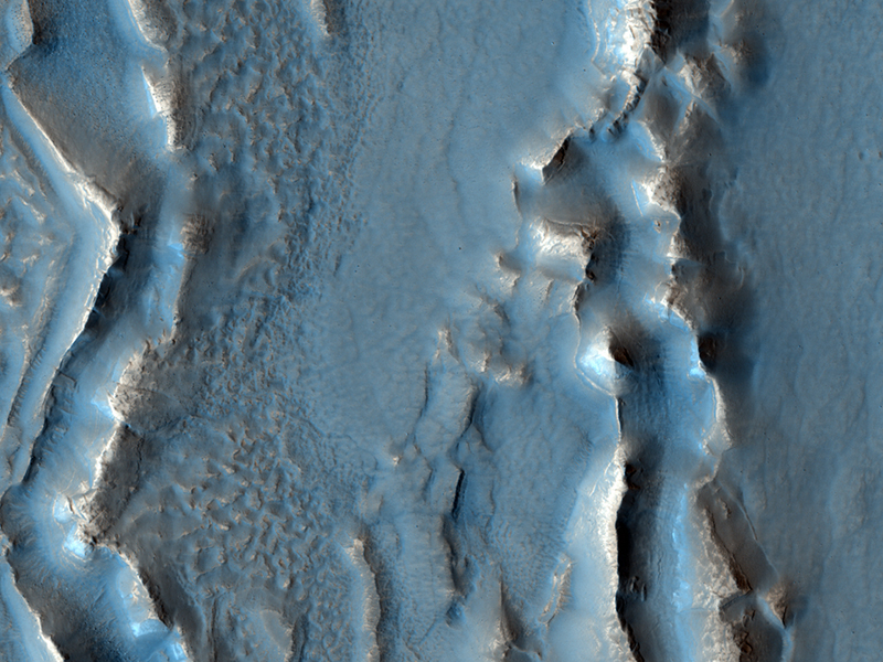
HiRISE Science Team wrote:Rough Surfaces in Deuteronilus Mensae (ESP_025174_2245)
The objective of this observation is to examine what may be formerly ice-rich terrain that has just lost ice to the atmosphere.
Research with the Shallow Radar instrument onboard the Mars Reconnaissance Orbiter has found that many areas in Deuteronilus Mensae are glaciers with a thin layer of debris on top of them. This image may show a transition from ice-rich to ice-poor terrain.
Removal of buried ice can cause collapse and may be responsible for the strange appearance of this terrain. Understanding the origin of features in this image tells us something about when buried ice was stable or unstable and therefore helps us figure out how the climate of Mars has changed.
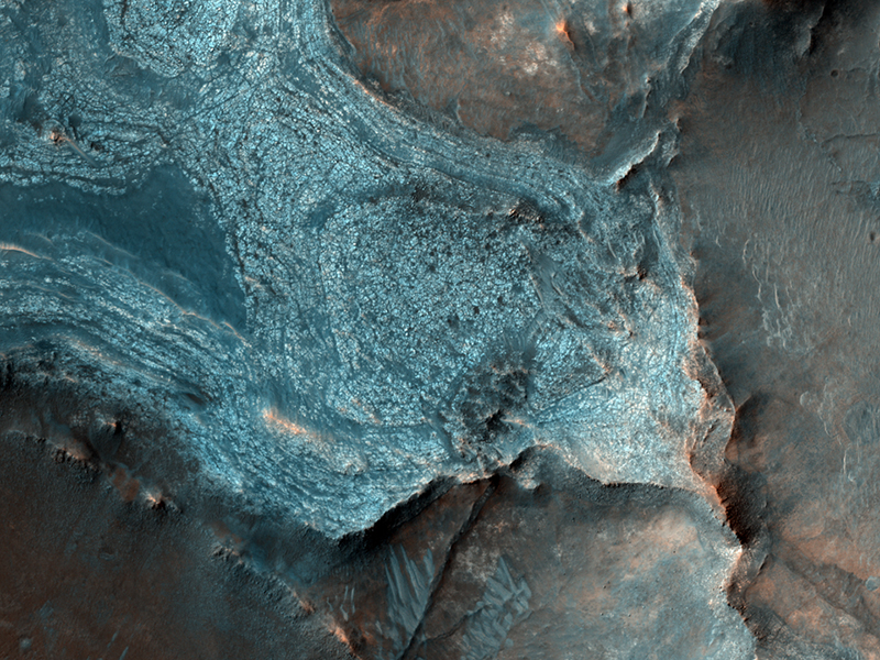
HiRISE Science Team wrote:Exploring Antoniadi Crater (ESP_025331_2005)
Some of of the challenges of exploring Mars is not only finding a safe landing spot for a future rover, but a place that is scientifically compelling as well.
HiRISE has taken scores of observations for other missions like Phoenix and the Mars Science Laboratory to help those science teams better understand possible terrain hazards. In this observation, we are trying to explore for the presence of minerals called quartz and feldspar, which are even more common on Earth than Mars.
Antoniadi Crater was identified, even prior to the MRO mission, as a likely ancient lake (now dry) that was supplied by both surface water and ground water. Note also how "flat" the terrain appears, an important factor for any potential landing spot.

HiRISE Science Team wrote:Ridges in Meridiani Planum (ESP_025386_1800)
When terrain gets squeezed by geologic forces, deep rocks sometimes break and get pushed upwards forming raised wrinkles on the surface. These wrinkle ridges are common on a lot of planets including Mars.
One of these ridges exists south of this image but seems to have been buried there. With HiRISE, we might be able to figure out the sequence of events by comparing the topography of the ridge with the younger layer that buries it.
Meridiani Planum is famous for another reason. This is where the rover Opportunity landed and has been exploring since 2004.
This is a stereo pair with ESP_025663_1800.

Ken Herkenhoff wrote:Colorful Layers in Nili Fossae (ESP_026992_2025)
This enhanced-color version of the central part of the HiRISE image shows colorful layers that may contain carbonate minerals.
Carbonates are commonly formed on Earth by marine organisms; the origin of these carbonates on Mars is unknown, but probably involved liquid water.
This image was taken along with the CRISM instrument, also onboard MRO, in what is called "ridealong" mode.
Credit: NASA/JPL/University of Arizona
<< Previous HiRISE Update