
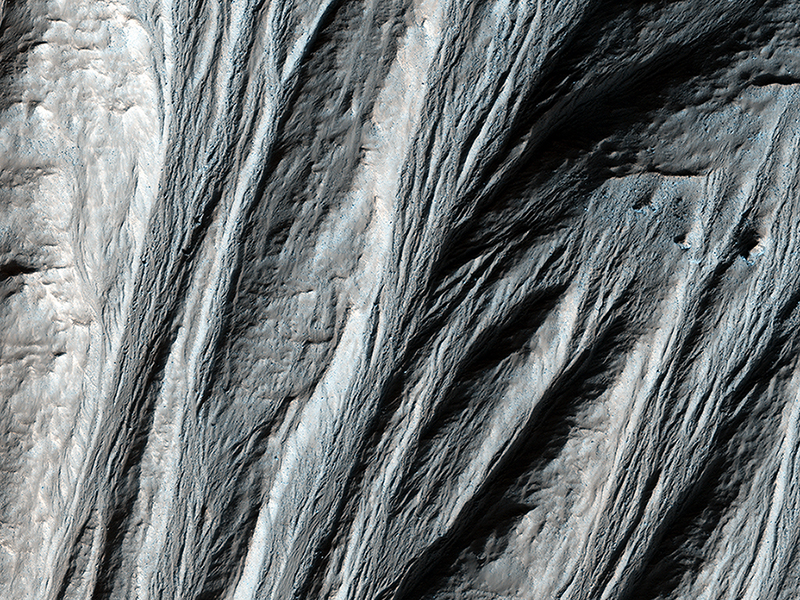
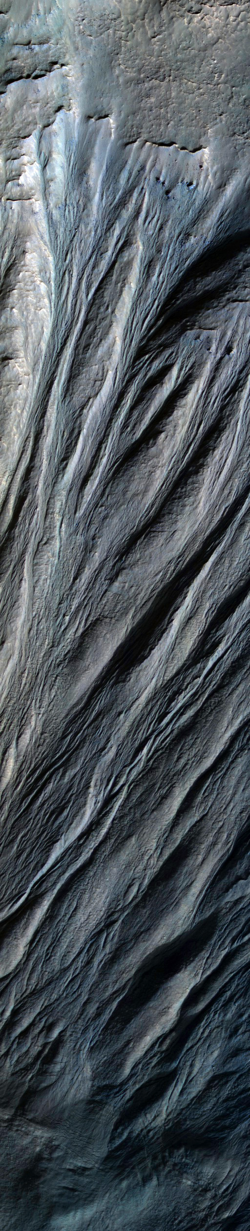
Alfred McEwen wrote:Giant Gullies North of the Argyre Impact Basin (ESP_034829_1325) (HiClip)
This image shows gullies that are large even by Mars standards, and much larger than the terrestrial landforms we call gullies. The length of some of these is over 6 kilometers (3.6 miles).
They are located on large mountains north of the Argyre impact basin. An enhanced color view (reduced scale) shows only subtle color differences.
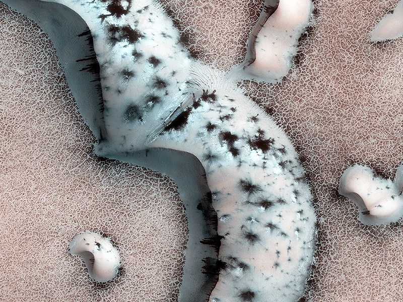
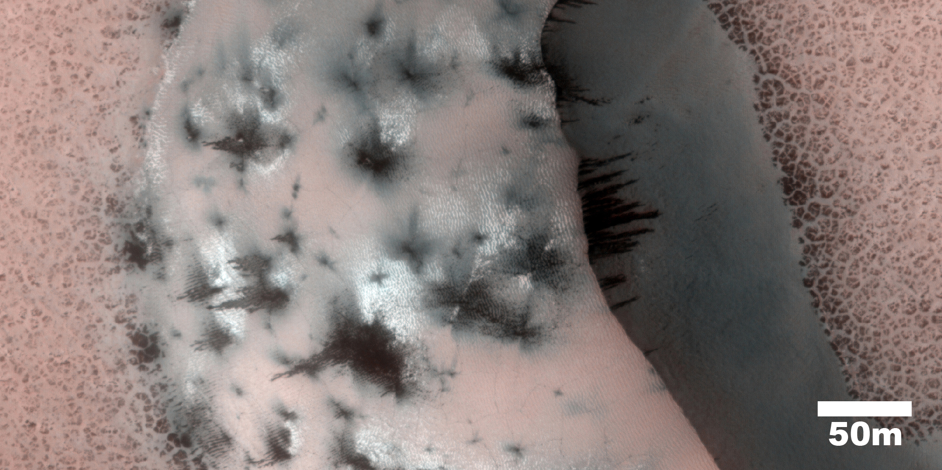
M. Ramy El-Maarry wrote:Shapes and Spots on a Polar Sand Dune (ESP_034441_2565) (HiClip)
This image shows numerous dark shapes and bright spots on a sand dune in the Northern polar regions of Mars.
The bright spots are carbon dioxide frost. On Mars, the main atmospheric component is carbon dioxide, which circulates seasonally between the atmosphere and the polar regions. One of the reasons that permit this process is the fact that temperatures on Mars are much colder than on Earth, which allows carbon dioxide frost to condense on the surface in winter.
When spring comes however, the surface heats up and the carbon dioxide frost eventually sublimates (turns directly from the solid to the vapor state), and forms jets of carbon dioxide mixed with dust, leading to the formation of the dark features we see in the image.
Such processes occur seasonally on Mars, and therefore are continuously being monitored by the HiRISE scientists to assess the differences from one year to the next.
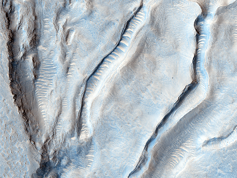
Cathy Weitz wrote:Light-Toned Deposits along Coprates Chasma Slopes (ESP_034329_1670) (HiClip)
Valles Marineris contains kilometers-thick light-toned layered sedimentary deposits along many of its floors. In this image, similar light-toned layered deposits are observed, except these are found along steeper wallrock slopes in Coprates Chasma.
Compositional data from CRISM and also stereo images—which we use to create 3D images—can help scientists determine how these sediments were deposited and if they are the same as the thicker deposits seen along the chasma floors.
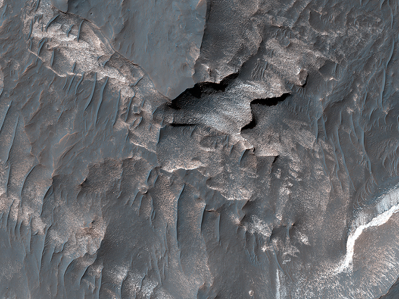
Joe Michalski wrote:Oxus Patera Collapse Feature (ESP_034656_2195) (HiClip)
Oxus Patera is an ancient, eroded depression in northern Arabia Terra. It is not known how Oxus Patera formed, though it has been suggested that the feature represents an ancient caldera formed through collapse and explosive volcanism.
Other possibilities include formation by impact and erosion, or collapse due to removal of subsurface volatiles. Regardless of how the massive depression originally formed, there is little doubt that the feature has been modified by younger ice-related processes.
This image shows an unusual landform on the floor of Oxus Patera. Notice an irregular, scalloped contact trending diagonally from southwest to northeast near the center of the image. The terrain in the upper left is likely composed of fine-grained, weakly consolidated materials because it does not form many topographic features within the unit (few mesas, buttes, mountains, etc.). Where it is eroded, it does not form boulders: it appears to be an easily crumbled, blanketing deposit. The terrain in the lower right is very unusual. It contains smooth surfaces marked by small, irregularly shaped cones and fractures that are bounded by upturned ridges. The boundary between the two terrains consists of scalloped fractures that appear to have formed where the terrain in the lower right has detached from the terrain in the upper left, and partially collapsed.
Credit: NASA/JPL/University of Arizona
<< Previous HiRISE Update