
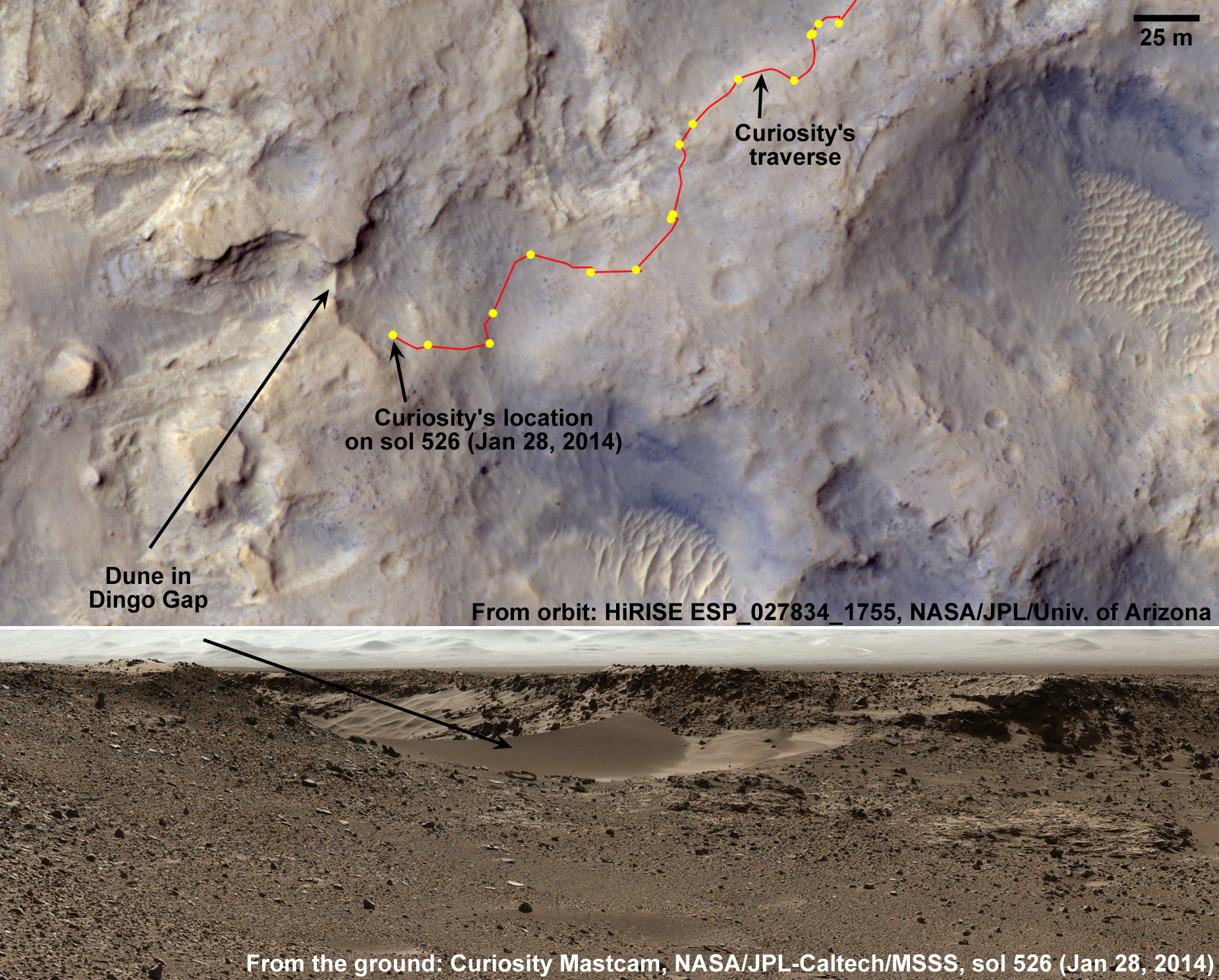
Lori Fenton wrote:Viewing Dingo Gap (ESP_027834_1755) (HiClip)
In this image, we see the saddle between two valleys named Dingo Gap—in Gale Crater—where the rover Curiosity just traversed. The gap is spanned by a single dune visible both from the ground and from orbit. (The rover itself is not in this image as it was acquired before MSL landed.)
With images taken with the Mastcam on Curiosity, we can see a view looking northwest and the Dingo Gap where the rover recently crossed.
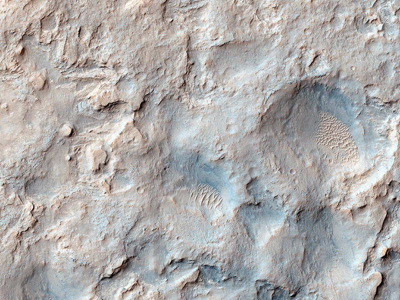
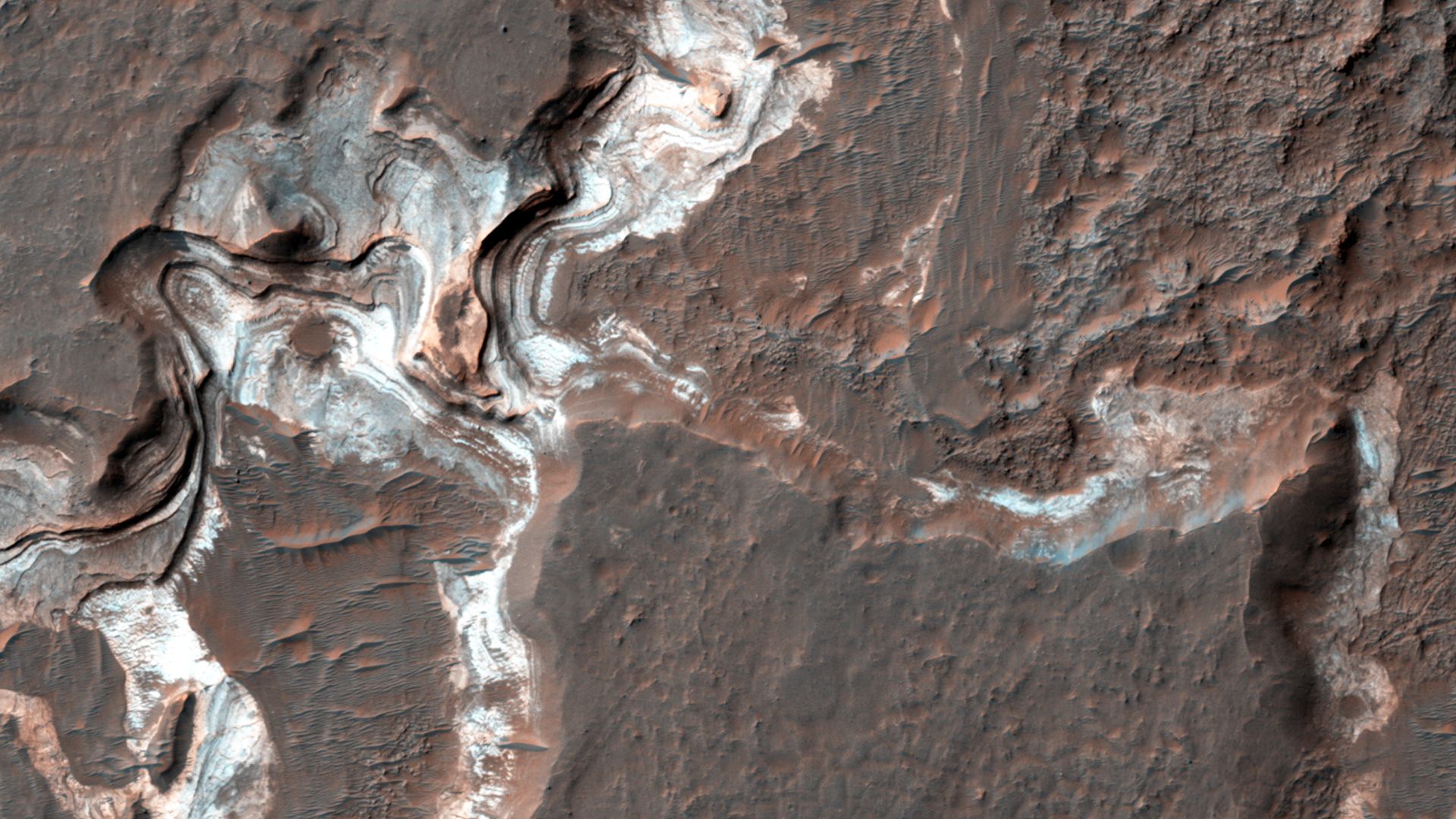
HiRISE Science Team wrote:Which Came First, the Yardang or the Platy Flow? (ESP_034255_1840) (HiClip)
One of the great strengths of HiRISE is that its high resolution can help resolve interesting questions: in this observation, is the platy flow material younger than the yardang-forming material?
A “yardang” is a streamlined hill made of loose rock and bedrock that’s been shaped by wind erosion. The volcanic platy flow material in the same area should be older than the yardang material. The purpose of this observation is to figure out whether the platy flow materials trap or catch (embay) the yardang-forming material, or are just covered by that material.
This is a stereo pair with ESP_025473_1840.
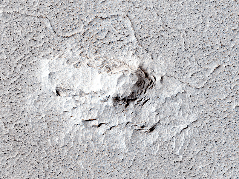
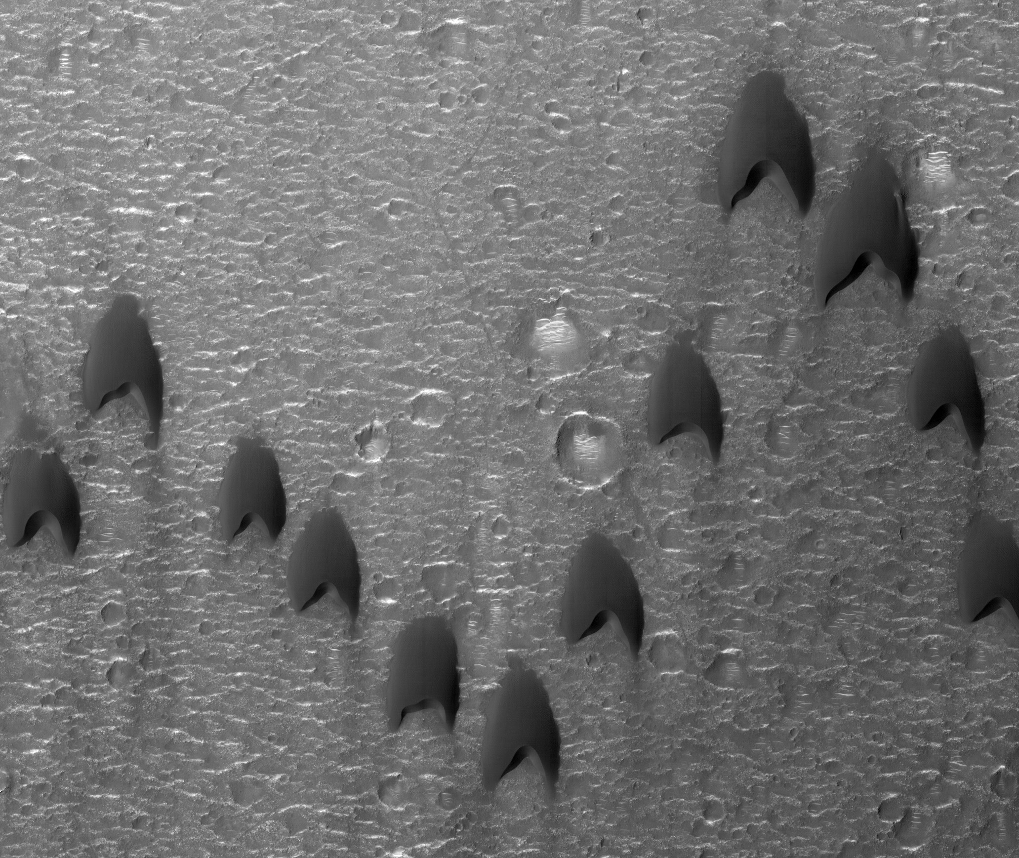
Alfred McEwen wrote:Dunes Flying in Formation (ESP_034815_2035) (HiClip)
Migratory birds and military aircraft--like during World War II--often fly in a V-shaped formation. The “V” formation greatly boosts the efficiency and range of flying birds, because all except the first fly in the upward motion of air--called upwash--from the wingtip vortices of the bird ahead.
In this image of a dune field in a large crater near Mawrth Vallis, some of the dunes appear to be in formation. For dune fields, the spacing of individual dunes is a function of sand supply, wind speed, and topography.

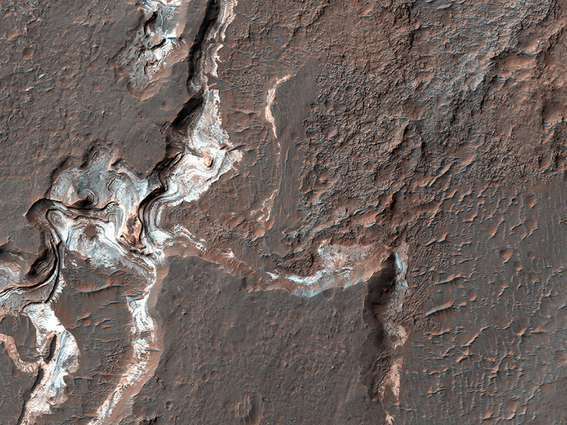
Cathy Weitz wrote:Bright Sediments on the Floor of Ladon Basin (ESP_034209_1605) (HiClip)
This image shows some bright layered deposits exposed within a linear trough along the floor of the Ladon Basin.
There is a large channel system that flows into the basin, called Ladon Valles, and scientists think that the basin may have once filled with water before another channel to the north formed and drained it. These exposures of light-toned layered sediments provide clues about the environment that existed within Ladon Basin when water may have ponded and deposited these sediments.
This is a stereo pair with ESP_034143_1605.
Credit: NASA/JPL/University of Arizona
<< Previous HiRISE Update