
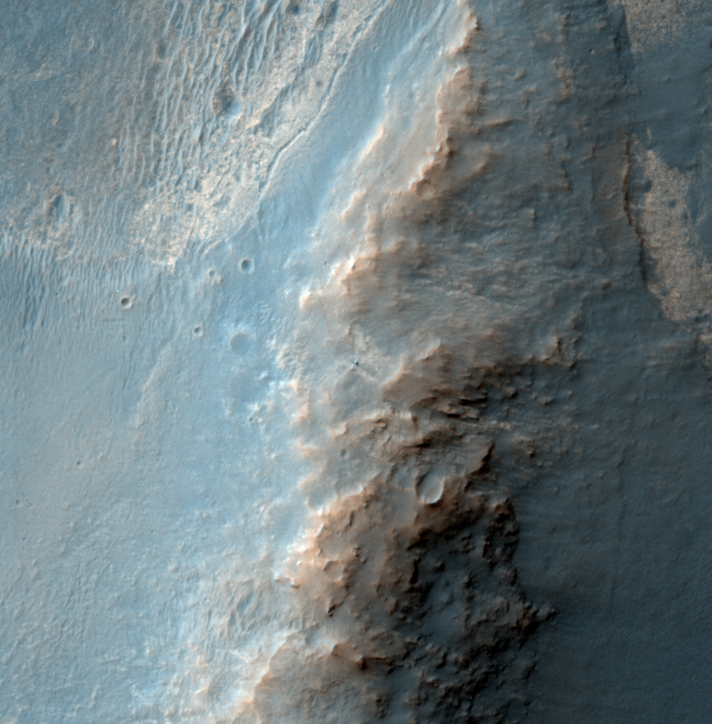
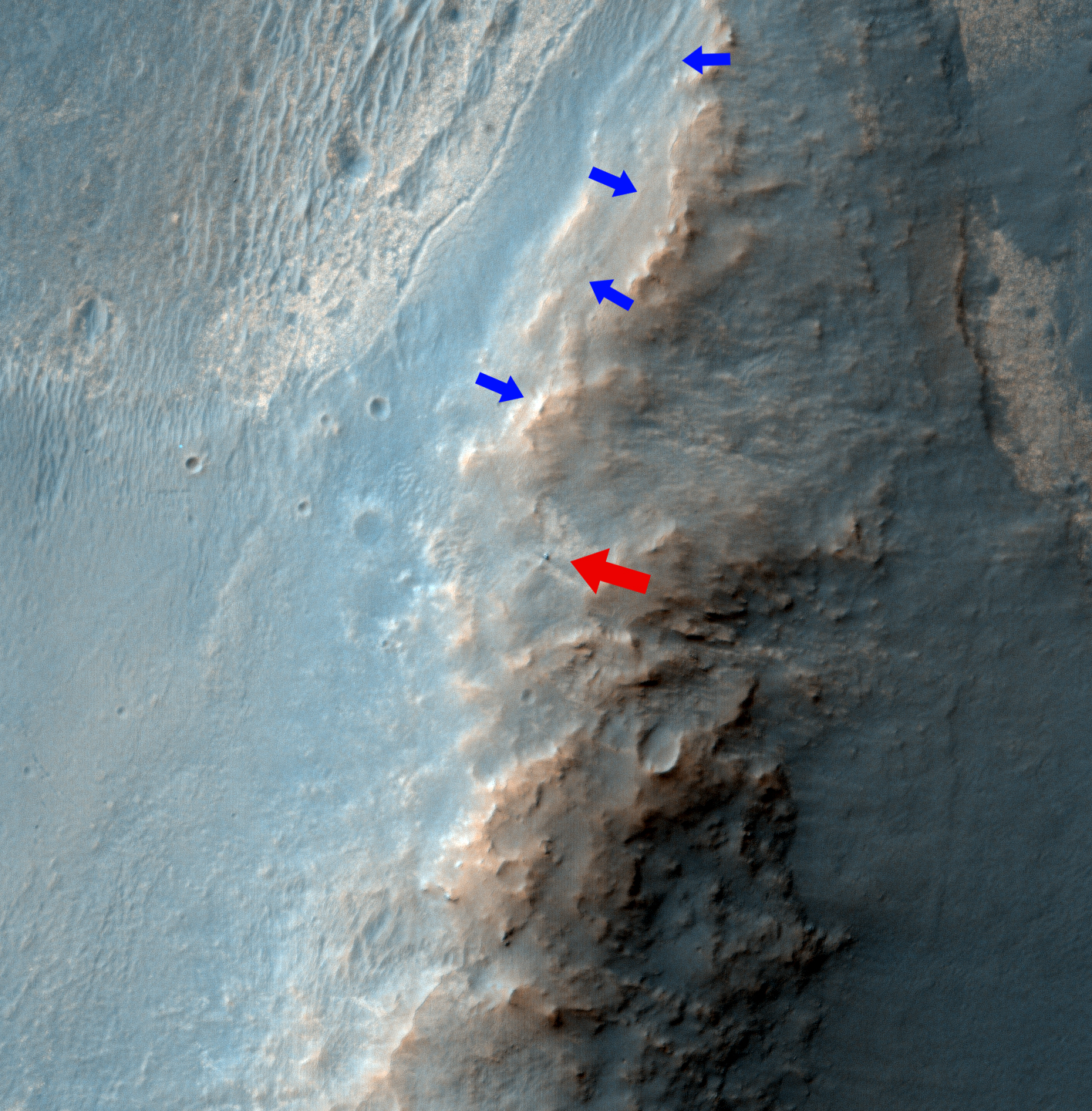
Alfred McEwen wrote:Opportunity Rover on Valentine's Day 2014 (ESP_035408_1775) (HiClip)
This is the latest HiRISE image of Opportunity rover at Solander Point, where it spent a few weeks investigating Pinnacle rock (the “jelly donut”) that was flipped over by the rover wheel.
We planned this image when this “new” rock was first seen; one hypothesis was that a recent impact deposited the rock. We see no obvious signs of a very recent crater in our image, but a careful comparison to prior images might reveal subtle changes (besides the rover position).
Changes in this region of Mars might be most likely from the action of wind (there are active sand dunes on the floor of Endeavour Crater), but new impacts could occur anywhere. The rover is located in the exact center of the color cutout.

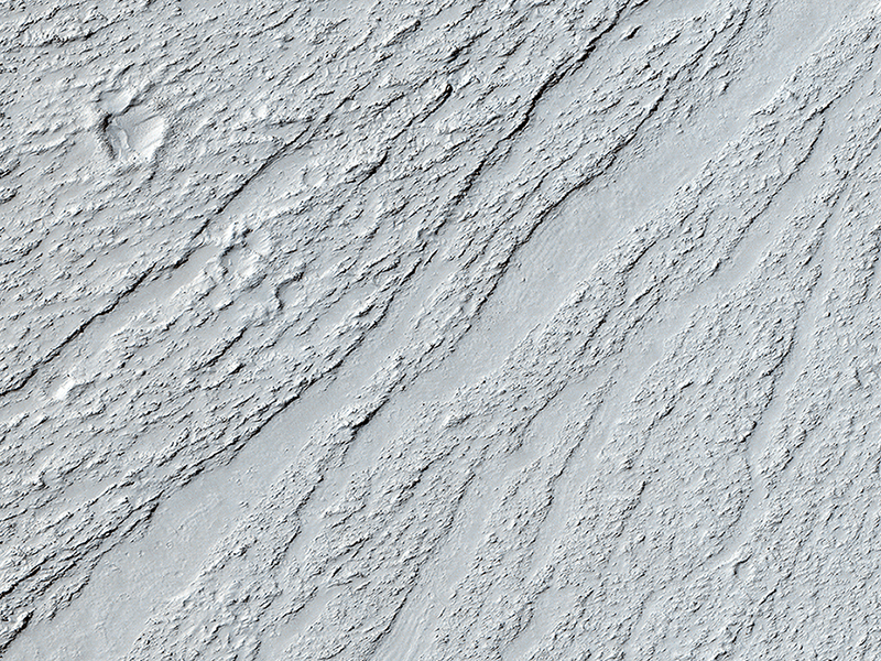
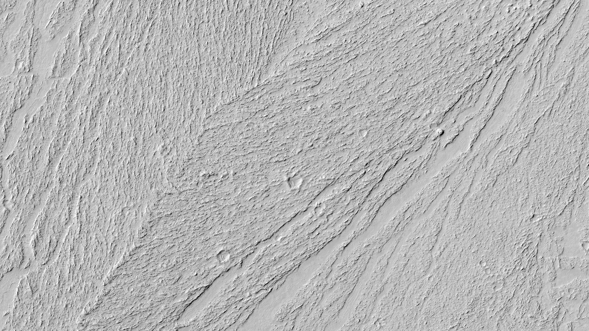
HiRISE Science Team wrote:Chevrons on a Flow Surface in Marte Vallis (ESP_034887_1870) (HiClip)
Lava flows cool as they move allowing their surface to freeze solid. The constant movement below this surface can break it up into a rough mass of jumbled broken rock. Sometimes larger surface areas that are thicker can behave like rafts that are dragged along by the flow.
Both features are visible in this image of an ancient lava flow in Cerberus Planitia. Isolated rafts that are still high-standing are visible and frozen into the flow. The rough areas show where the flow was fastest and have merged in places forming the large chevron-shaped features we see here.
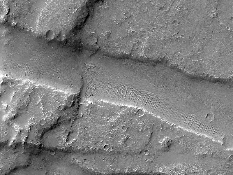
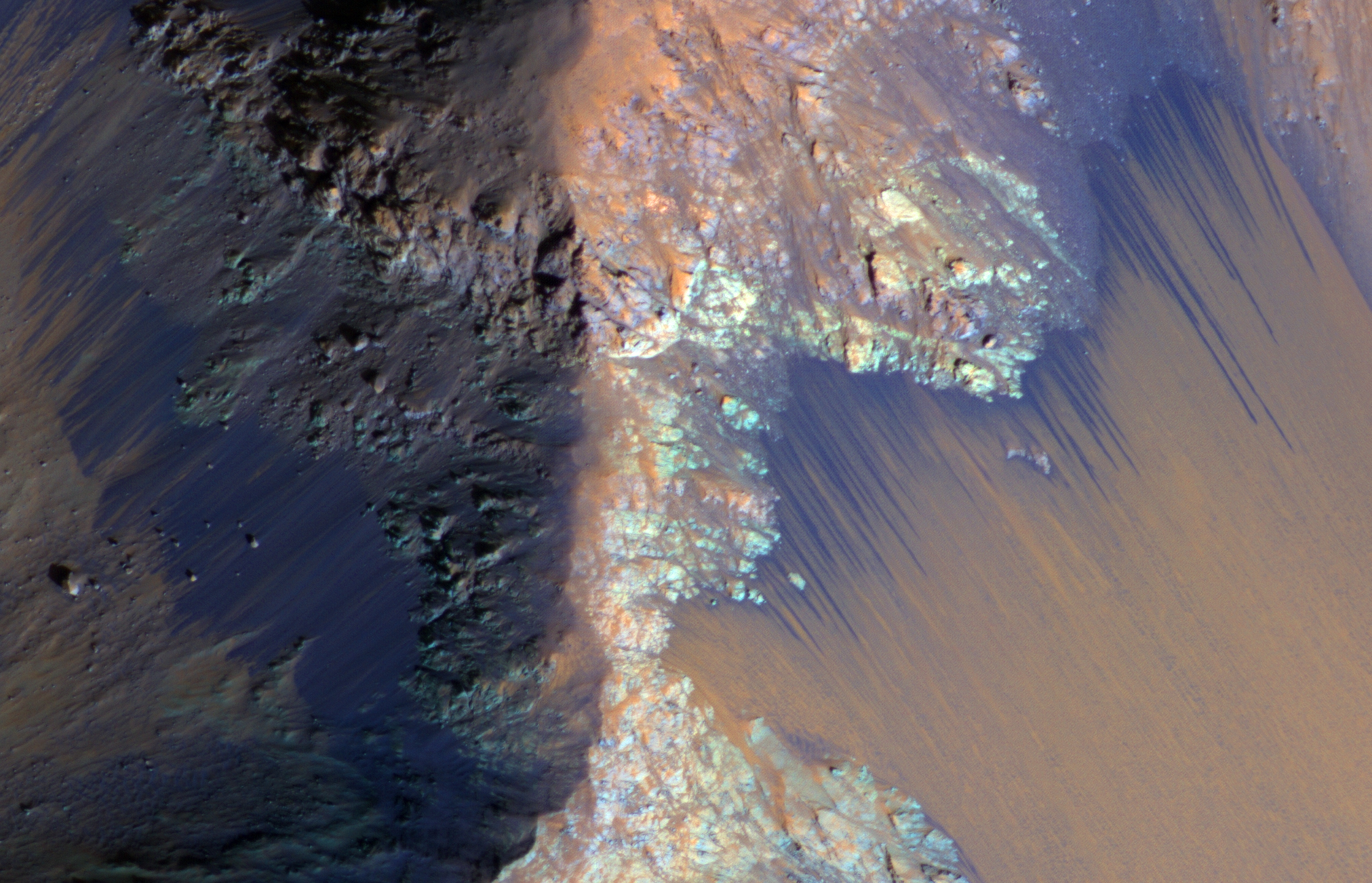
HiRISE Science Team wrote:Finding Faults in Melas Chasma (ESP_034883_1645) (HiClip)
Melas Chasma is part of the Valles Marineris canyon system, the largest canyon in the Solar System. It has been recently suggested that Melas Chasma may have been produced by an impact crater. To test this idea, HiRISE has been imaging surrounding small faults such as the ones seen in this image.
There are actually three faults in this image. The two trench-like features are called “graben” and are caused when the surface stretches apart and blocks of rock drop downwards. The third fault is the wavy ridge the cuts across both of the graben. This type of fault is sometimes called a “wrinkle ridge” and occurs when surface rocks are compressed causing one block of rock to be thrust up on top of another. So this area has been both stretched in the north-south direction and squeezed in the east-west direction.
With enough HiRISE images scientists hope to reconstruct the full history of this area and uncover the origin of one of Mars’ most spectacular features.
This is a stereo pair with ESP_034817_1645.
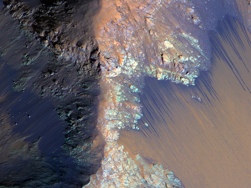
Alfred McEwen wrote:Recurring Slope Lineae in Coprates Chasma (ESP_034830_1670) (HiClip)
Recurring slope lineae (RSL) may be due to active seeps of water. These dark flows are abundant along the steep slopes of ancient bedrock in Coprates Chasma.
The enhanced-color cutout shows a full-resolution sample. The RSL are most prominent on the bright fans at the base of the bedrock, but actually extend back into the bedrock following small channels. MRO is continuing to monitor key sites to better understand this and other geologic activity on Mars.
This is a stereo pair with ESP_034619_1670.
Credit: NASA/JPL/University of Arizona
<< Previous HiRISE Update