
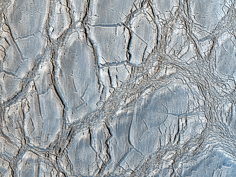
HiRISE Science Team wrote:An Unusual Mound (ESP_035078_2185) (HiClip)
With its cracked, blistery appearance, this mound near the center of a very large, over 5-kilometer diameter mid-latitude crater poses an interesting question: how did this form?
More importantly, what is the relationship between the mound and the surrounding, viscous features? Did those flow features play a role in forming the mound? Can that material help explain the cracked surface of the mound?
This is a stereo pair with ESP_034287_2185.
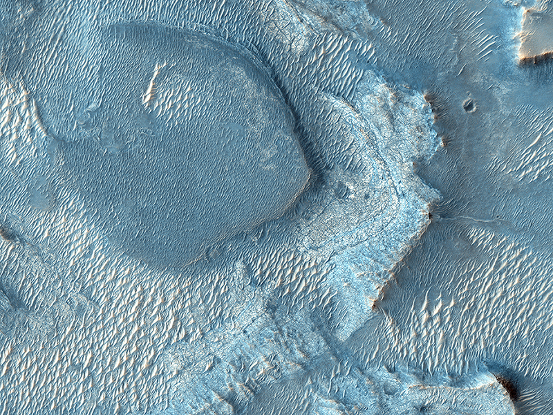
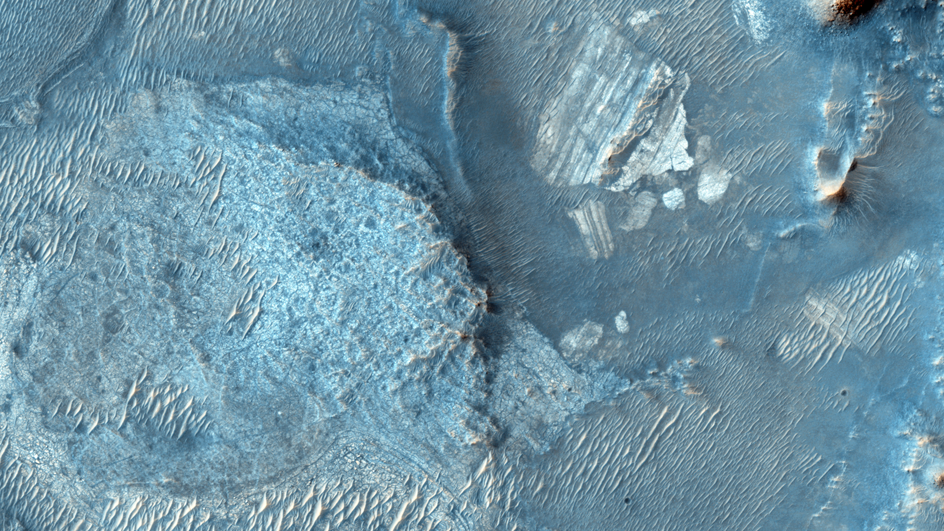
HiRISE Science Team wrote:A Large, Banded Angular Fragment in Nili Fossae (ESP_035062_1995) (HiClip)
In a Context Camera (CTX) image, there is a large angular fragment that appears to have light and dark-toned bands. HiRISE images of similar fragments nearby also show this banding, and the resolution of our camera may help determine what these layers are.
Nili Fossae was once considered a potential landing spot for the Mars Science Laboratory, and has one of the largest, most diverse exposures of clay minerals. Clay minerals contain water in their mineral structure and may preserve organic materials.
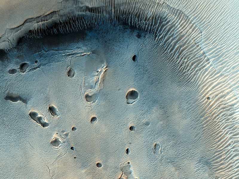
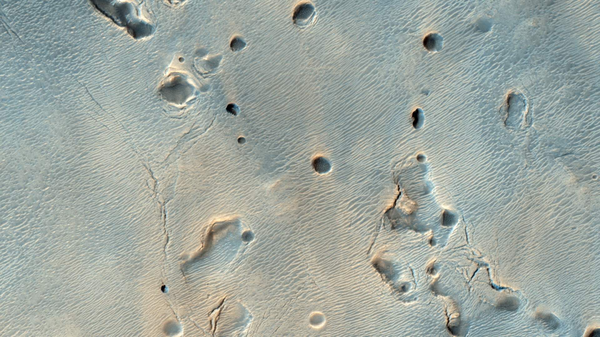
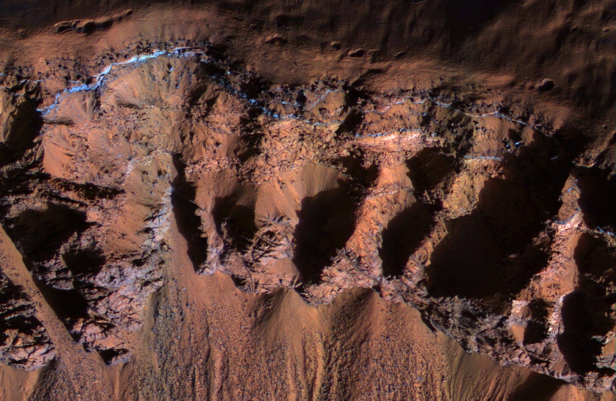
HiRISE Science Team wrote:A Dark-Toned, Pitted Mound in a Crater in Northeast Arabia Terra (ESP_034970_2040) (HiClip)
This fascinating observation shows us a dark-toned mound with pits inside an impact crater. Are these pits the result of sublimation?
The crater itself is an ancient one, as evidenced by the eroded rim. For the mound inside, HiRISE resolution can give us a closer look at textural features that might help explain what we're looking at: layers in pit walls, or perhaps cracks from expansion?
This is a stereo pair with ESP_034324_2040.
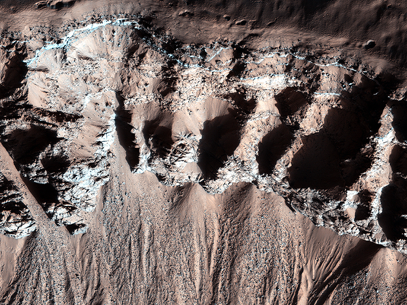
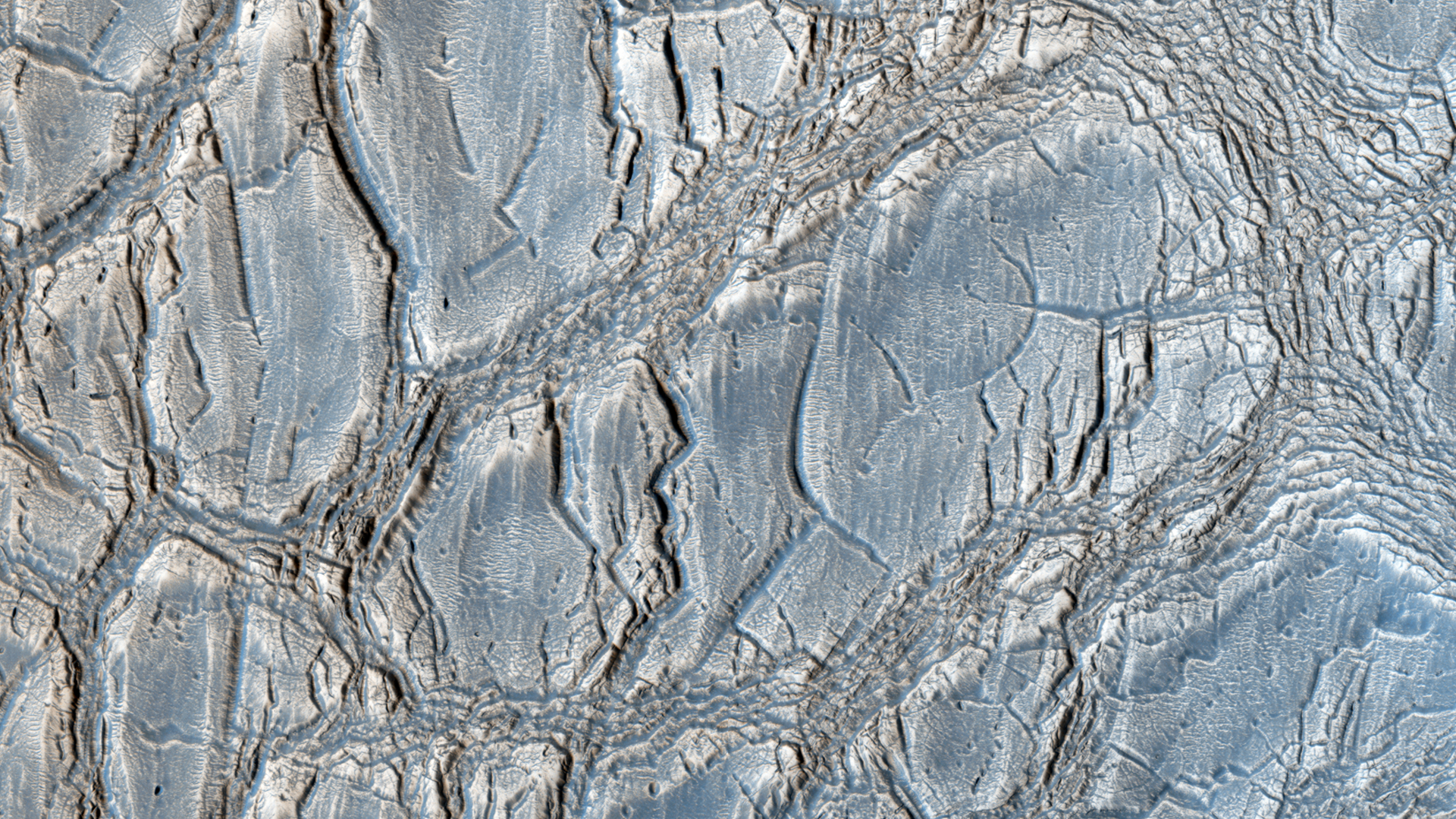
Alfred McEwen wrote:Bedrock in a Trough in Asimov Crater (ESP_035777_1320) (HiClip)
This image was acquired in southern winter over part of Asimov Crater (latitude 47.5 S), showing the equator-facing slope of a deep trough inside the crater. The crater appears to have been completely filled by a thick sequence of materials, perhaps including sediments and lava flows.
Later, deep troughs formed around the outer edge of the fill material, probably by collapse over void spaces at depth. What made the void space is not known, but one idea is that there were lenses of ice that slowly sublimated into the atmosphere. Another idea is that this is part of a sequence of crater fill and “exhumation”, that includes Gale Crater (home of the Curiosity rover). In other words, continued collapse and erosion of Asimov crater could eventually lead to a central mound like Eolis Mons (popular known as “Mt. Sharp”) in Gale Crater. However, at Asimov crater, the southern trough has destroyed the southern rim of the original crater, which didn’t happen at Gale Crater.
Many of these steep trough slopes in Asimov crater, where facing the equator, have recurring slope lineae (RSL) activity in the summer when the sun-facing slopes get warm. The RSL fade in the winter, so none are seen in this image even if they were present last summer. There are no previous HiRISE images acquired in the summer over this location.
Asimov Crater was named after Isaac Asimov, professor of biochemistry and prolific writer of science fiction and popular science books.
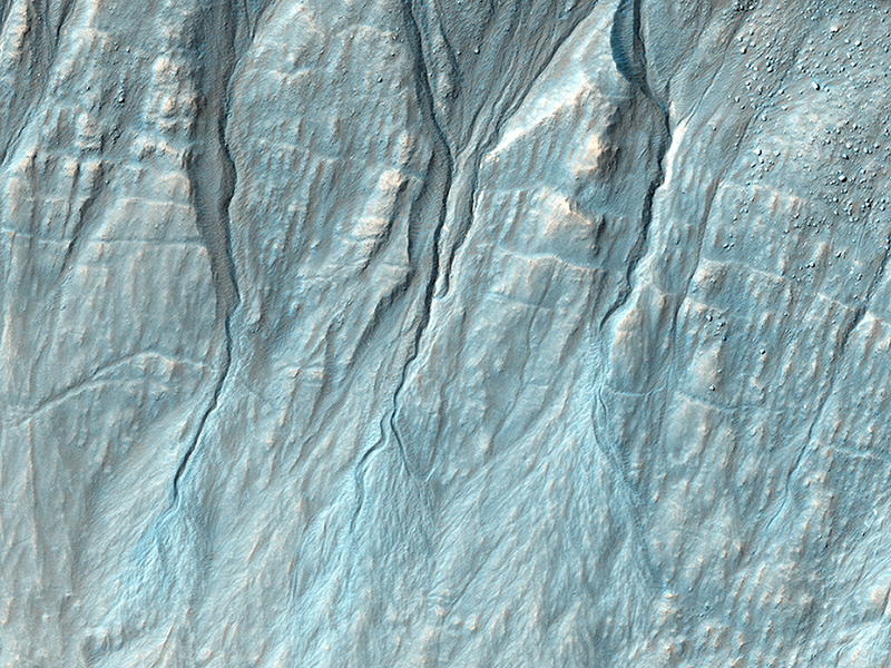
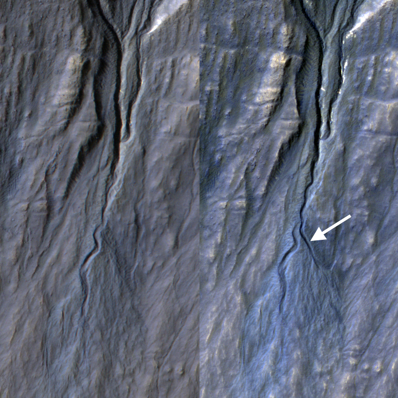
Colin Dundas wrote:A New Gully Channel in Terra Sirenum (ESP_032011_1425) (HiClip)
Gully, or ravine, landforms are commonly found in the mid-latitudes on Mars, particularly in the Southern highlands. These features typically have a broad upslope alcove, feeding into a channel and apron of debris that has been carried from above.
HiRISE has discovered many examples of activity in these gullies, likely driven by seasonal carbon dioxide (dry ice) frost. Images to look for such changes have been key targets for HiRISE in recent years, as we seek to understand the full range of surface processes that are active today.
This area was targeted to look for changes in gullies previously covered by ESP_020051_1420 and ESP_013115_1420. Comparing the newer and older images, we see that a substantial new channel formed sometime between November 2010 and May 2013. Material flowing down from the alcove broke out of the old route, eroded a new channel, and formed a deposit on the apron.
Observations like this show that gullies are forming today. Although we cannot pin down the season of this event, locations where HiRISE has been able to image more often demonstrate that this sort of event generally occurs in the winter, when liquid water is very unlikely. Despite their resemblance to water-formed ravines on Earth, carbon dioxide may play a key role in the formation of many Martian gullies.
Credit: NASA/JPL/University of Arizona
<< Previous HiRISE Update