
John Bridges wrote:A Possible Landing Site in Aram Dorsum for the ExoMars Rover (ESP_037030_1880) (HiClip)
One of the important roles of HiRISE is to take high resolution images of potential landing sites for future landing missions.
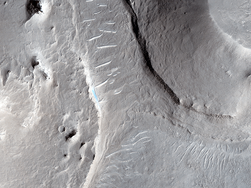
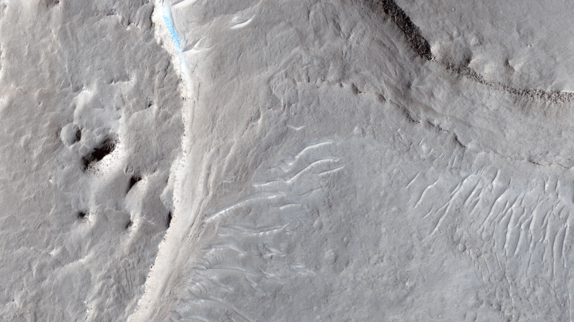
This image is of an area called Aram Dorsum (also known by its old name, Oxia Palus) that has been suggested for the 2018/2020 ExoMars Rover, because it contains an ancient, exhumed alluvial system.
Imaging is needed both to check for boulder fields and other obstacles, as well as checking the scientific justification for choosing a site. This image is one part of what we call a stereo observation, where taking a view at a different angle from another orbit of the same areas will allow a 3D model (a digital terrain model) to be prepared. With this model, accurate measurements of slopes can then be made. Although it won't show the exhumed alluvial system, images of the area are needed to characterize the landing site.
The main image of the Aram Dorsum site contains a relatively fresh, 150-meter diameter impact crater with associated boulders. This small (1 kilometer square) part also shows signs of erosion into an overlying plateau, plus recent formation of some transverse aeolian ridges (called TARs) within the resulting valley. Overall, however, the site has relatively few obstacles for a lander.
This is a stereo pair with ESP_036740_1880.
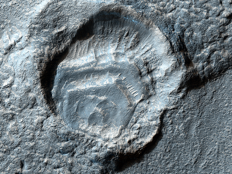
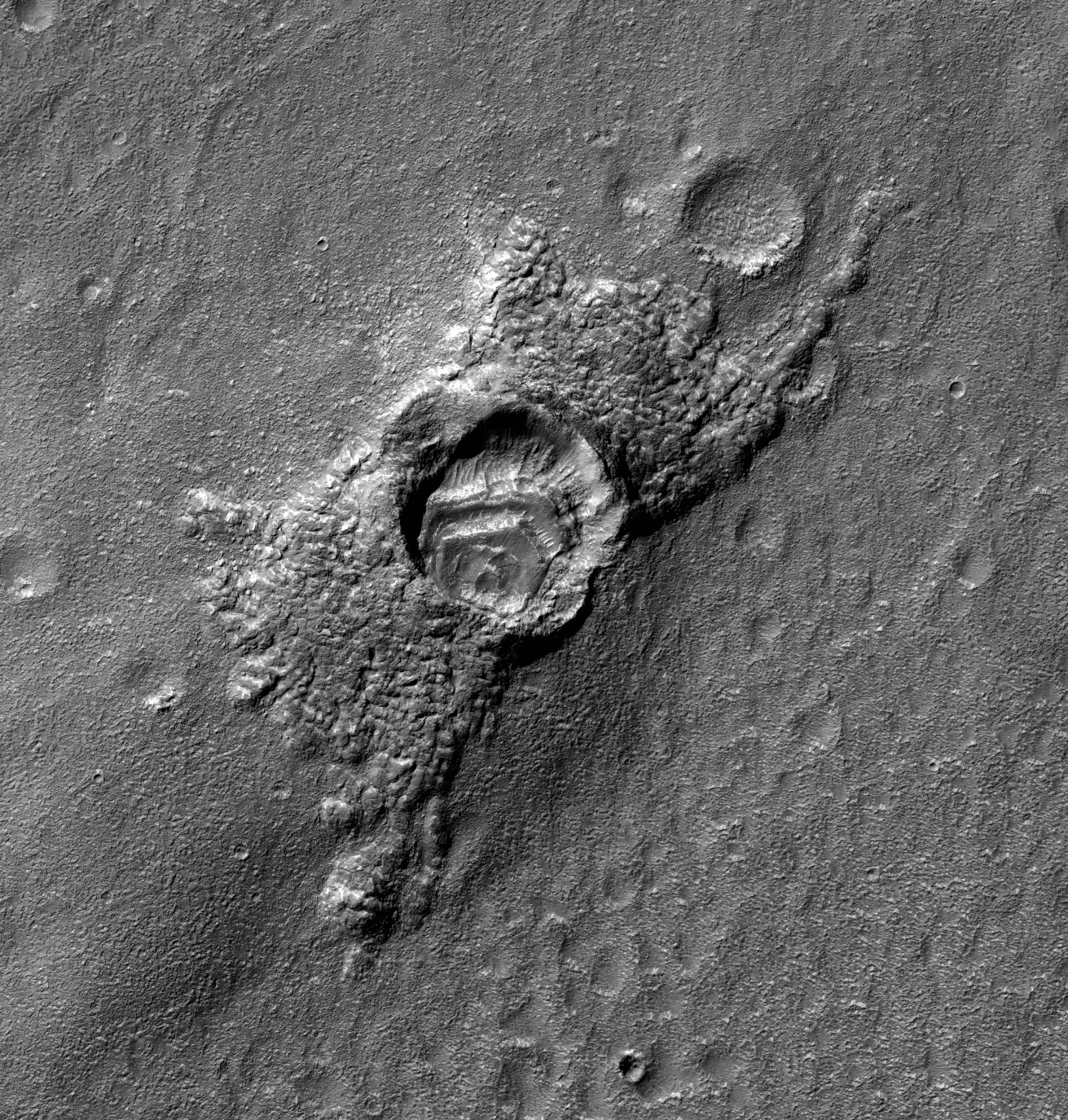
Alfred McEwen wrote:Weird Crater (ESP_037237_1435) (HiClip)
This feature has a strange appearance, as if the crater has feet with toes sticking out of two sides. Let’s try to explain this.
First, there was a highly oblique impact event, with the bolide (or meteorite) striking the ground while flying almost horizontally over the surface. Such oblique impacts tend to send ejecta in two directions to the sides of the bolide trajectory, rather than in all directions around the crater. However, there was ice near the surface, covered and protected by the ejecta, and the unprotected ice sublimated at some later time, so the ejecta now appears especially thick.
Also, there were layers of dust (maybe along with ice) deposited inside the crater. Or maybe something else happened, but likely involving the ice that comes and goes in the middle latitude regions of Mars.
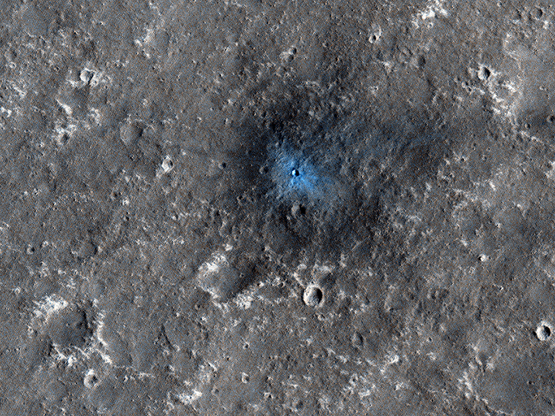
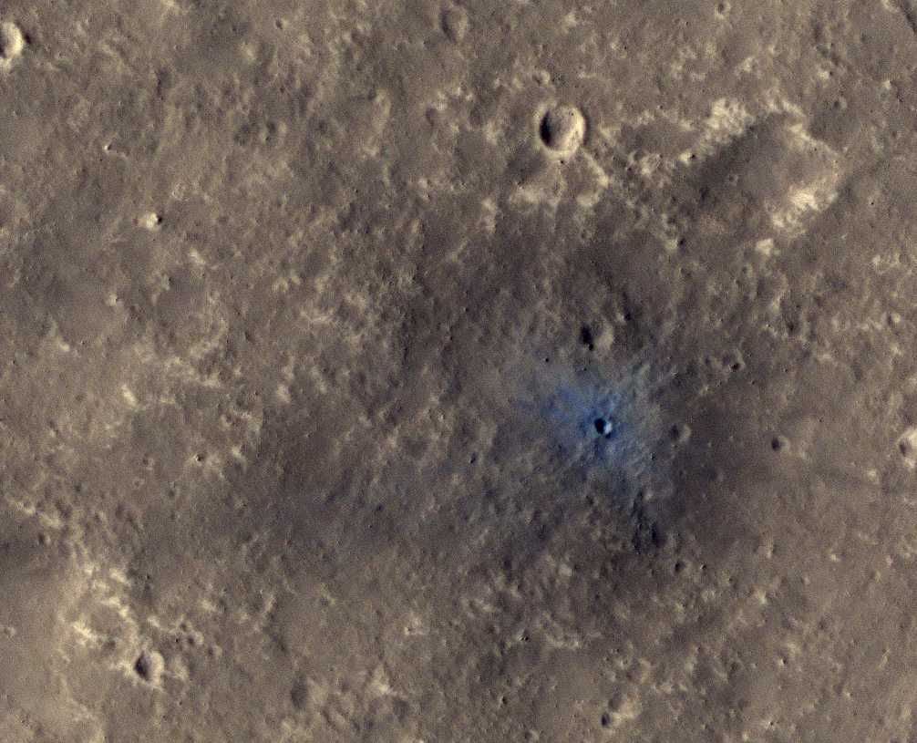
Alfred McEwen wrote:A New Impact Crater Near NASA's InSight Landing Region (ESP_037328_1845) (HiClip)
InSight (Interior Exploration using Seismic Investigations, Geodesy and Heat Transport) is a NASA Discovery Program mission that will place a single geophysical lander on Mars in September 2016 to study its deep interior.
InSight needs seismic signals, and one sure way to get them is from the impact of bolides onto Mars. InSight can detect large impacts that are far from the lander and smaller impacts that are closer.
This recent HiRISE image, acquired to certify a landing site for the mission, shows a distinctive crater with a very sharp rim and ejecta that is darker and bluer than almost all of this dust-covered region. This must be a very recent impact because there hasn't been sufficient time for atmospheric dust to settle over this spot and re-brighten the surface.
In fact, previous images suggest it formed between 2008 and 2012. This illustrates the type of feature that orbiting cameras will search for during the InSight mission, to attempt to correlate seismic signals to the point of origin.
This is a stereo pair with ESP_037684_1845.
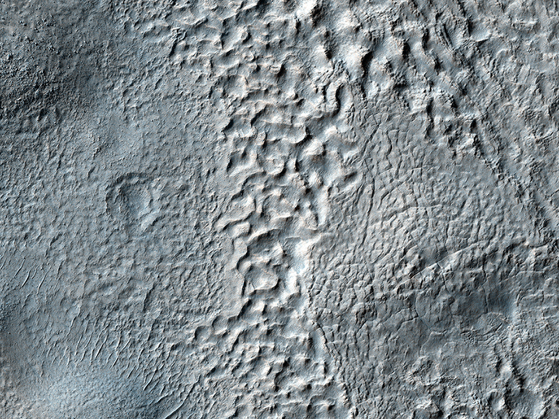
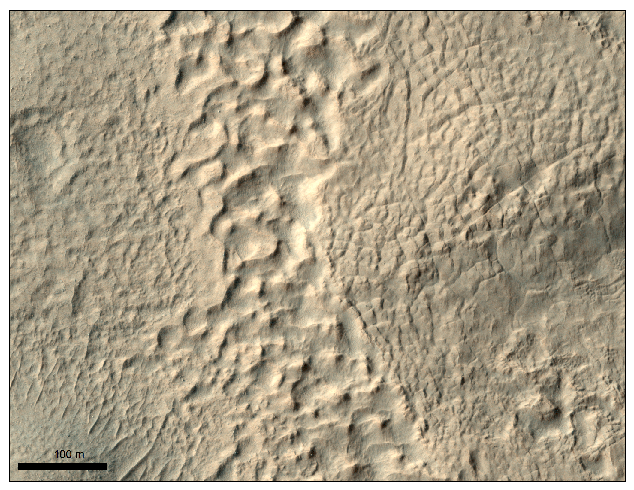
Dan Berman wrote:Mantled Terrain in the Southern Mid-Latitudes (ESP_037474_1380) (HiClip)
The mid-latitudes of Mars (approximately 30 to 60 degrees, north and south) are covered in ice-rich mantling deposits in varying states of degradation.
This mantle is thought to be deposited as snow during periods when the angle of the tilt of Mars’ rotational axis—called obliquity—is much higher, which last happened around 10 million years ago.
This HiRISE image shows terrain typical of these mantling deposits in the Southern Hemisphere, east of Reull Vallis. The pitted texture suggests that ice is sublimating out from the deposits as the region is warmed under current lower obliquity conditions.
Credit: NASA/JPL/University of Arizona
<< Previous HiRISE Update