
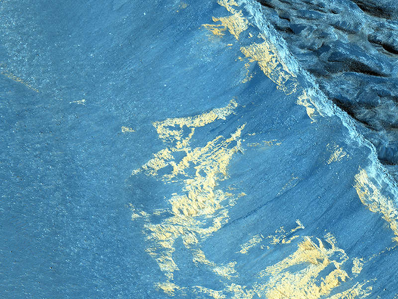
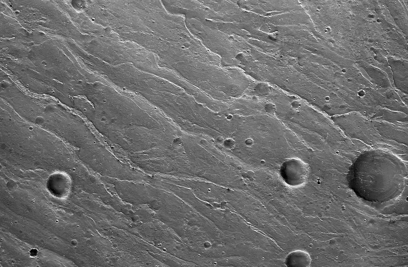
HiRISE Science Team wrote:Slope Monitoring in Aram Chaos (ESP_039655_1835) (HiClip)
A previous image, ESP_025954_1835 showed some striking dark downslope flows. Since this is a dark, low-dust setting, these are probably not slope streaks (which form in bright dusty areas).
This image can provide us with another look, particularly in order to detect any changes. Recurring slope lineae (RSL) are another type of dark streak seen on Martian slopes and are thought to form from flow of liquid water. Do these streaks behave like RSL? Additional images such as this one allow us to test whether these streaks grow seasonally and recur annually.
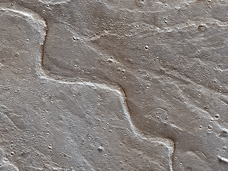
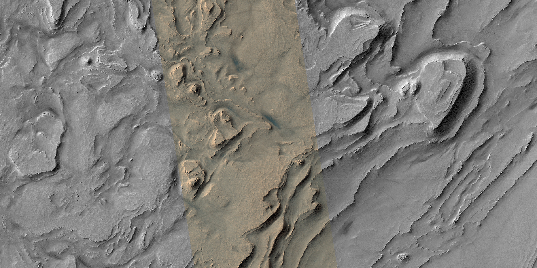
HiRISE Science Team wrote:Embayment in Tectonized Fluvial Terrain (ESP_039658_1425) (HiClip)
This highly tectonized terrain (meaning it possesses many faults) has its low-lying areas filled with some form of younger material. This particular fill is what geologists call “embayment.”
This observation helps scientists unravel the relative timing of the emplacement of the younger material and the numerous tectonic faults that run through this area.

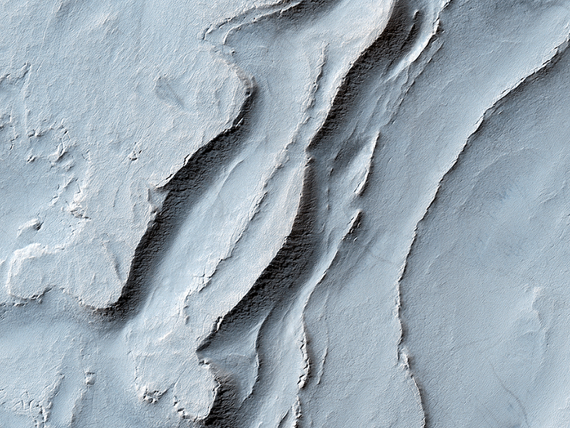
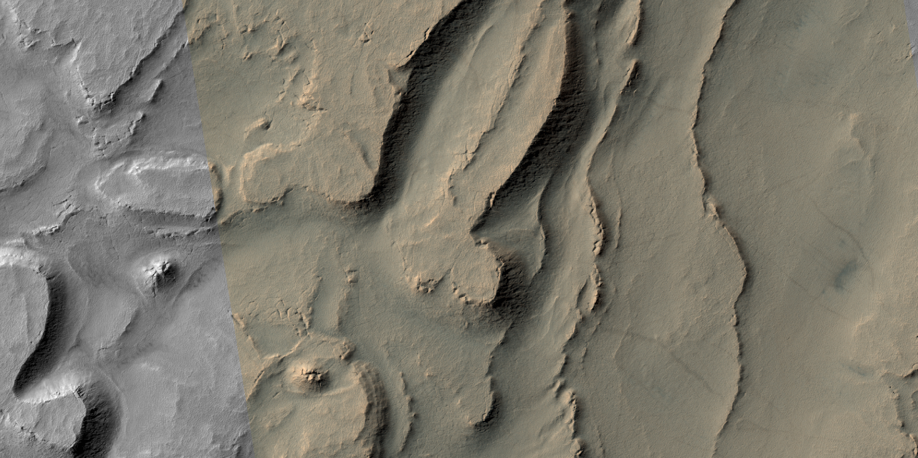
HiRISE Science Team wrote:Sinuous Ridge on the Orson Welles Bajada (ESP_039867_1805) (HiClip)
Alluvial fans are piles of debris dumped by rivers when they emerge from the mountains and enter a mostly dry valley. A bajada (such as this example named after the famous American filmmaker) consists of a series of coalescing alluvial fans along a mountain front.
On the surface of this bajada, one can see many sinuous ridges. These ridges mark the path that streams of water took as they flowed into this crater. The sinuosity of the ridges tells us something about the speed of the water flow. Fast moving flows tend to be straighter than slow-moving.
Observations like this help us build a picture of how rivers behaved on ancient Mars.
This is a stereo pair with ESP_032469_1805.
M. Ramy El-Maarry wrote:Layering in Spallanzani Crater (ESP_040258_1215) (HiClip)
In this recent HiRISE image, we can see quite a spectacular layering pattern inside an impact crater called Spallanzani. Seeing layering is always exciting to geologists because it implies that the region has experienced multiple climatic conditions or geologic processes through time. The study of layering is so important in geology that it has its own dedicated branch of study: stratigraphy!
Commonly, layering implies different lithologies (i.e., rock types). However, sometimes the layers could be of very similar composition but formed in different periods of time. This could happen for example in the case of annual flood deposits from rivers, multiple volcanic eruptions, or annual or periodic deposition of ice-rich material.
We can also see in this image another feature called terracing, which happens when the layers form distinctive planes on top of one another like terraces. This could imply that the layers are being eroded with time but some of the layers are being eroded quicker than others because they are less resistant to erosion.
So what is the composition of these layers? Spallanzani Crater lies in the high latitudes of the Southern hemisphere (around 60 degrees in latitude) so there is a good possibility that the deposits are ice-rich. If we look more closely we will notice fractured mounds, which sometimes indicate the presence of subsurface ice. Another interesting observation is the presence of grooves in the shaded slopes of some of the layers. Perhaps these grooves formed because of the sublimation (the direct transfer of solid ice to water vapor) of ice from these slopes since slopes tend to get warmer than the surrounding terrains.
A close inspection of this image may help answer this question and investigate the multiple cycles in which these deposits were laid down as well as the duration of these individual cycles.
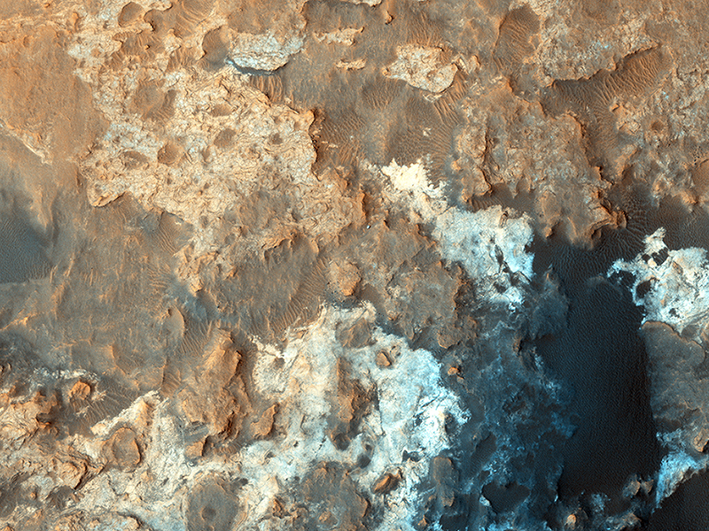
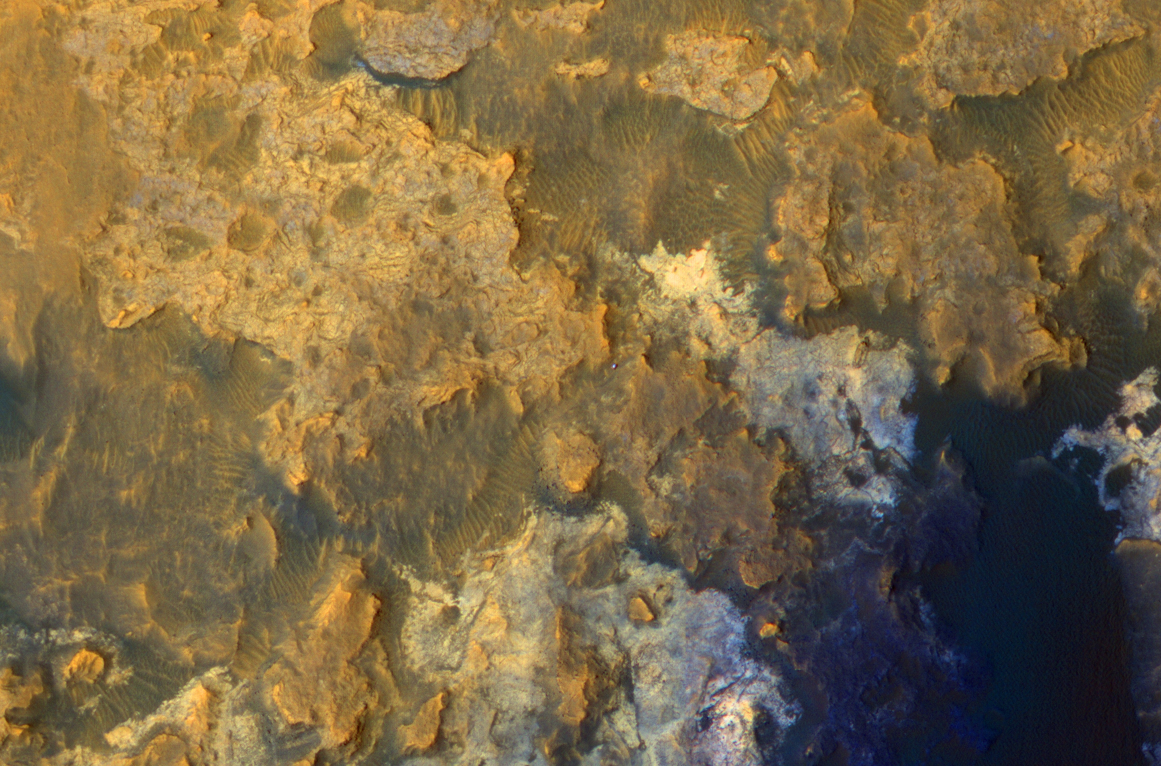
Alfred McEwen wrote:Latest View of Curiosity Rover in Gale Crater (ESP_040770_1755) (HiClip)
We periodically image the Curiosity rover and its surroundings, monitoring for changes such as from active dunes.
This is the latest image, with an enhanced-color cutout centered on the rover. Oddly, the rover’s tracks are not visible nearby, maybe because the surfaces it has driven over lately don't make high-contrast lines, or maybe some blowing dust has recently erased the tracks.
ADDENDUM: With HiRISE’s capability of high resolution (down to 25 cm/pixel) and ability to image the same area periodically, our team is keeping track of the Curiosity (MSL) and Opportunity (MER) rovers. For Curiosity, we recently acquired our first image in four months and the first in 2015. Here we see the rover parked over dark sand in a valley bounded by light-toned rock outcrops. These rocks make up the “Pahrump” member of the Murray Formation, a suite of sandstones, siltstones, and calcium sulfate veins that compose the lowermost exposed rocks of Mount Sharp (Aeolis Mons) in Gale Crater. This image also addresses several objectives besides keeping track of the rover location, such as the monitoring of nearby active sand dunes and the degree to which rover tracks are preserved on the underlying terrain. Unlike other regions of for which Curiosity has traversed, here the rover tracks are not apparent, likely because the disturbed, underlying, dark sand is similar in tone to that on the surface. (Nathan Bridges)
Credit: NASA/JPL/University of Arizona
<< Previous HiRISE Update