
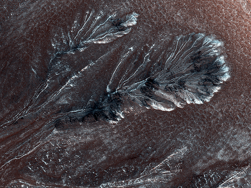
Colin Dundas wrote:Frosty Gullies on the Northern Plains (ESP_040811_2410) (HiClip)
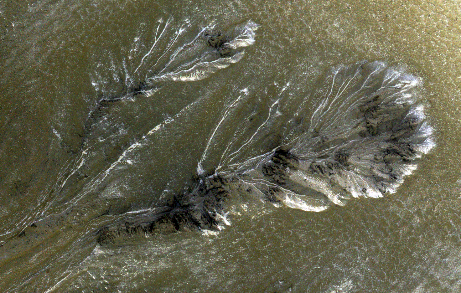
Seasonal frost commonly forms at middle and high latitudes on Mars, much like winter snow on Earth. However, on Mars most frost is carbon dioxide (dry ice) rather than water ice. This frost appears to cause surface activity, including flows in gullies.
This image shows frost in gully alcoves in a crater on the Northern plains. The frost highlights details of the alcoves, since it forms in different amounts depending on slopes and shadows as well as the type of material making up the ground. Rugged rock outcrops appear dark and shadowed, while frost highlights the upper alcove and the steepest route down the slope.
Most changes associated with gullies are observed in the Southern hemisphere. However, some are seen in the Northern hemisphere, where steep slopes are less common. HiRISE is monitoring these gullies to look for changes and to understand the behavior of the frost.
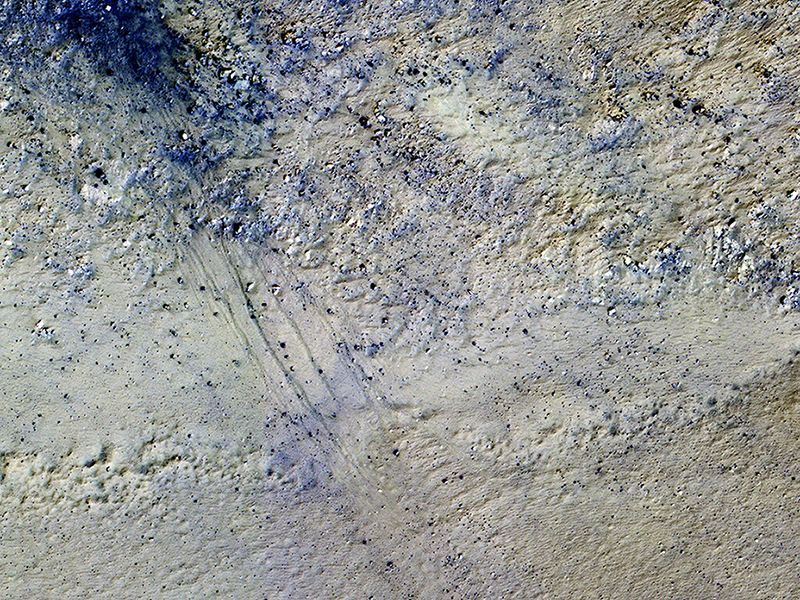
Matthew Chojnacki wrote:Potential Active Processes in Porter Crater (ESP_040885_1295) (HiClip)
The extended-mission status of the Mars Reconnaissance Orbiter and the HiRISE camera has greatly increased our understanding of numerous active processes occurring on Mars. By taking carefully planned repeat images of surface, we now have an important record of how the surface evolves for a maximum of 5 Mars years.
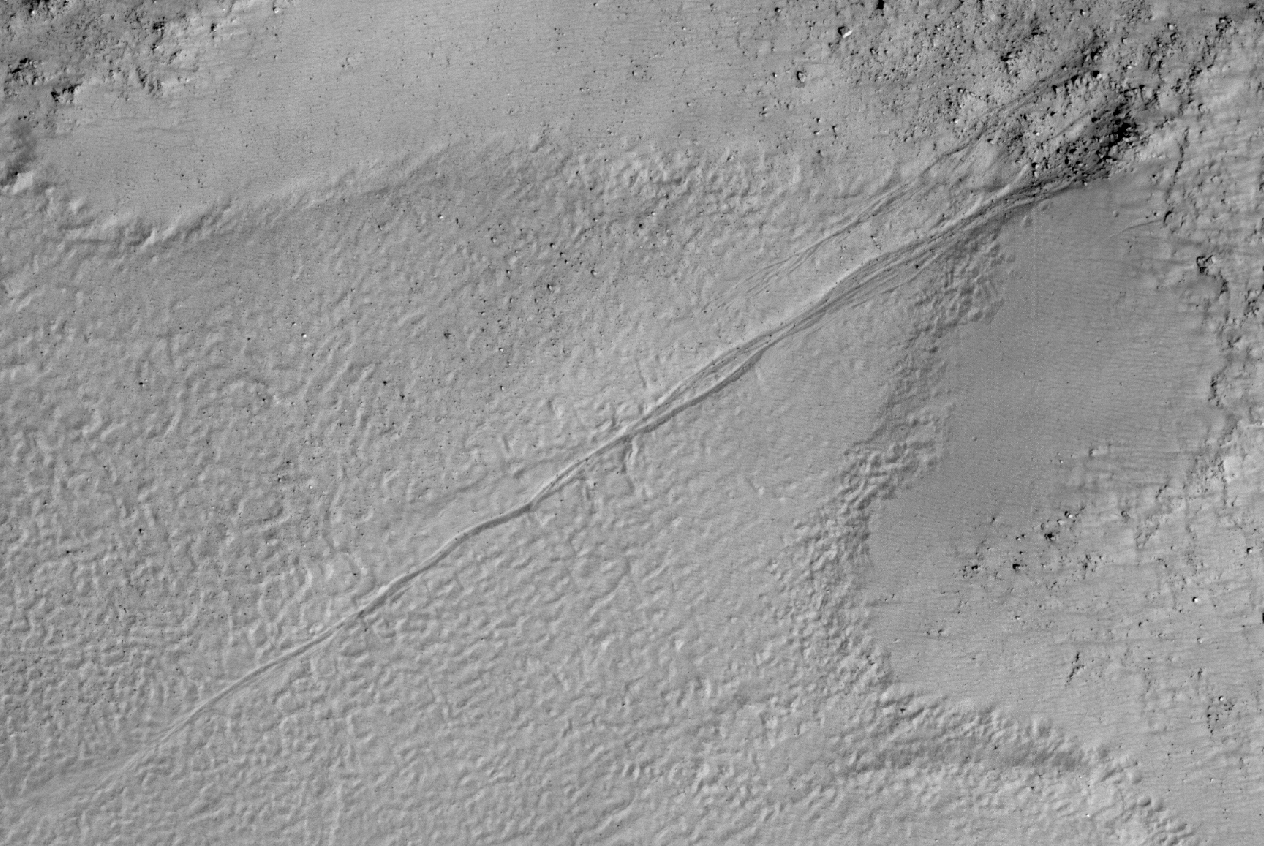
This image shows the central peak in Porter Crater. Although there are no repeat images here we can infer several active geologic processes, based on morphologic evidence and lessons learned from past well-monitored sites.
Shallow gullies are located on the south and east facing slopes of the central peak. These features might have been carved by volatiles, such as carbon dioxide frost, sometime in the recent geologic past.
Meanwhile on the northern slopes are several smaller slope features that have a morphology hinting at recurring slope lineae (RSL). Alternatively, these features could be the remnants of past active gullies. Several more HiRISE images would be needed to characterize their behavior and confirm their status as RSL (see “Recurring Slope Lineae in Equatorial Regions of Mars”).
Southward on the slopes below the peak is a large dune field. Dunes show sharp crests with prominent ripples, both signs of actively migrating dunes. Also, we can see dust devil tracks crossing the nearby dusty surfaces and clear evidence for ongoing modification by swirling winds that persistently remove surface dust.
Ongoing operations by HiRISE are dedicated to studying all of the active surface and atmospheric processes operating on Mars.
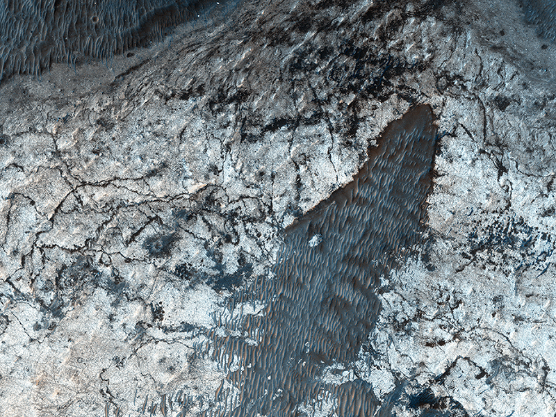
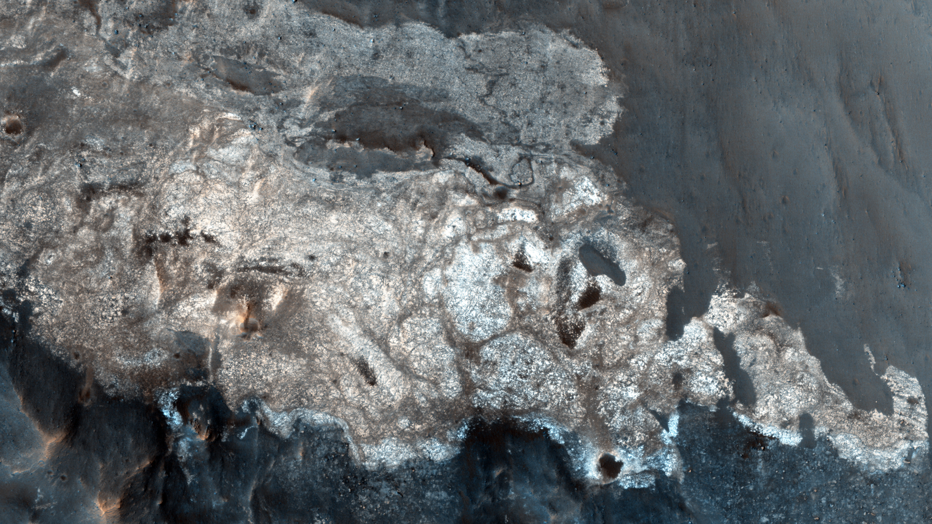
Cathy Weitz wrote:Sedimentary Deposits within Ius Chasma (ESP_040976_1725) (HiClip)
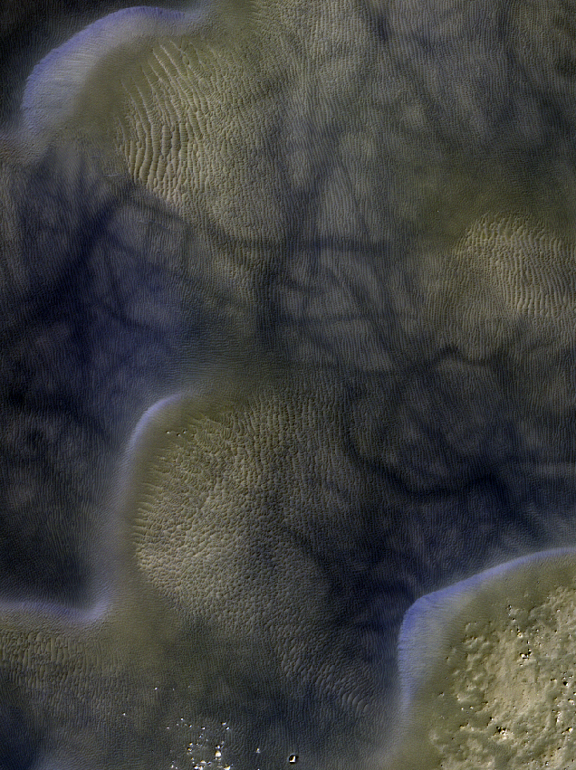
Sedimentary deposits are common within Valles Marineris. Most of the larger chasmata contain kilometer-thick light-toned layered deposits composed of sulfates. However, some of the chasmata, like Ius Chasma shown in this HiRISE image, either lack these deposits or have much thinner deposits.
The light-toned deposits in Ius Chasma are observed both along the floor and inner wallrock materials. Some of the light-toned deposits appear to post-date formation of the chasma floor, whereas other deposits appear to lie beneath wallrock materials, indicating they are older. By examining the stratigraphy using digital terrain models and 3D images, it should be possible to decipher the relative ages of the different geologic units. CRISM data may also provide insight into the mineralogy, which will tell scientists about the aqueous conditions that emplaced the light-toned deposits.
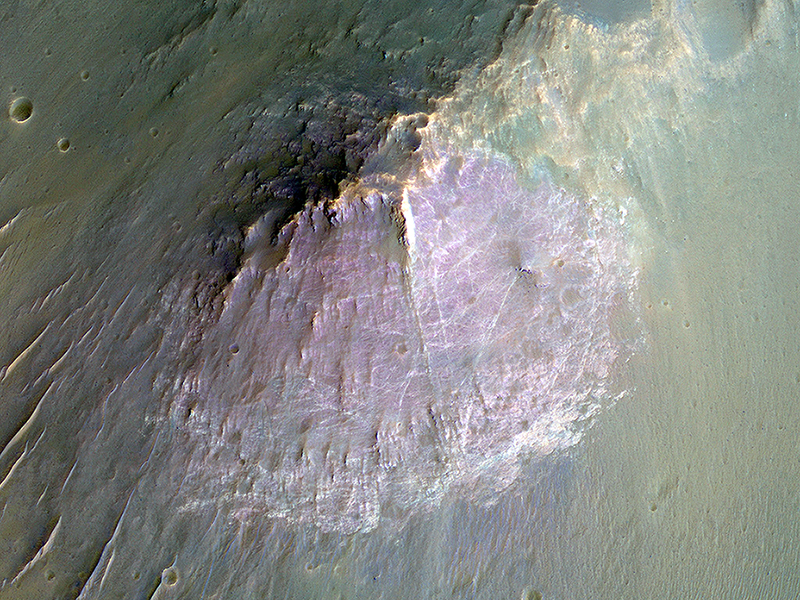
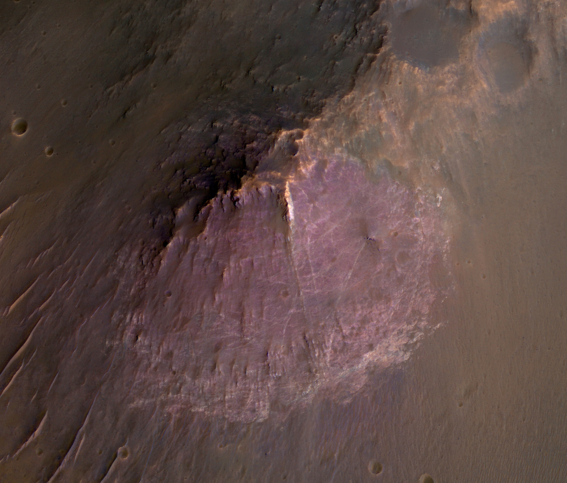
Alfred McEwen wrote:Purple Mountain's Majesty (ESP_041088_1535) (HiClip)
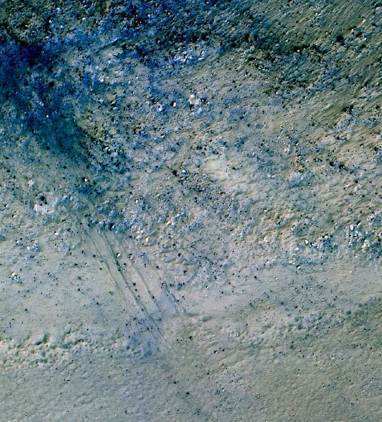
This image of an isolated mountain in the Southern highlands reveals a large exposure of “purplish” bedrock.
Since HiRISE color is shifted to longer wavelengths than visible color and given relative stretches, this really means that the bedrock is roughly dark in the broad red bandpass image compared to the blue-green and near-infrared bandpass images.
In the RGB (red-green-blue) color image, which excludes the near-infrared bandpass image, the bedrock appears bluish in color. This small mountain is located near the northeastern rim of the giant Hellas impact basin, and could be impact ejecta.
Credit: NASA/JPL/University of Arizona
<< Previous HiRISE Update