
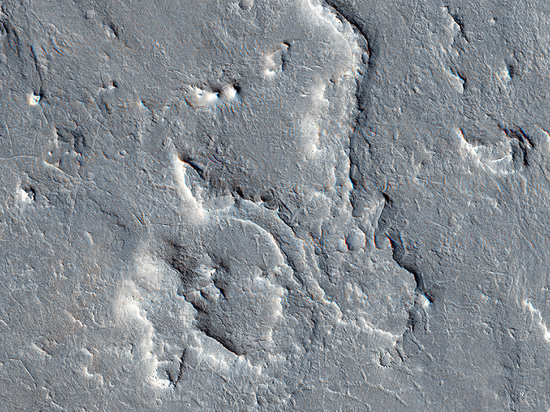
John Bridges wrote:A Possible Landing Site for the ExoMars Rover in Aram Dorsum (ESP_040881_1880) (HiClip)
This image is part of a proposed landing site for the ExoMars Rover, planned for launch in 2018.
We can see how an upper layers of light toned sediments have been eroded, leaving a lower surface which appears dark. The retreating sediment scarp slopes would be an important target for the rover if it ends up going to Aram Dorsum.
The retreating scarps will be relatively recent compared to the ancient age of the terrain. That means that organic compounds—which is what ExoMars is designed to drill to 2 meters depth and analyze—will not have been exposed to the full effects of solar and galactic radiation for their entire history. Such radiation can break down organic compounds. Prior to this later erosion, the rocks formed in the ancient, Noachian era as alluvial deposits of fine grained sediment.
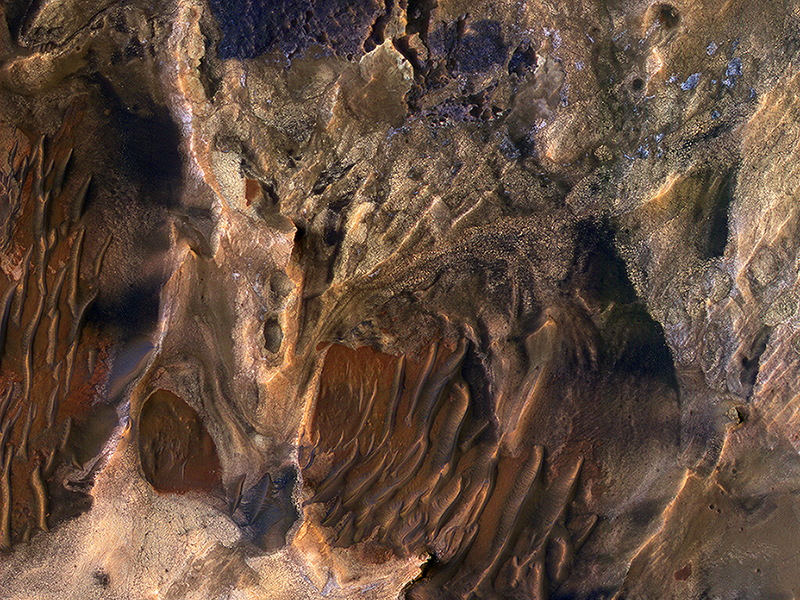
Alfred McEwen wrote:Diverse Deposits in Melas Chasma (ESP_041134_1720) (HiClip)
This scene includes chaotic deposits with a wide range of colors. The deposits are distinctive with both unique colors and small-scale textures such as fracture patterns.
These are probably sedimentary rocks, transported and deposited in water or air. The original layers may have been jumbled in a landslide. Dark or reddish sand dunes cover some of the bedrock.
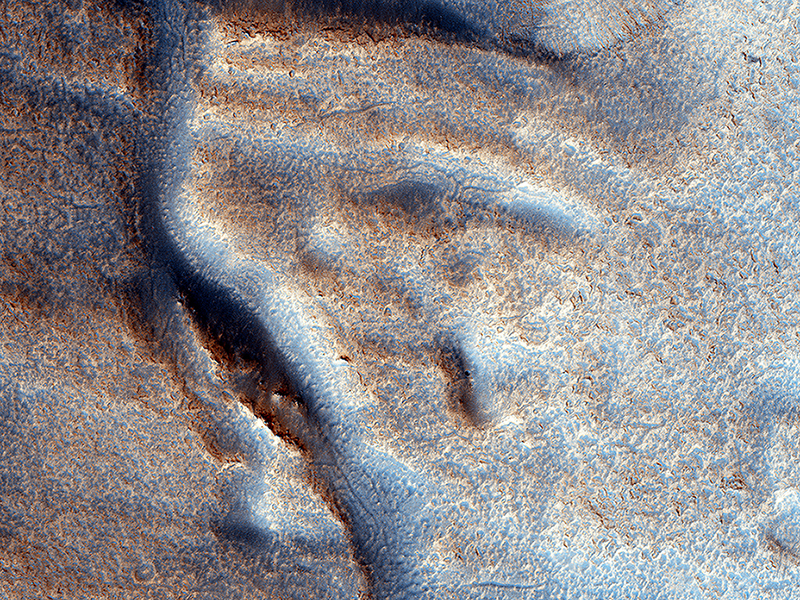
Cathy Weitz wrote:A Fresh Shallow Valley Transitions to an Inverted Channel (ESP_041144_2200) (HiClip)
This image shows a portion of a long valley system in northern Arabia Terra. The valley must be relatively young because it cuts through the ejecta of an impact crater that still retains it entire ejecta blanket, indicating the crater is also fairly young and fresh.
The valley is interesting because it transitions to an inverted channel near its end point. Inverted channels form when a valley fills with materials. Later, erosion removes the surrounding terrain leaving behind higher standing and more resistant material that filled the valley.
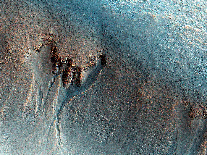
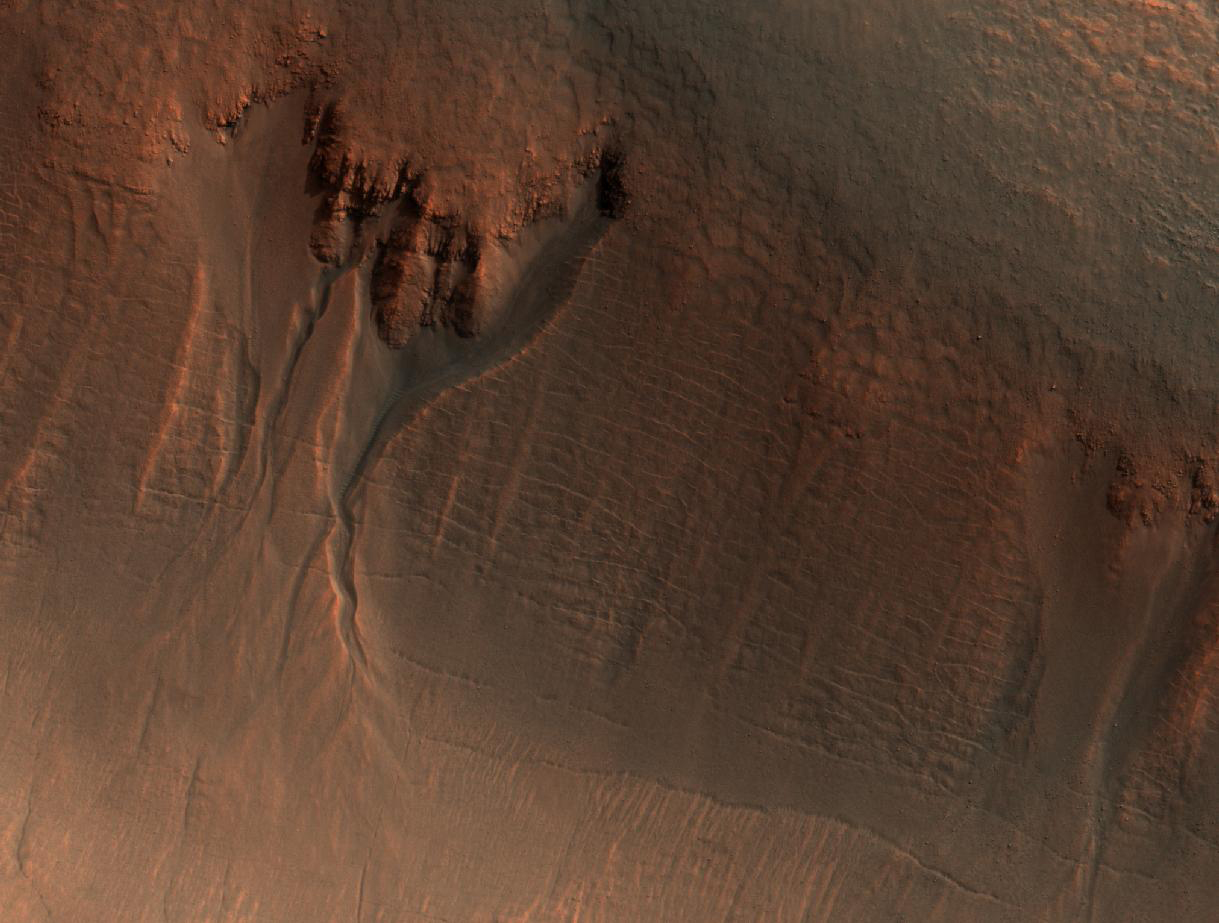
Livio Tornabene, Tanya Harrison, Elizabeth Silber, and Kayle Hansen wrote:Gullies on the Wall of an Unnamed Crater in Utopia Planitia (ESP_041866_2290) (HiClip)
This enhanced-color image of gullies in the northern wall of an unnamed crater in Utopia Planitia covers an area of approximately 750 by 1100 meters. The banked, sinuous shape of the gully channels suggest that water was involved in their formation. The source of this water however is a subject of debate. Hypotheses include melting of snow or near-surface ground ice.
Other features also suggest the past (and possibly present) presence of snow or ground ice in this region. For example, the “mantle” deposit on the crater wall displays polygonal fractures. Polygons on Earth are associated with periglacial activity. This refers to processes that occur from the presence of ground ice, which interacts with surface and subsurface materials, as well as the Martian atmosphere as a function of climate and seasons). The mantle itself may be the remains of a dusty snowpack deposited in Mars’ recent past.
At the base of the mantle are fractures associated with the slumping of these deposits under their own weight and Martian gravity. The largest gullies cut into these mantling deposits, and in some places obscure the underlying fractures at the base of the crater wall. This indicates that the largest gullies are younger than both the mantle and the fractures.
Credit: NASA/JPL/University of Arizona
<< Previous HiRISE Update