
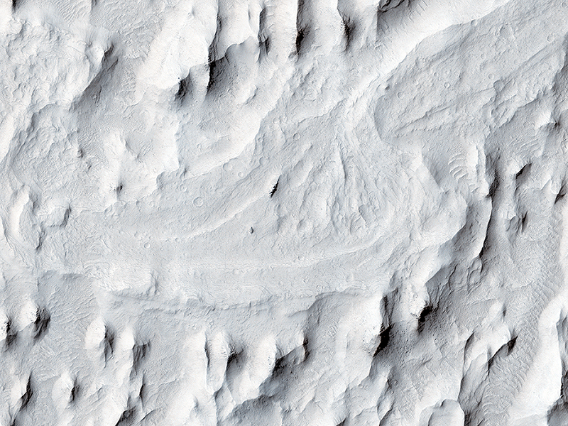
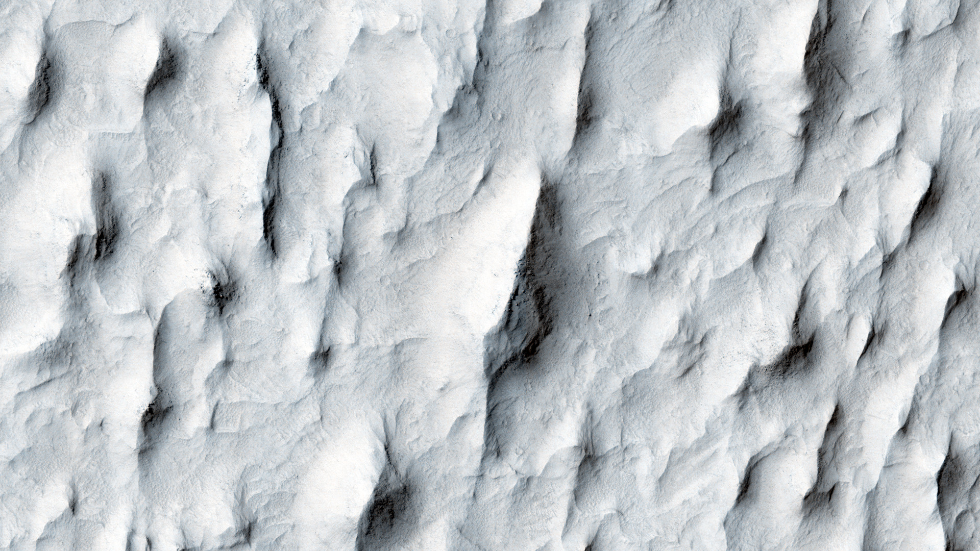
Austin S. Guynn and Marjorie A. Chan wrote:Meanders in Ridge Form in the Zephyria Region (ESP_024695_1745) (HiClip)
In this image, an ancient sinuous meandering river system is surrounded by features called “yardangs.” The yardangs are the ridge-like landforms that align approximately north-south. These features were created as the wind scoured and eroded the bedrock.
The raised relief of the meandering river suggests inverted topography, likely due to lithification and cementation of the riverbed sediment. The cemented channel deposits were resistant, and thus less susceptible to erosion over time. However, the area surrounding the riverbed suggests that this area was a floodplain of weaker lithology that was subsequently eroded and shaped to the yardangs.
The main meandering inverted riverbed within the image has a length of about 13 kilometers. The elevation of the channel at the top of the image is on the order of 113 meters higher than the bottom, based on Mars Orbiter Laser Altimeter (MOLA) data. This elevation difference and the increase in sinuosity of the channel shape in the southerly direction implies that the flow of the ancient river may have been heading south-southwest.
This is a stereo pair with ESP_025407_1745.
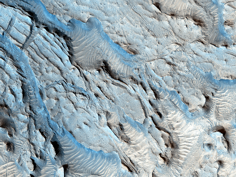
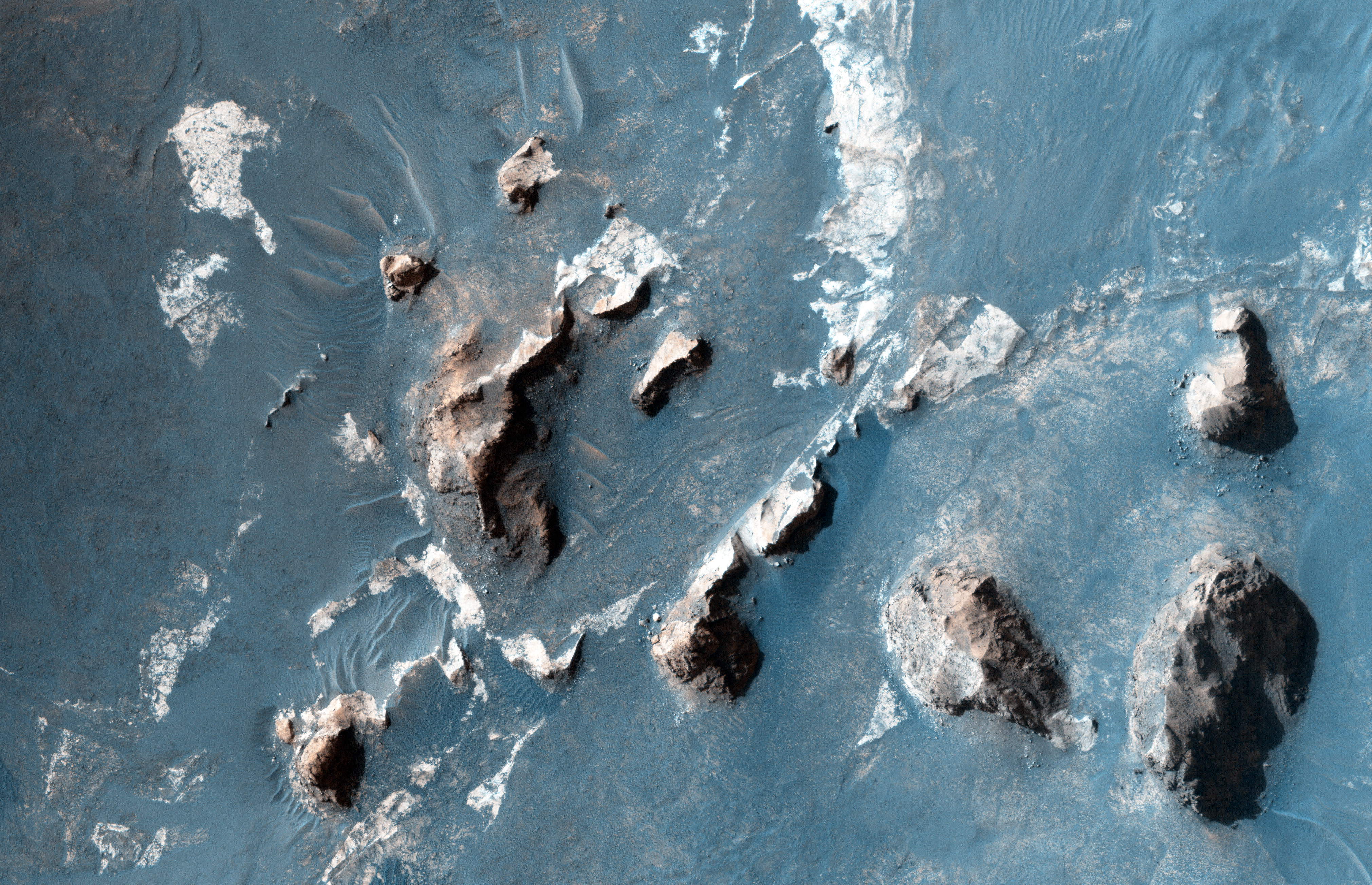
David Purcell and Marjorie A. Chan wrote:Small Channels and a Rocky Patch in the Cydonia Region (ESP_032283_2115) (HiClip)
The southern section of this image is dominated by both a series of craters and the remnants of channels that may be from a past fluvial system.
The paleochannel system has wind-blown bedforms in its interior, with crests oriented approximately perpendicular to the channel walls. The large rocky patch near the center of the image shows some evidence of bedding as would be expected for a river delta or other water-lain sediments, but the rough dissected nature of outcrops and superimposed aeolian bedforms and other sediments makes identification of this feature difficult.
This is a stereo pair with ESP_031993_2115.
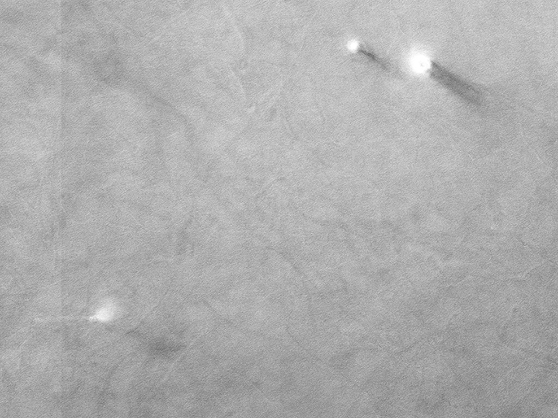
Paul Geissler wrote:Marching Dust Devils (ESP_042201_1715) (HiClip)
On an early fall afternoon in Ganges Chasma (Valles Marineris), we managed to capture a cluster of 8 dust devils, five of them in the enhanced color strip. They’re together on a dark sandy surface that tilts slightly to the north, towards the Sun.
Both of these factors help warm the surface and generate convection in the air above. The surface is streaked with the faint tracks of earlier dust devils. A pair of dust devils appears together at top right, spaced only 250 meters apart. These two have quite different morphologies. The bigger one (on the right) is about 100 meters in diameter and is shaped like a doughnut with a hole in the middle. Its smaller companion is more compact and plume-like, but it too has a small hole in the center, where the air pressure is lowest. It may be that the smaller dust devil is younger than the larger one. A row of four dust devils are in the middle of the color strip, separated by about 900 meters from one another.
This image might answer some interesting questions about the behavior of dust devils. Dust devils are theoretically expected to migrate uphill on a sloping surface, or migrate downwind when there is a breeze. Where they are found close together in pairs, they are expected to rotate in opposite directions. HiRISE color observations can be used to determine the direction of rotation and—for fast moving dust devils—the direction of their travel. This is because the different color observations (infrared, red, and blue) are taken at slightly different times. The differences between the earliest color observation and the last tell us about the changes that took place during that time interval.
All this requires careful analysis, but if these dust devils are moving fast enough, and spaced closely enough, these here might display some interesting “social dynamics,” possibly marching together and rotating in alternating directions.
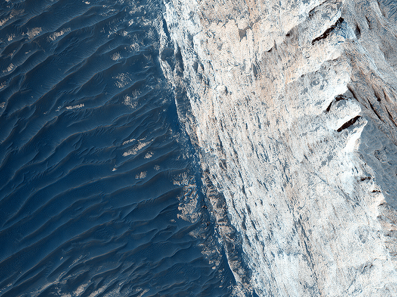
Kirby Runyon wrote:Layers and Fractures in Ophir Chasma (ESP_042360_1755) (HiClip)
Ophir Chasma forms the northern portion of Valles Marineris, and this image features a small part of its wall and floor.
The wall rock shows many sedimentary layers and the floor is covered with wind-blown ridges, which are intermediate in size between sand ripples and sand dunes. Rocks protruding on the floor could be volcanic intrusions of once-molten magma that have pushed aside the surrounding sedimentary layers and “froze” in place.
Images like this can help geologists study the formation mechanisms of large tectonic systems like Valles Marineris.
(The word “tectonics” does not mean the same thing as “plate tectonics.” Tectonics simply refers to large stresses and strains in a planet’s crust. Plate tectonics is the main type of tectonics that Earth has; Mars does not have plate tectonics.)
Credit: NASA/JPL-Caltech/University of Arizona
<< Previous HiRISE Update