
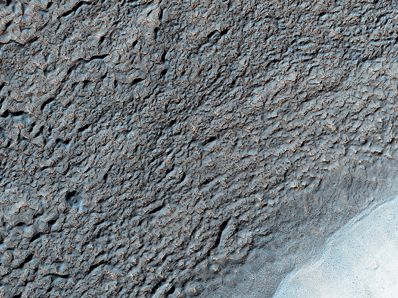
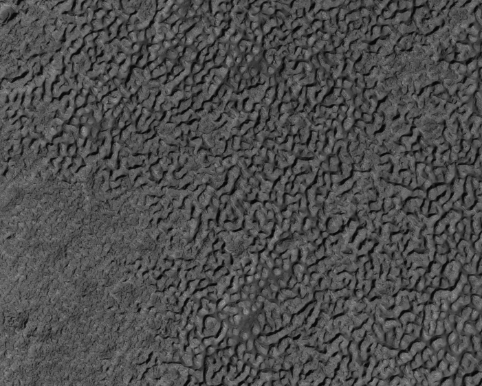
Kirby Runyon wrote:The Coming and Going of Ice (ESP_042440_1380) (HiClip)
Like Earth’s water table, Mars has an ice table. Sometimes, the ice table coincides with the ground’s surface as it does here. The knobby, pitted terrain is caused when ice is deposited and then sublimates over and over again. This geologic process is called “accrescence” and “decrescence” and also occurs on Neptune’s moon Triton and on Pluto, though in the outer Solar System the ice is not water ice.
Other evidence for ice here includes the rope-like, curved flow feature that resembles glacial flow.
Solis Planum—a huge mound south of Valles Marineris—is the location of this image.
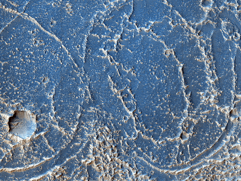
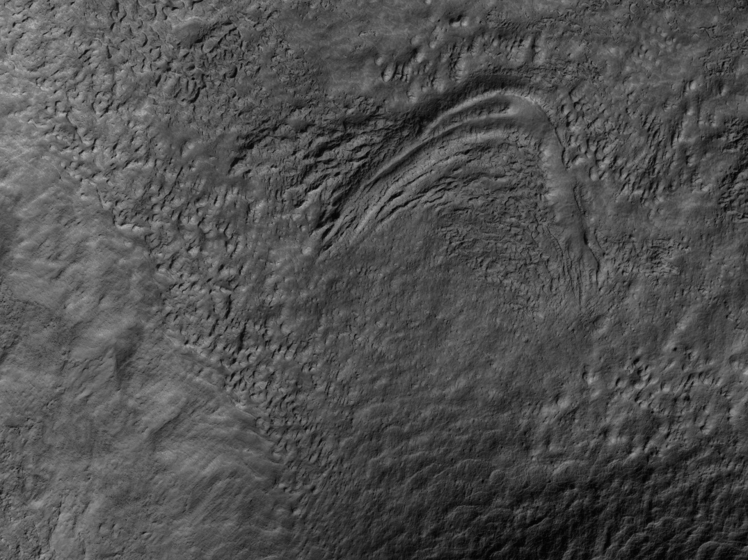
Alfred McEwen wrote:Strange Patterns in Echus Chasma (ESP_042835_1800) (HiClip)
This image shows bright and dark patterns with curving boundaries, a good example of Mars art. What caused this appearance?
This region of Echus Chasma has been flooded by lava flows that produced rough and smooth surfaces. The rough areas then trap bright dust, creating the contrasts in brightness.
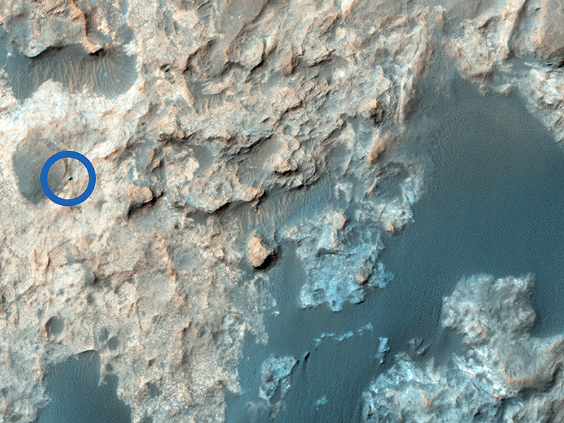
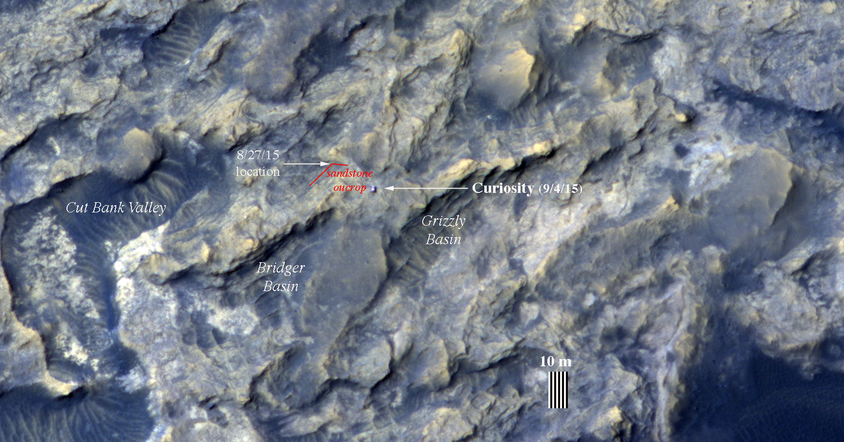
Nathan Bridges wrote:Curiosity Trek (ESP_043539_1755) (HiClip)
The Mars Science Laboratory, Curiosity, continues its exciting traverse of Mars. In an image acquired in September, it was exploring the boundary between two rock units: the light-toned Murray Formation and the overlying and darker-toned Stimson unit. We can clearly see the rover in a complex terrain marked by tonally varied rocks, which on the surface, can correspond to the contact between rock units and dark sand.
In a second more recent image, the rover has moved quite aways from its previous location: it’s now further south, closer to the dark Bagnold dune field. These red lines delineate the boundary of a sandstone outcrop imaged by Curiosity’s Mastcam camera on 27 August 2015.
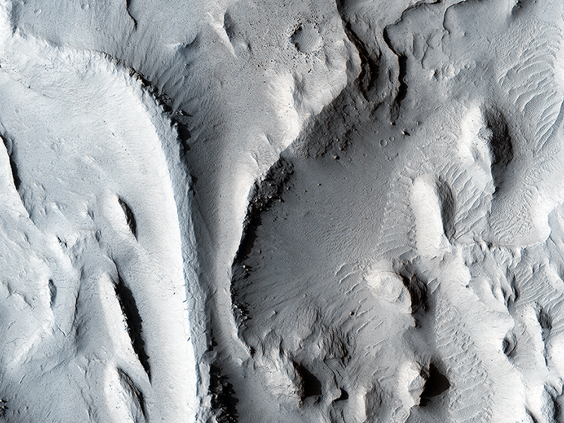
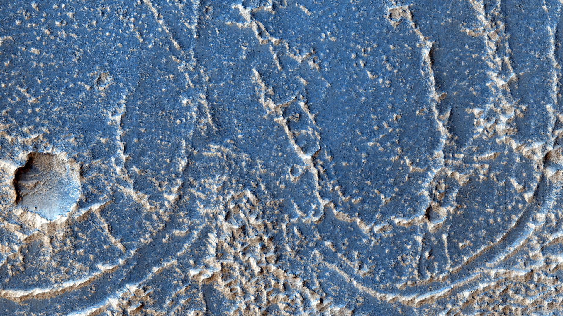
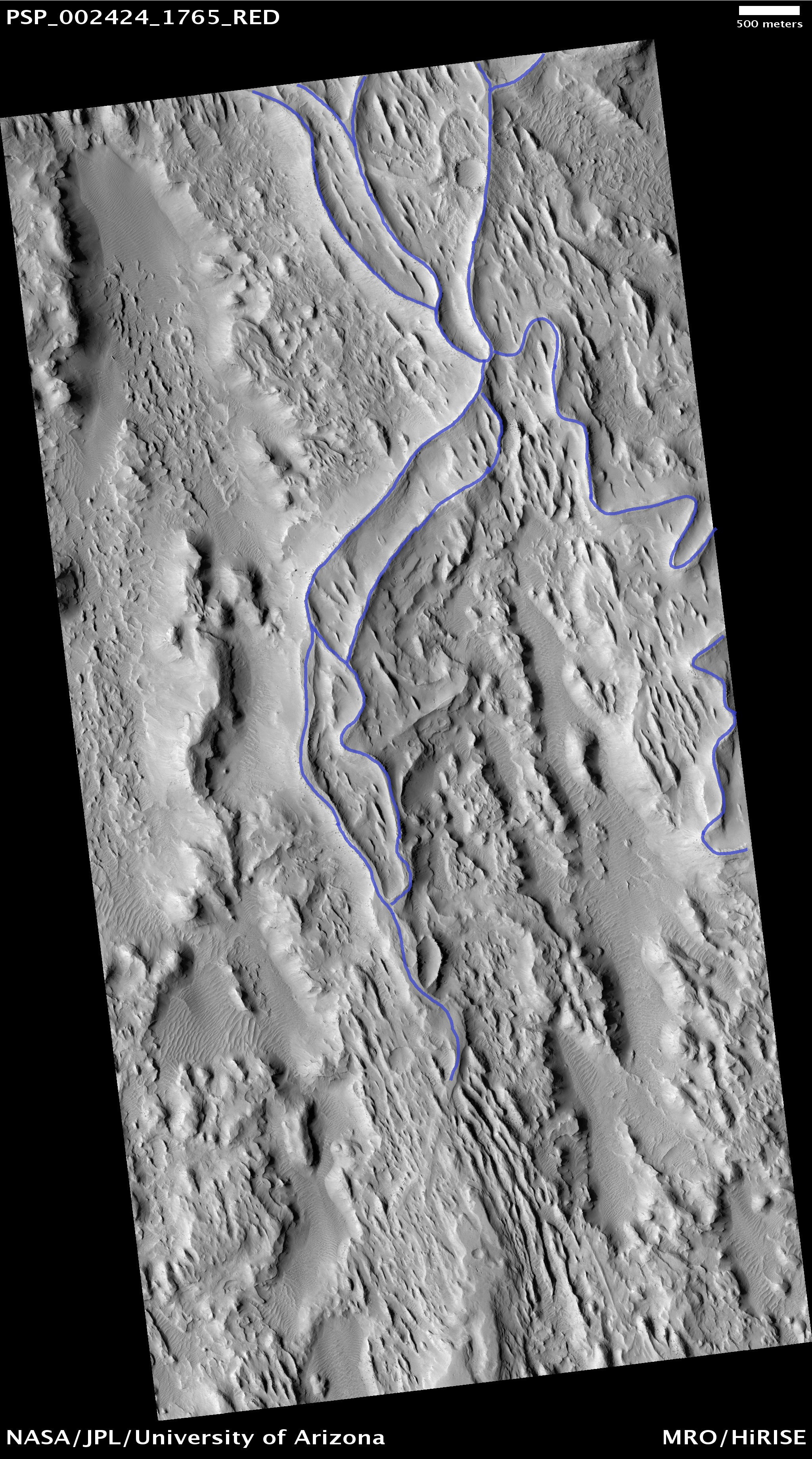
Hayden Smith and Marjorie A. Chan wrote:Inverted Streams in the Aeolis Region (PSP_002424_1765) (HiClip)
The sinuous ridges in this image display strong characteristics of ancient meandering riverbeds that are preserved as inverted topography (blue). The ancient river sediments that make up the ridges might have allowed fluids to produce cements (e.g., calcite or iron oxides) to make the channel lithology resistant to weathering and erosion. Later, physical and/or chemical processes removed the weaker surrounding flood plain material and left inverted river channels, or “positive relief.” On closer inspection, degradation along sections of some inverted channels display large blocks of cemented sediment that were transported downslope by mass wasting.
The sinuous character of the ridges resembles multi-thread river branches, implying that the ancient river flowed down a gentle to nearly horizontal slope (i.e., a moderate to low stream gradient). This ancient river was a mature meandering system, with flow from south to north. Multiple branches that diverted from the main flow later converged back with it.
This is a stereo pair with ESP_019803_1765.
Credit: NASA/JPL-Caltech/University of Arizona
<< Previous HiRISE Update