
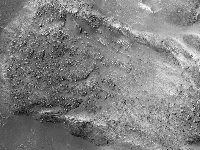
HiRISE Targeting Specialists wrote:Boulders on a Landslide (ESP_035831_1760) (HiClip)
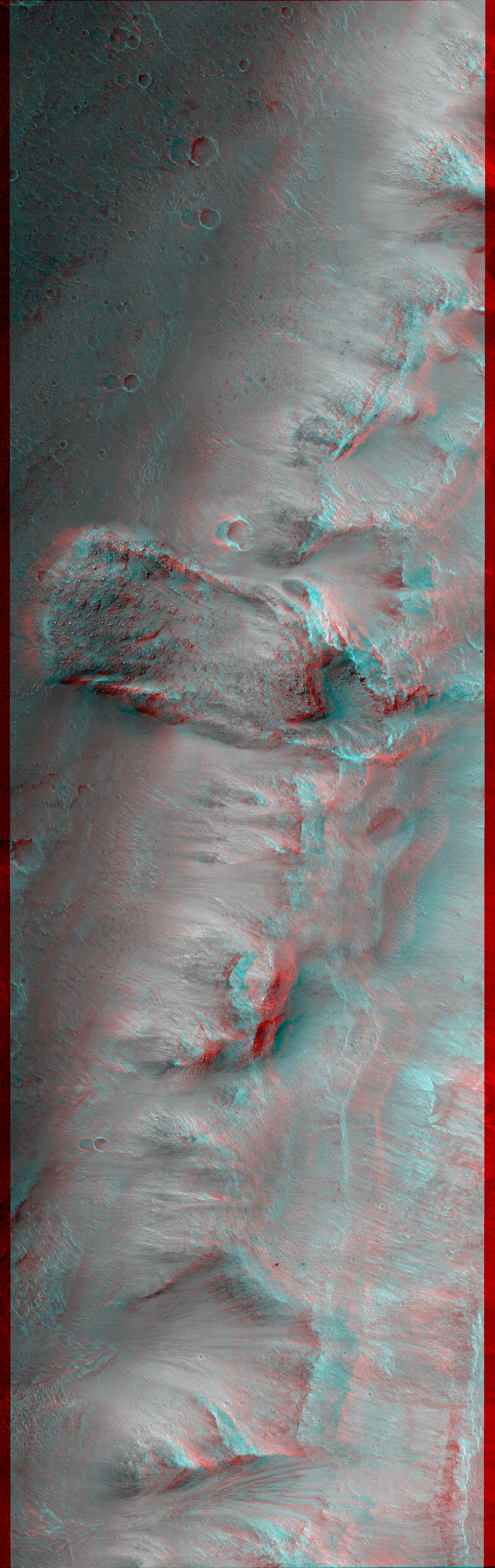
The striking feature in this image is a boulder-covered landslide along a canyon wall. Landslides occur when steep slopes fail, sending a mass of soil and rock to flow downhill, leaving behind a scarp at the top of the slope. The mass of material comes to rest when it reaches shallower slopes, forming a lobe of material that ends in a well-defined edge called a toe. (Take a look at the anaglyph to compare the steep cliff and landslide scarp to the relatively flat valley floor. )
This landslide is relatively fresh, as many individual boulders still stand out above the main deposit. Additionally, while several small impact craters are visible in the landslide lobe, they are smaller in size and fewer in number than those on the surrounding valley floor. The scarp itself also looks fresh compared to the rest of the cliff: it, too, has boulders, and more varied topography than the adjacent dusty terrain.
Just to the north of the landslide scarp is a similarly-shaped scar on the cliffside. However, there is no landslide material on the valley floor below it. The older landslide deposit has either been removed or buried, a further indicator of the relative youth of the bouldery landslide.
This is a stereo pair with ESP_036886_1760.
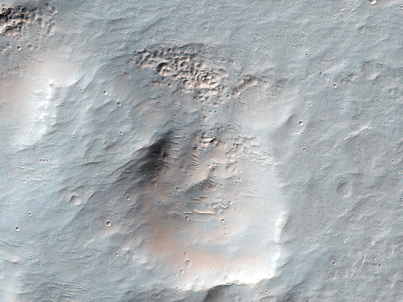
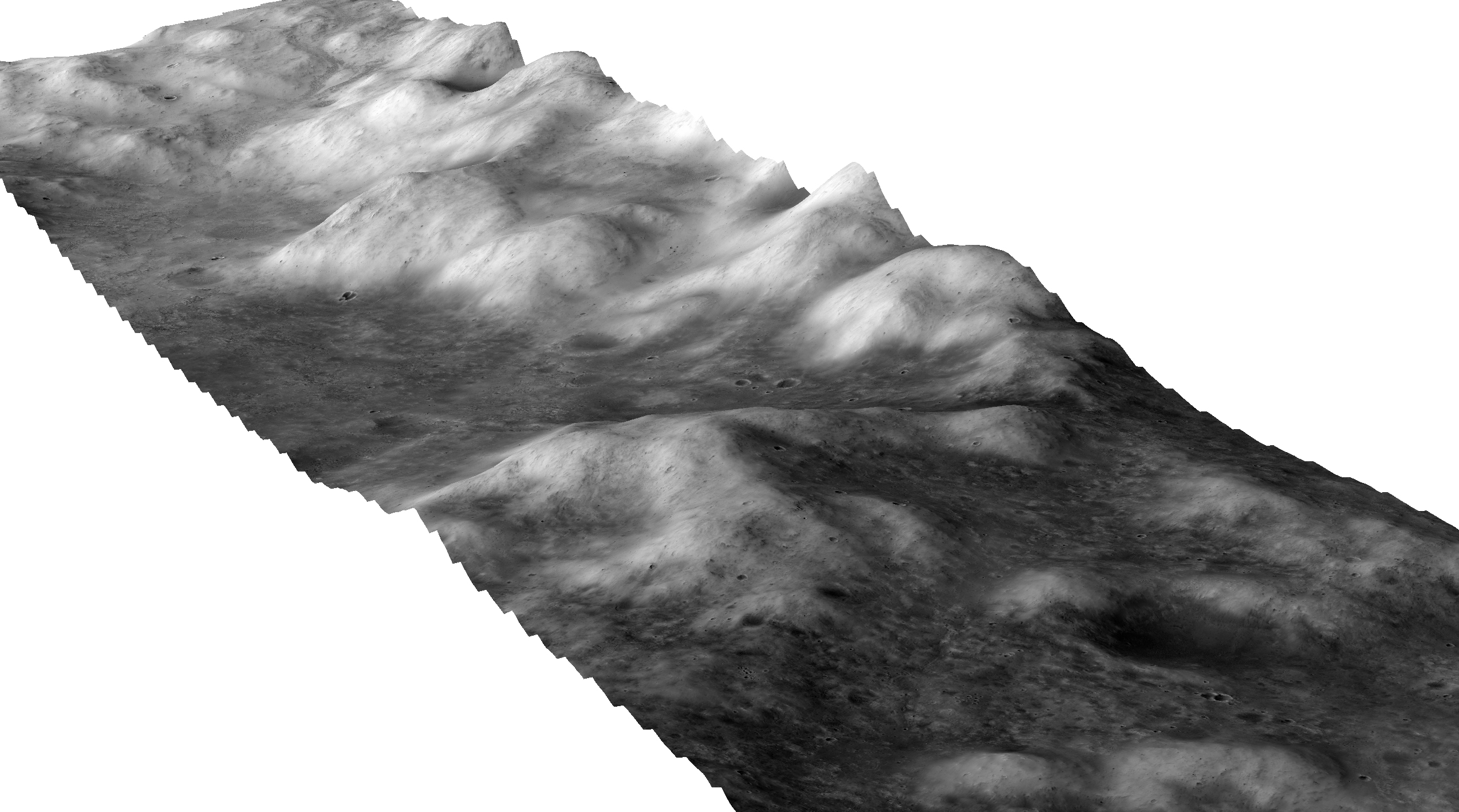
Matt Chojnacki wrote:Topography of the Western Edge of Marth Crater (ESP_042753_1930)
This HiRISE digital terrain model shows a small portion of the 94-kilometer-diameter Marth Crater. This location is along the fictional traverse to the Ares 4 landing site by astronaut Mark Watney in the book "The Martian" by Andy Weir .
This high resolution terrain model was constructed with NASA approval in support of film version of "The Martian," but will also be useful for science. For example, one can clearly observe the relatively steep hummocky nature of terrain in this northeastward perspective view. We can also tell these surfaces slope west and away from the crater center, indicating they are part of ejected material rather than the excavated crater interior.

Mike Mellon wrote:Icy Erosion (ESP_042886_1480) (HiClip)
This image shows an interesting collection of kilometer-scale craters with flat and smooth floors. The craters themselves may be the result of secondary impacts, craters caused by debris from a distant larger impact. Since then, the surface has been significantly modified and reworked, muting the craters and flattening their floors.
Presently, there are a few sand dunes and a broad overlay of a dusty soil mantle. This soil mantle occurs over much of the middle latitudes of Mars. Here, as elsewhere, the mantle covers these craters, but a closer inspection reveals that its smooth texture becomes significantly pitted and bumpy on the pole facing slopes of each crater interior wall.
It has been hypothesized that this pitting of the mantle is the result of the evaporation of shallow ice. As subsurface ice is lost, the removal of this bonding ice cement allows soil grains to be eroded by the wind. Then the resulting deflation of the soil forms the observed pitted textures. Alternatively, the loss of relatively pure underground ice deposits would cause a reduction of the surface soil and collapse to form the same textures.
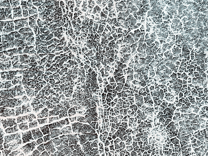
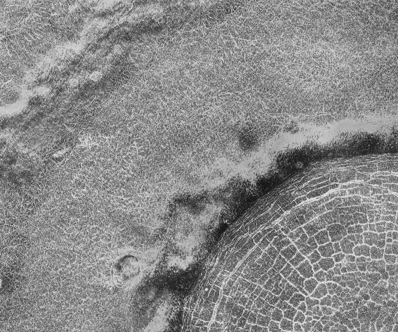
HiRISE Targeting Specialists wrote:A Frost Enhanced Landscape (ESP_042895_2495) (HiClip)
The arc of hills in this image is the rim of an old and infilled impact crater. The sediments that were deposited within the crater have since formed polygonal cracks due to repeated cycles of freezing and thawing. The process of polygon formation is common at these polar latitudes, but polygons are not always as striking as they are here. In this image, the polygons have been highlighted by persistent frost in the cracks.
The crater rim constrains the polygon formation within the crater close to the rim, creating a spoke and ring pattern of cracks. This leads to more rectangular polygons than those near the center of the crater. The polygons close to the center of the crater display a more typical pattern. A closer look shows some of these central polygons, which have smaller polygons within them, and smaller polygons within those smaller polygons, which makes for a natural fractal!
Credit: NASA/JPL-Caltech/University of Arizona
<< Previous HiRISE Update