
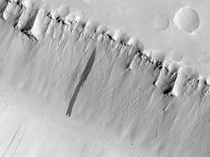
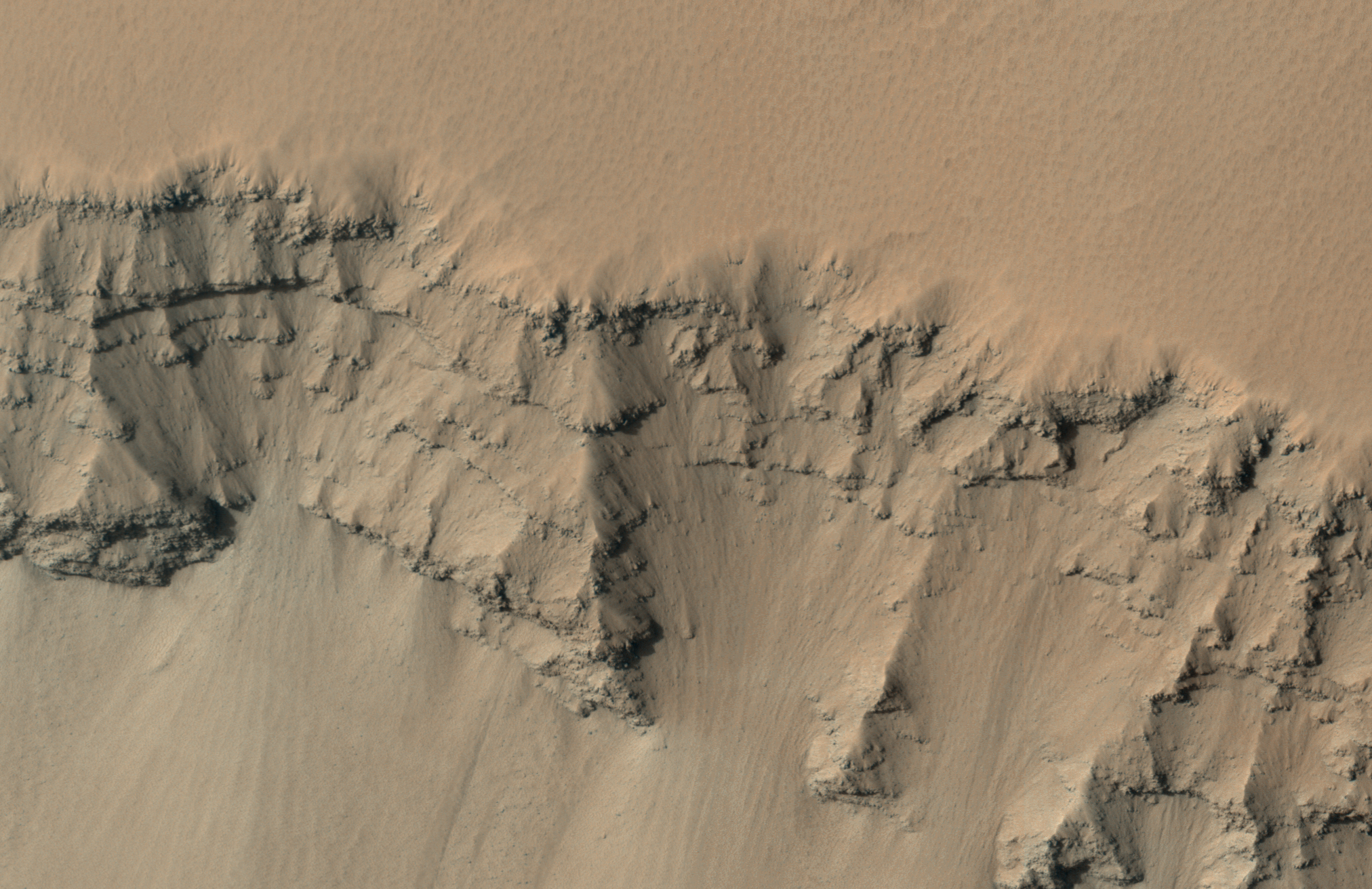
Ian Pritchard, Livio Tornabene, Eric Pilles and Christy Caudill wrote:Troughs in Elysium Fossae (ESP_044884_2050) (HiClip)
The two linear depressions in this image form part of the Elysium Fossae complex, a group of troughs located in the Elysium quadrangle of Mars.
These troughs are tectonic features, likely formed by the stretching, tearing and subsequent collapse of the crust resulting from the rise of the nearby Elysium volcanic province. The north and south troughs in this image are roughly 4.8 and 3.7 kilometers across respectively, and around 800 meters deep. Strata, or layering from successive deposition of material (likely ash and lava), are exposed in the upper wall of the trough.
Upon closer inspection, another interesting phenomenon becomes visible: slope streaks. Observable on the slopes of both troughs, these dark features (also known as dust avalanches) are the result of a mass movement of loose, fine-grained material exposing darker material. Over time, these features superpose and cross-cut one another, manifesting as light-toned angular features on either side of the slope streak. Slope streaks have also been known to form as the result of an impact on or near the slope which shakes loose dust, triggering an avalanche.
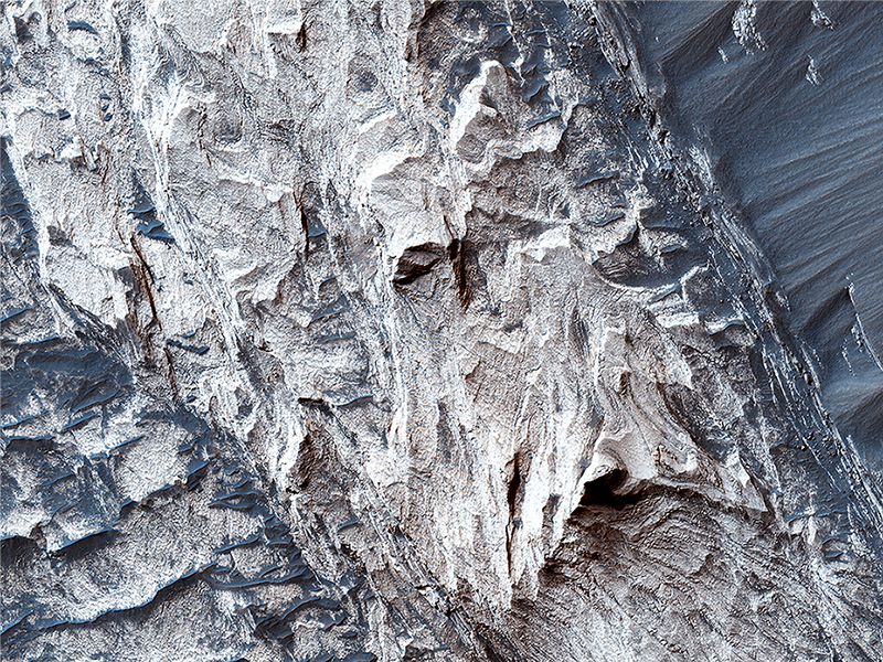
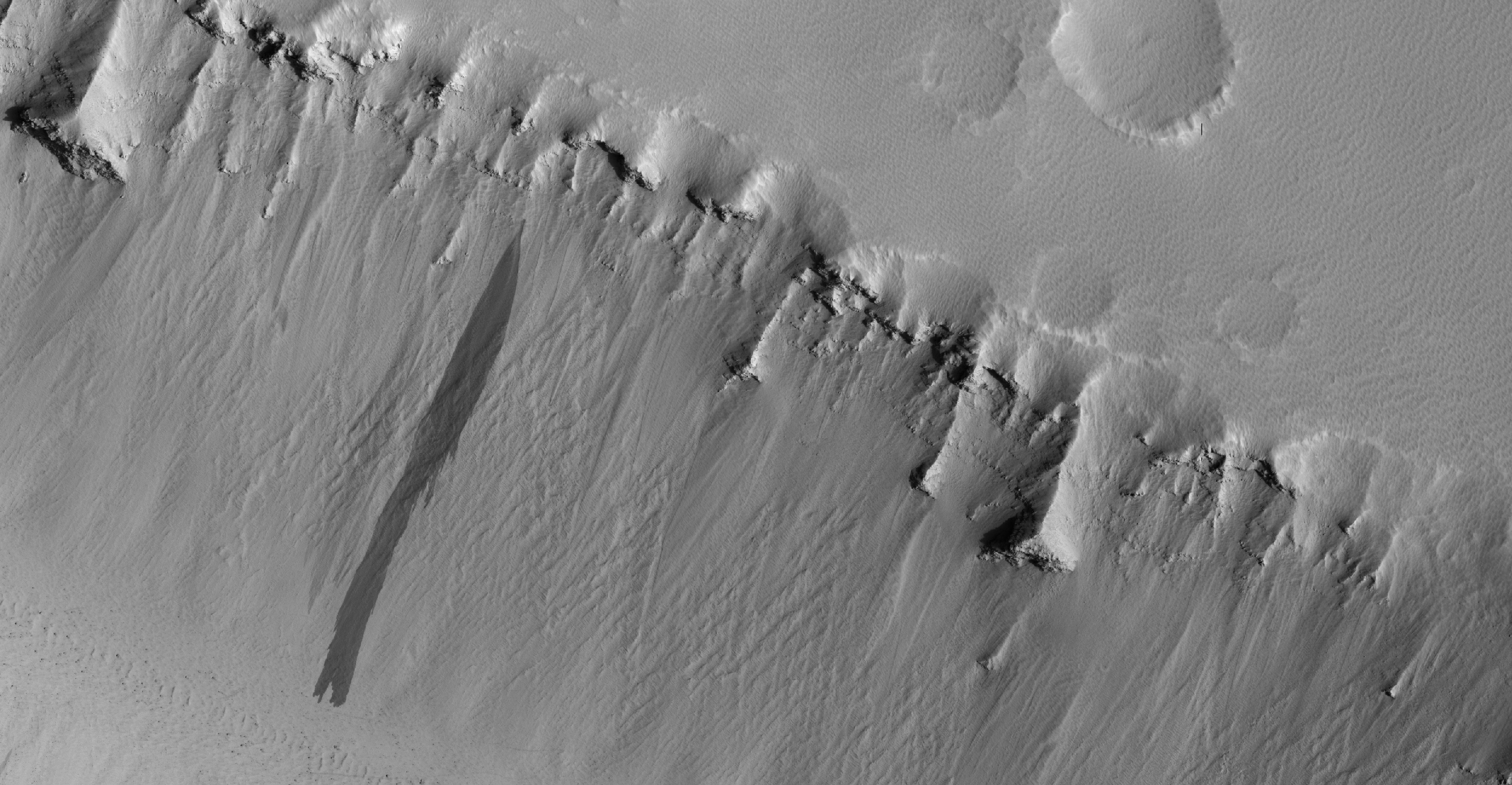
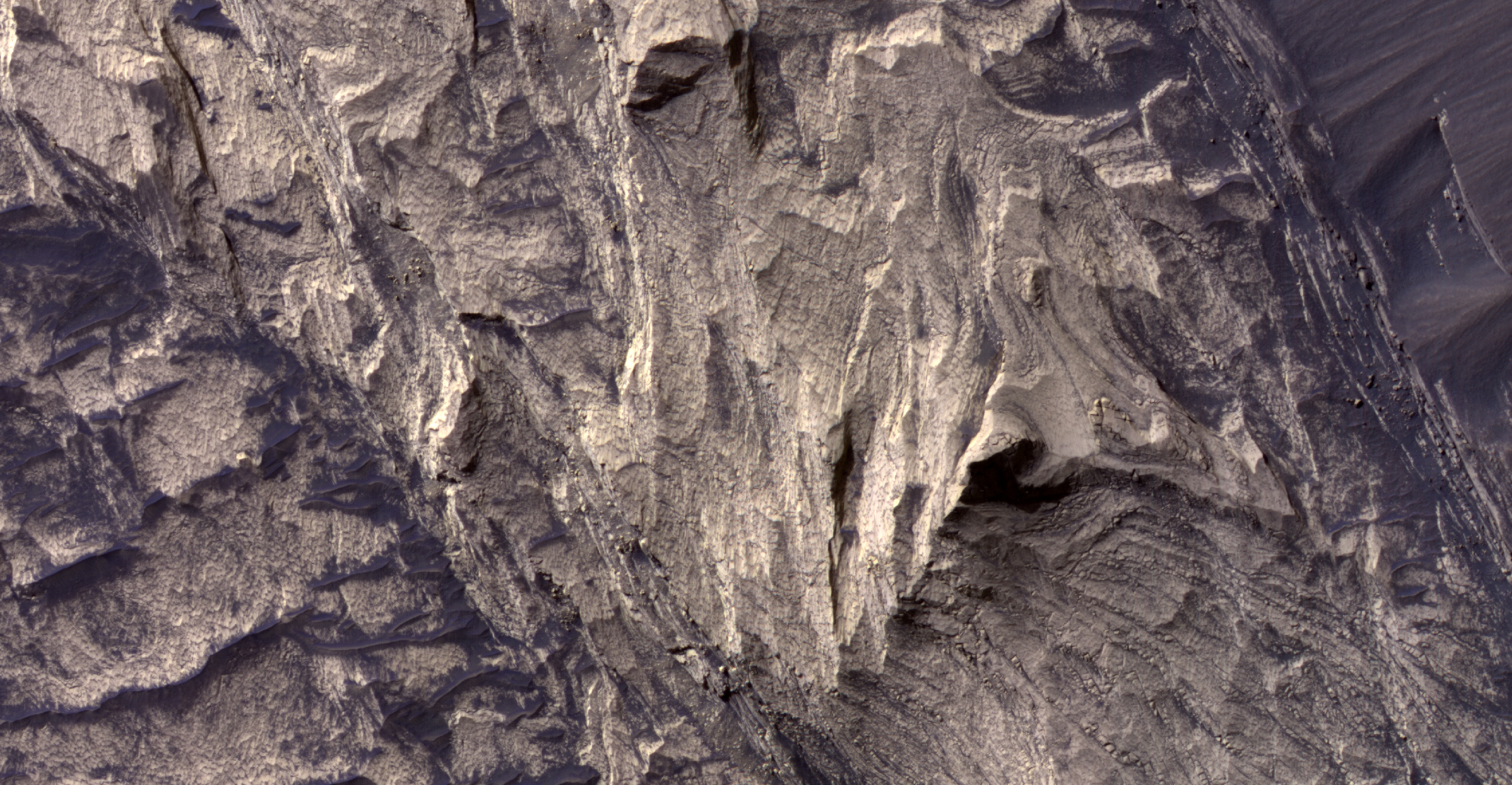
Eric Pilles, Livio Tornabene, Christy Caudill and Ian Pritchard wrote:Possible Sulfate Deposits in West Melas Chasma (ESP_044892_1695) (HiClip)
Melas Chasma is the widest segment of Valles Marineris, the largest canyon in the Solar System. In this region, hydrated sulfate salts have been detected, and are found extensively throughout the canyon. These salt-bearing deposits likely indicate that water was present in the past.
This image shows many interesting features that are common to Melas Chasma. At the north end, we can see typical “spur and gully” (or, ridge and trough) features that also mark the rim of the Valles Marineris throughout the canyon system. Emanating from the troughs we see debris flowing towards the bottom of the slope. The floor of the valley shows sparse exposures of bedrock, which is otherwise covered in dark rippled dunes.
Slopes in the north and south reveal layered sulfates that that were deposited into the canyon system, and subsequently eroded to reveal the layered sulfate-bearing rock. As you can see from these two images, distinguishing the various layers within the deposit would be rather difficult without high resolution color.
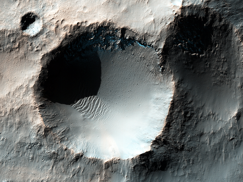
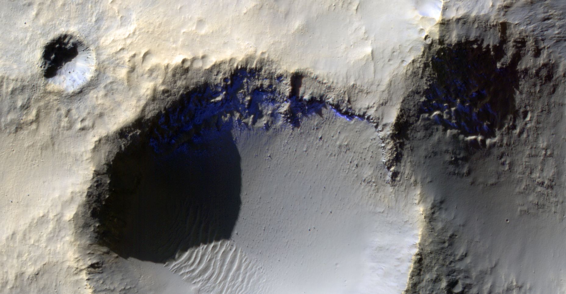
Livio Tornabene wrote:Southern Winter Frost Accumulations (ESP_044909_1450) (HiClip)
This enhanced color HiRISE image shows several craters somewhere in the southern mid-latitudes of Mars. It is currently mid-winter in the Southern hemisphere, so we can observe accumulating frost (neon blues) on pole-facing slopes (i.e. south-facing) and in shadowed areas.
However, the bluish deposits and ejecta deposits associated with the smaller crater we see are not consistent with frost deposits. These materials are most likely iron-bearing minerals that have not been previously oxidized (i.e., rusted), and have only recently been exposed to the surface when this small well-preserved crater was formed.
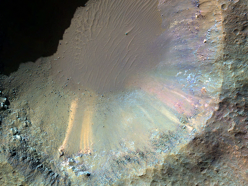
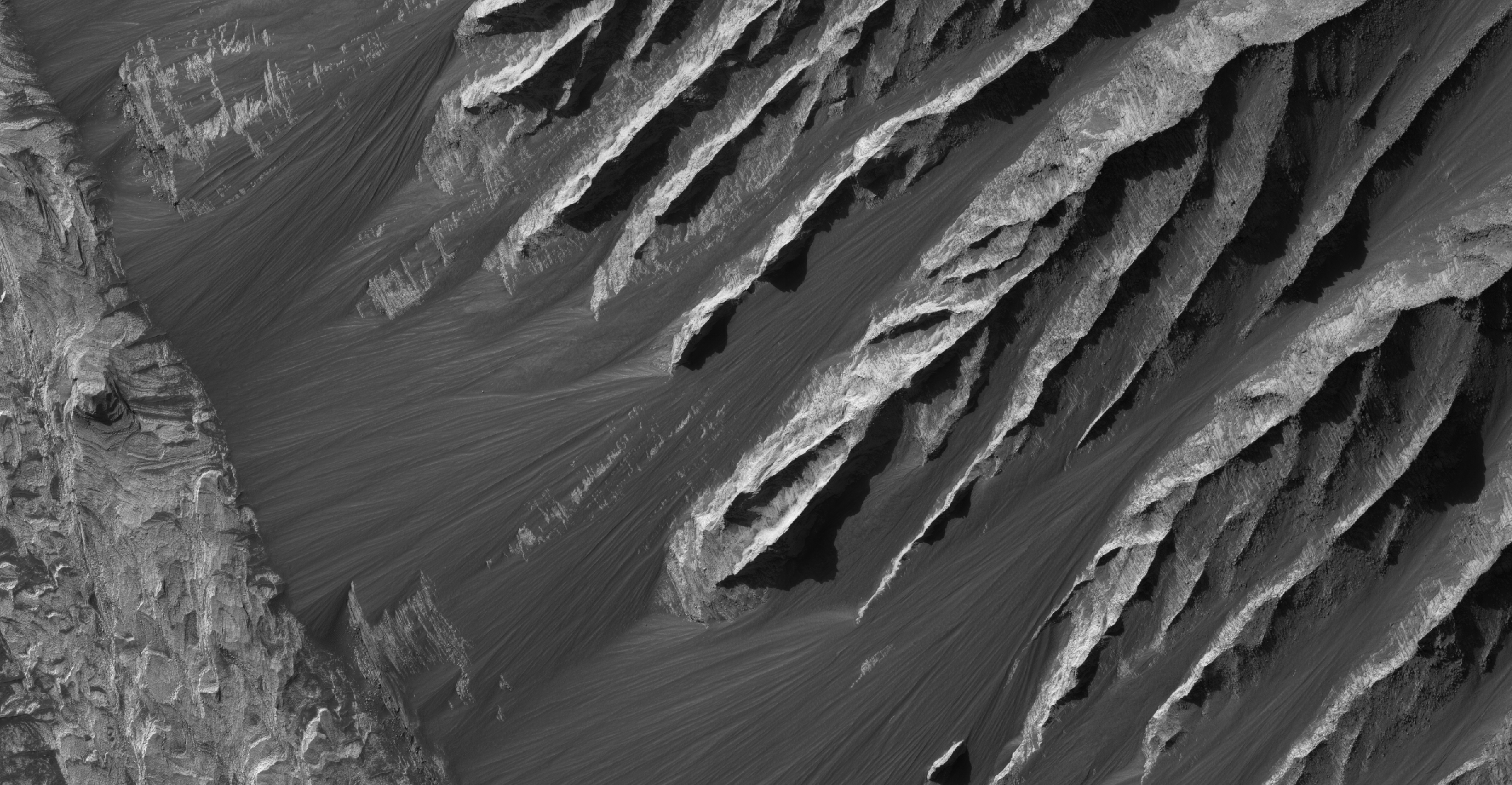
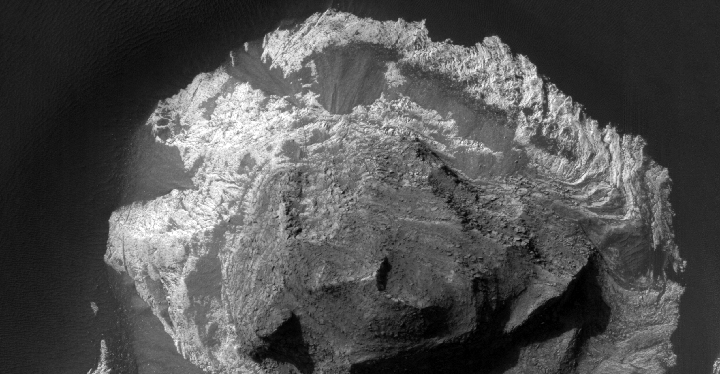
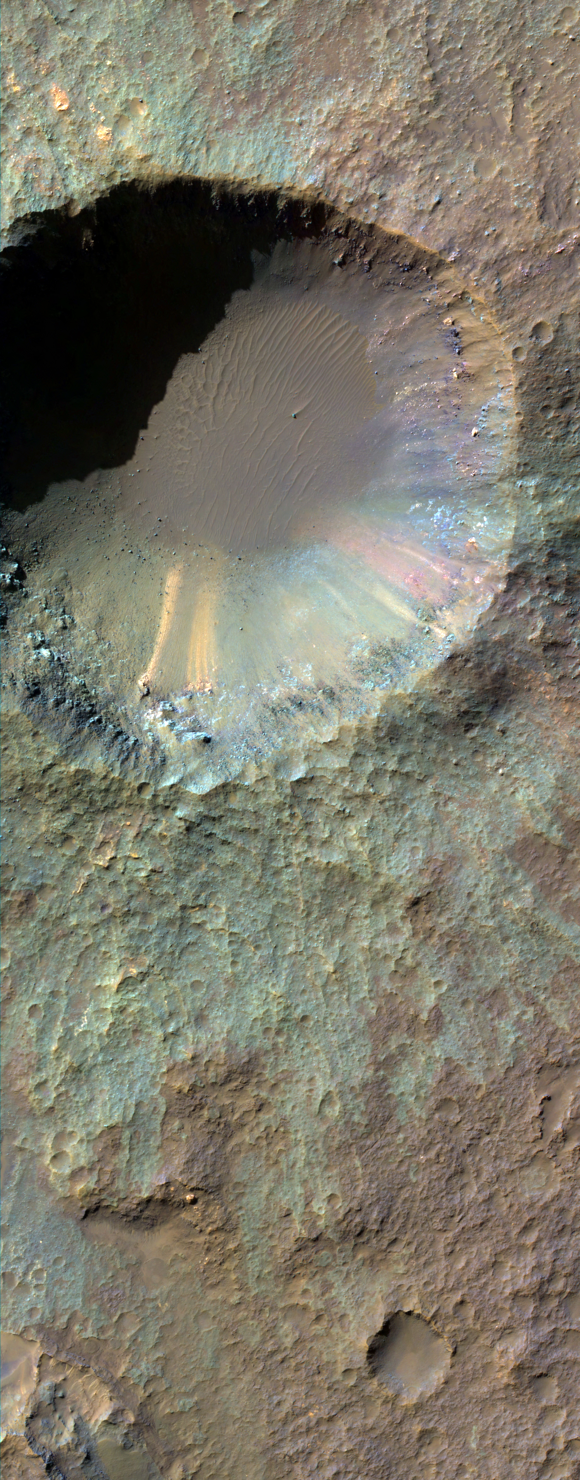
Eric Pilles, Livio Tornabene, Christy Caudill and Ian Pritchard wrote:A One-Kilometer Crater on the Floor of Saheki Crater (ESP_044913_1580) (HiClip)
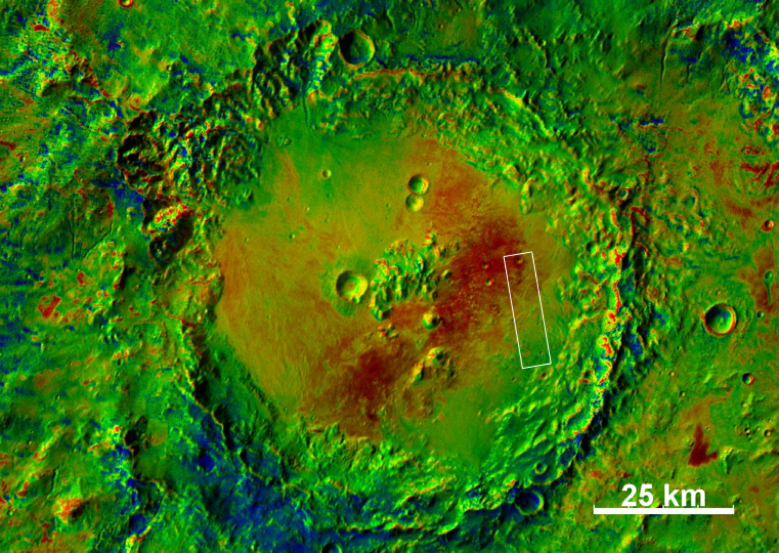
This HiRISE image shows several smaller craters that formed on the floor of Saheki Crater, an 85-kilometer diameter impact crater north of Hellas Basin.
The western portion of this crater is covered by alluvial fan-like deposits that emanate from channels that cut into the crater rim. This HiRISE image—indicated by a white box atop of a colorized THEMIS temperature image of Saheki—was taken just east of the central uplift, where vividly colored materials now lie exposed in a kilometer-sized crater.
An enhanced color infrared image shows a close-up of the 1-kilometer crater and its contents. The wall of the crater shows a rainbow-like array of bedrock and deposits. Much of this material has been eroded over time and has slumped downwards towards the crater floor, leaving behind chalk-like streaks of color. We can also see reddish and dark-toned layered deposits to the south now covered by the crater’s green-toned ejecta.
Credit: NASA/JPL-Caltech/University of Arizona
<< Previous HiRISE Update