
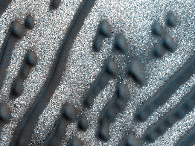
HiRISE Targeting Specialists wrote:Martian Morse Code (ESP_044675_2580) (HiClip)
These dark dunes are influenced by local topography. The shape and orientation of dunes can usually tell us about wind direction, but in this image, the dune-forms are very complex, so it’s difficult to know the wind direction.
However, a circular depression (probably an old and infilled impact crater) has limited the amount of sand available for dune formation and influenced local winds. As a result, the dunes here form distinct dots and dashes. The “dashes” are linear dunes formed by bi-directional winds, which are not traveling parallel to the dune. Instead, the combined effect of winds from two directions at right angles to the dunes, funnels material into a linear shape. The smaller “dots” (called “barchanoid dunes”) occur where there is some interruption to the process forming those linear dunes. This process is not well understood at present and is one motivation for HiRISE to image this area.
This is a stereo pair with ESP_045334_2580.
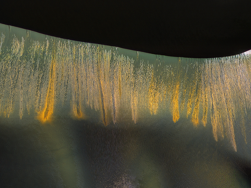
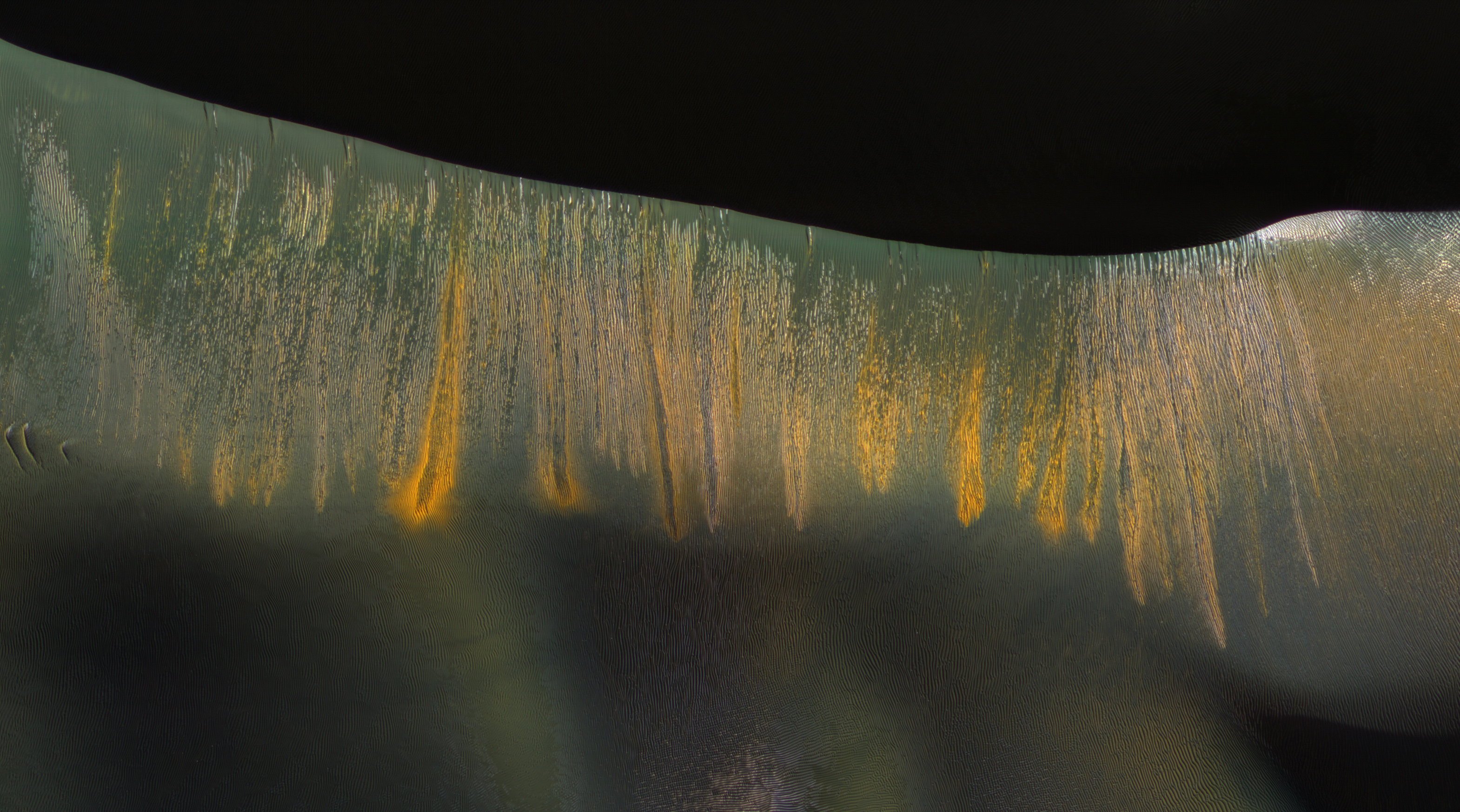
Alfred McEwen wrote:Glowing Gullies in Kaiser Crater Dunes (ESP_045324_1325) (HiClip)
The giant sand dunes in Kaiser Crater experience gully erosion of the steep slip faces every year in late winter as the sun warms these slopes and seasonal carbon dioxide frost sublimates (meaning it changes from a solid to gas).
Some of these gullies produce a variety of colors that are highlighted on the west-facing (illuminated) slopes, where the gullies appear to be glowing in the winter light.
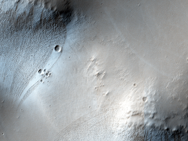
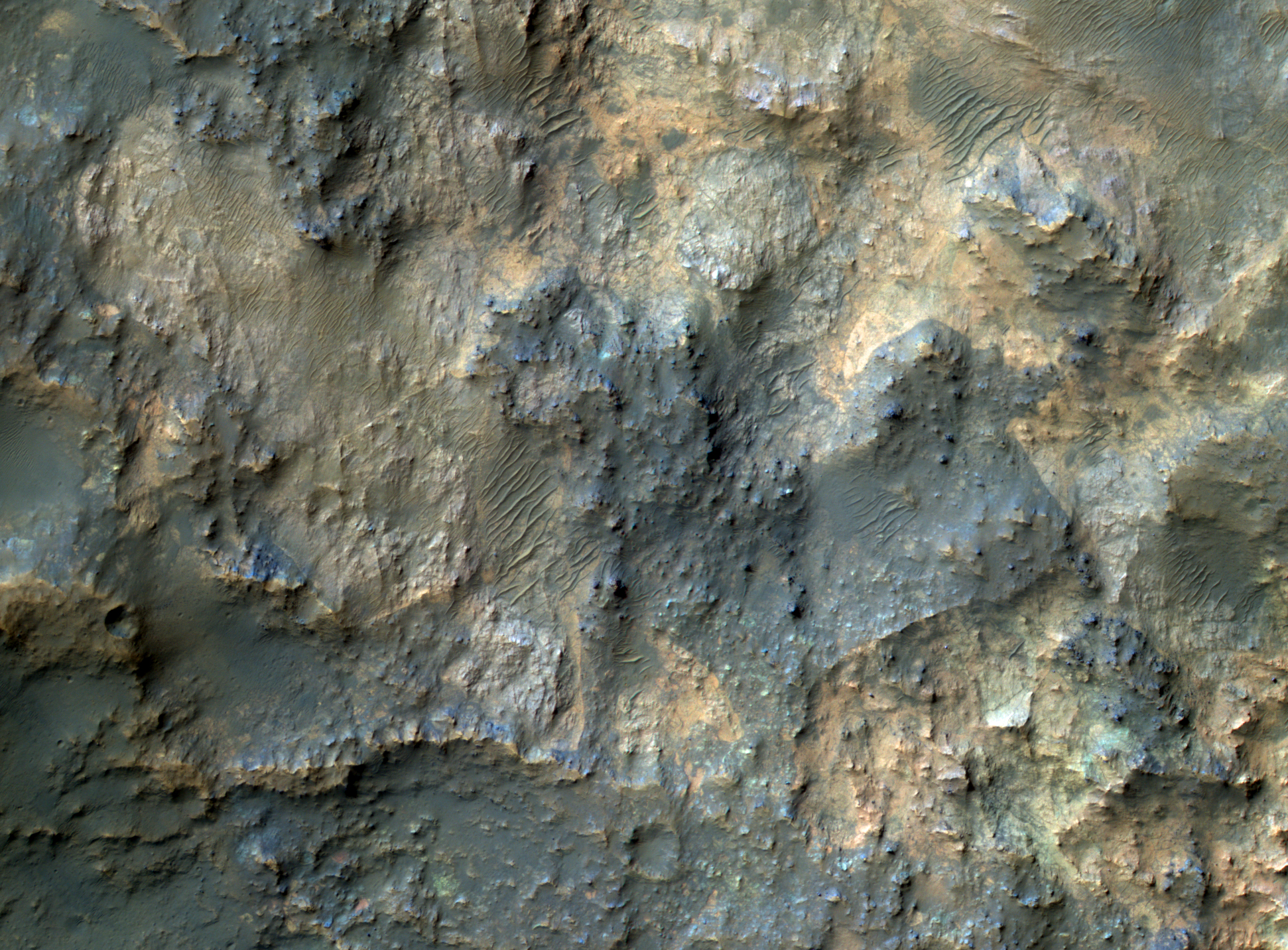
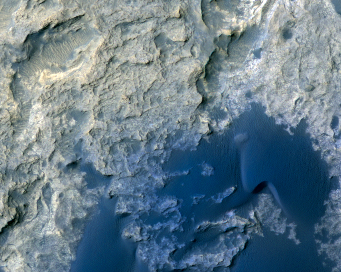
Alfred McEwen wrote:Bedrock North of Terby Crater (ESP_045335_1535) (HiClip)
This image samples the excellent bedrock exposures north of Terby Crater, which lies on the northern rim of the giant Hellas basin.
An enhanced-color cutout shows a sample of this bedrock, which has a variety of colors and textures. The warm-colored bedrock probably contains hydrated minerals such as clays, whereas the blue-green bedrock is dominated by unaltered mafic minerals. These may be some of the oldest rocks exposed at the Martian surface. Such ancient rocks are extremely rare on Earth.

Kirby Runyon wrote:Dreaming of Graben in the Labyrinth of the Night (ESP_045605_1715) (HiClip)
Noctis Labyrinthus is a highly tectonized region immediately to the west of Valles Marineris. It formed when Mars’ crust stretched itself apart.
In this region, the crust first stretched in a north-south direction (as evidenced by the east-west trending scarp) and then in an east-west direction (as evidenced by the north-south trending smaller scarps). This sort of tectonic stretching creates faults in the crust (cracks along with masses of rock slide. This process is totally unrelated to Earth’s plate tectonics.).
The lower portions between faults are called “grabens” and the interspersed higher portions are called “horsts.” The Basin and Range tectonic province of the western United States is a close Earth analog to Noctis Labyrinthus, which is Latin for “labyrinth of the night.”
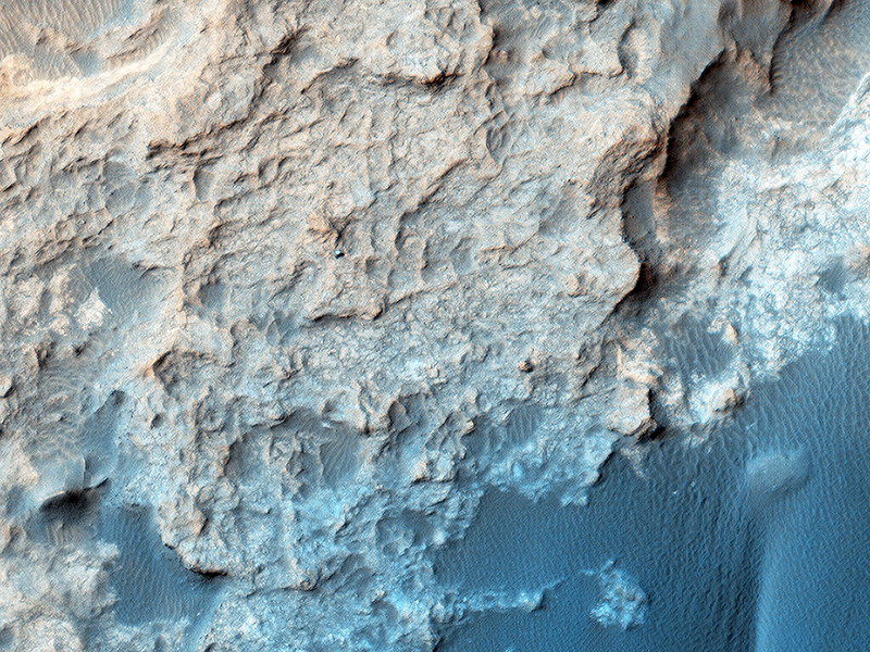
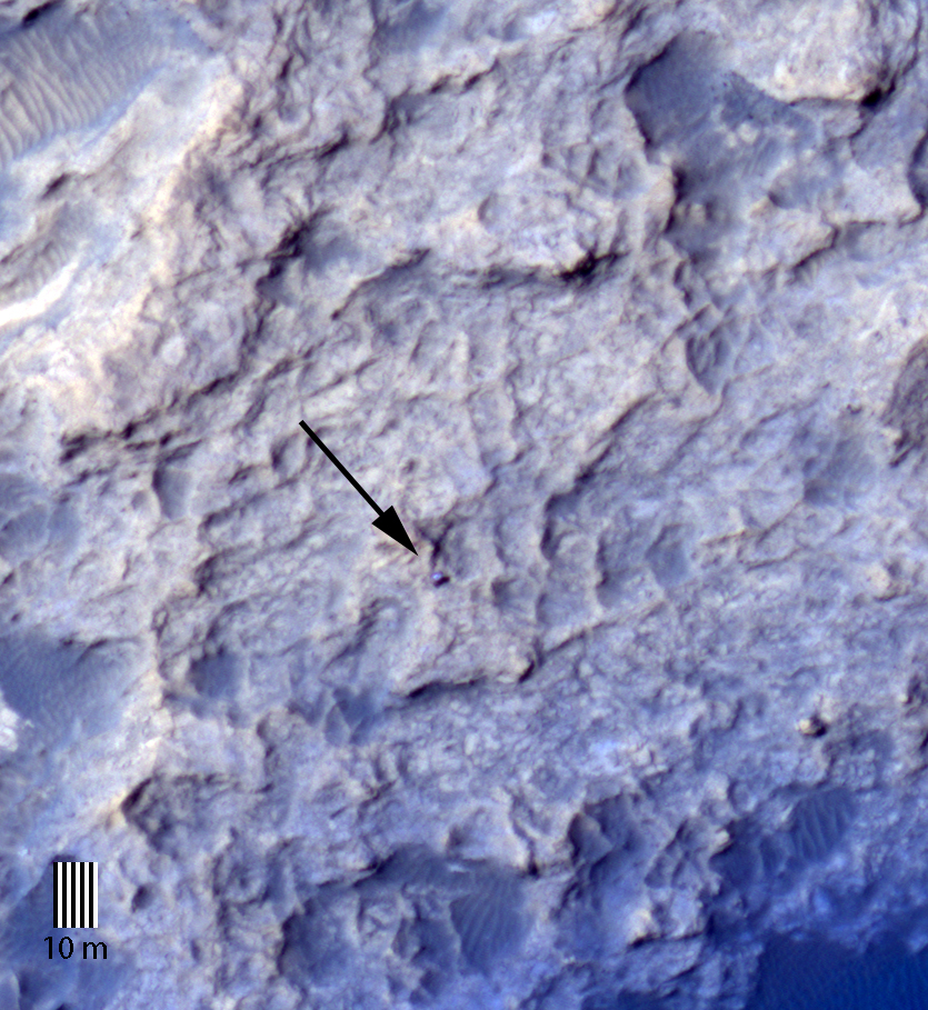
Nathan Bridges wrote:Curiosity on the Naukluft Plateau (ESP_045293_1755) (Mastcam 360)
HiRISE periodically acquires images of the two working rovers on Mars, Opportunity (Mars Exploration Rover) and Curiosity (Mars Science Laboratory). Although earlier pictures are generally sufficient for mapping the terrain and topography, new images allow scientists and engineers to study rover tracks and their covering with dust over time.
The ability to keep track of the rovers' progress and seeing their current location on Mars in the HiRISE images is of great interest to the public. In the case of Curiosity, new images allow the tracking of active sand dunes currently in the vicinity of the rover. This dune field, informally named the “ Bagnold Dunes” after the pioneering British aeolian scientist Ralph Bagnold (1896-1990), has recently been investigated by Curiosity.
Curiosity is currently located on the Naukluft Plateau just north of the Bagnold Dune field. Its position was captured by HiRISE on 25 March 2016 (MSL Sol 1291. Views from the surface at this location are available here and here.) The rover is within sandstone outcrops informally named the “Stimson Formation.” There are no obvious rover tracks in the HiRISE views indicating that this bedrock contains little dust that otherwise could be disturbed by the rover wheels as has been seen earlier in Curiosity's traverse.
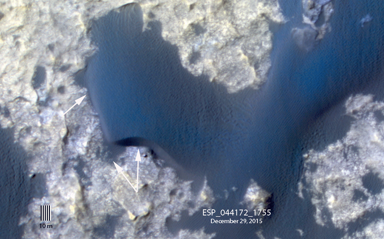
By comparing a portion of this image to an earlier view, we can see subtle changes in the margin of “Namib dune”. These changes result from the wind redistributing sand, including avalanching of the Namib dune slipface, over the bright bedrock. Note that the rover is in front of the dune in the December image (see surface images here).
Unannotated images:
Credit: NASA/JPL-Caltech/University of Arizona
<< Previous HiRISE Update