
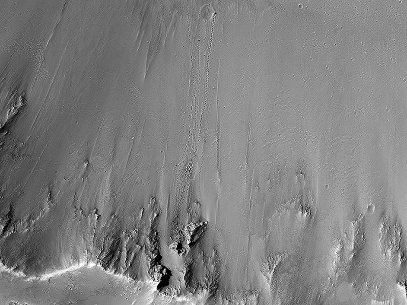
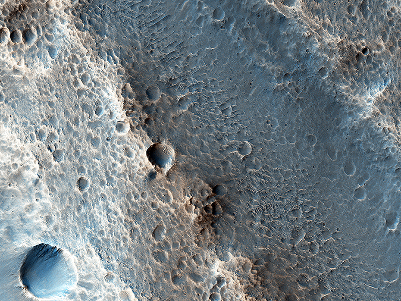
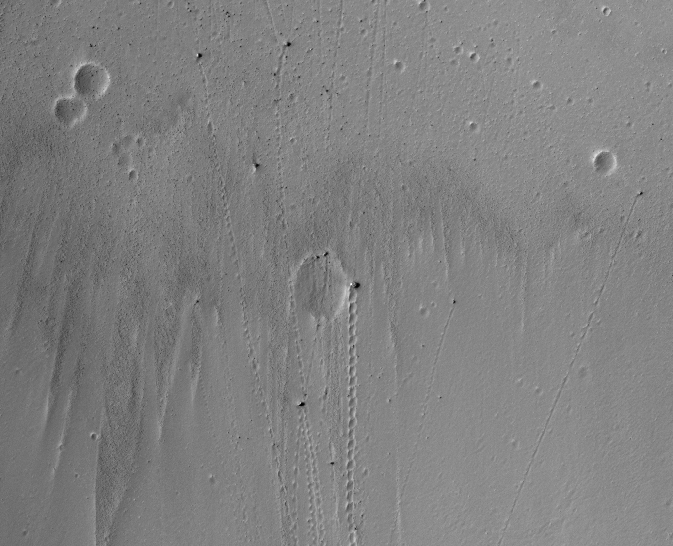
HiRISE Targeting Specialists wrote:Slope Instability (ESP_037700_1710) (HiClip)
One small section of this image shows boulders that have rolled down the slope of a crater wall. The boulders vary in size, with the largest one approximately 6 meters across. Unlike the boulder in a previous image, this one is not standing on end. We can tell by using the sun angle and shadow length to figure out the height and then comparing that to its other measurements.
We can determine the origin of the boulders by tracing their up-slope tracks. They appear to come from one small part of the crater wall that is less stable than surrounding materials. It is likely that there have been numerous rockfall events from this area, as suggested by the many boulders down-slope of this area, some with clear tracks and others with indistinct or no tracks visible.
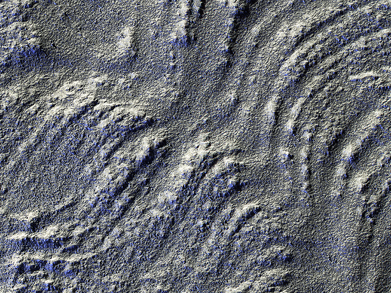
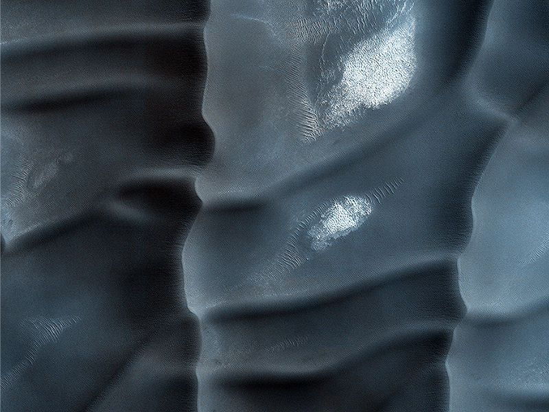
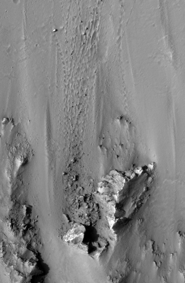
Alfred McEwen wrote:Glorious Glacier (ESP_045334_1350) (HiClip)
This image has low-sun lighting that accentuates the many transverse ridges on this slope, extending from Euripus Mons (mountains).
These flow-like structures were previously called “lobate debris aprons,” but the Shallow Radar (SHARAD) instrument on MRO has shown that they are actually debris-covered flows of ice, or glaciers. There is no evidence for present-day flow of these glaciers, so they appear to be remnants of past climates.
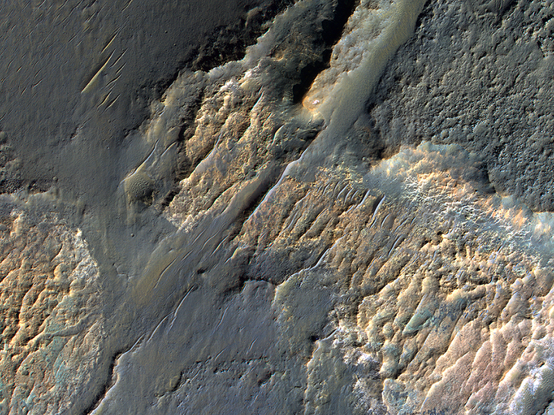
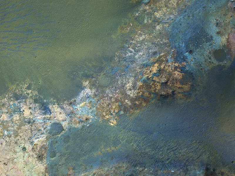
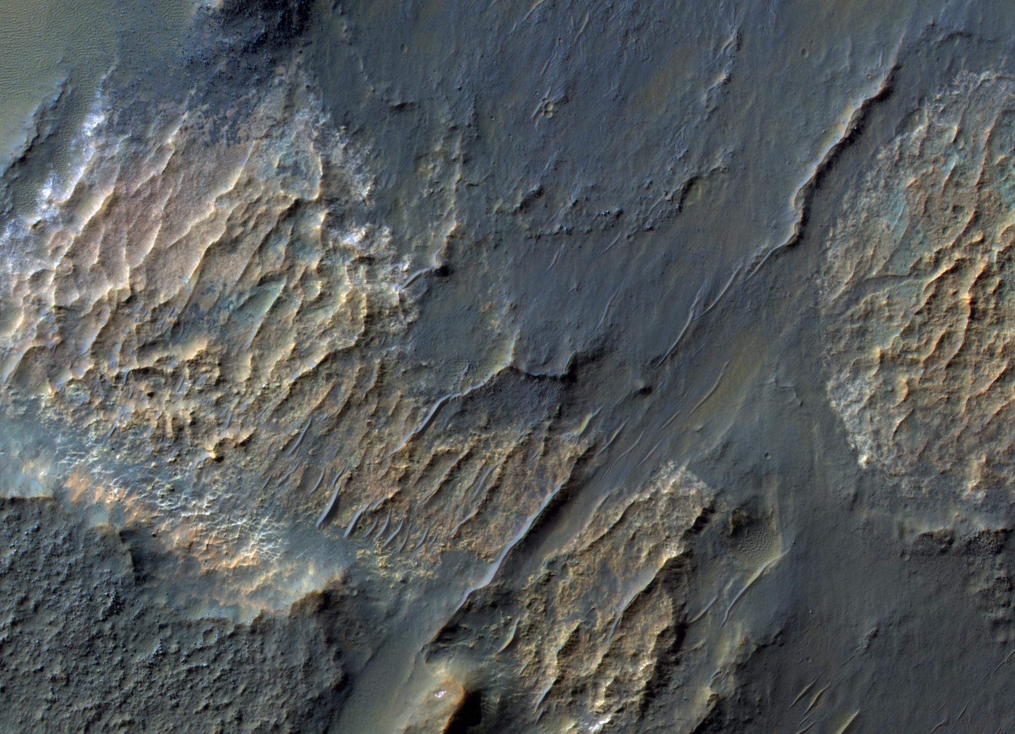
Alfred McEwen wrote:Einstein and Mars (ESP_045344_1420) (HiClip)
In February 1917, Albert Einstein wrote in a letter: “It is a pity that we do not live on Mars and just observe man’s nasty antics by telescope.” We do have a telescope at Mars, but we use it to image Mars rather than Earth, such as this image of bizarre landforms in Gorgonum Basin.
This basin may have contained an ancient lake, with channels draining into the lake from the sides. After sediments are deposited, they become hardened to varying degrees, then eroded by the wind. More hardened bedrock will remain as high-standing topography following erosion of the weaker materials, perhaps inverting the initial forms. For example, high-standing linear or meandering topography may have been fluvial channels. The enhanced-color cutout shows some of the bedrock as well as dark sand.
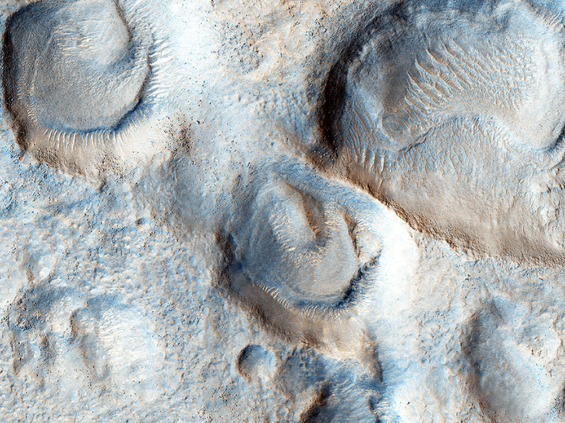
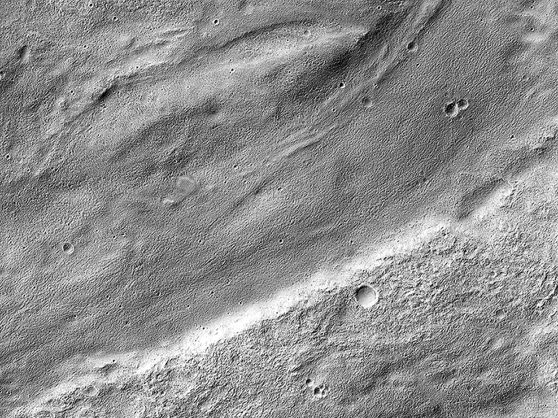
Alfred McEwen wrote:Mesas and Pits (ESP_045390_2215) (HiClip)
What’s up and what’s down? This image covers mesas, or high-standing plateaus, to the north and pits, or low-standing, depressions to the south. If it looks the other way around, then you are not seeing the topography correctly.
Remember that the Sun is coming from the left (west) at MRO’s imaging time of about 3 p.m. What formed these mesas and pits is a question that is not so easy to answer.
Kirby Runyon wrote:Faulting Mars (ESP_045497_1800) (HiClip)
This region of Xanthe Terra has mostly been contracted due to thrust faulting, but this local region shows evidence of extensional faulting, also called normal faulting.
When two normal faults face each other, they create a bathtub-like depression called a “graben.”
This is a stereo pair with ESP_046064_1800.
Kirby Runyon wrote:North Polar Gypsum Dunes in Olympia Undae (ESP_045501_2605) (HiClip)
These sand dunes are a type of aeolian bedform and partly encircle the Martian North Pole in a region called Olympia Undae.
Unlike most of the sand dunes on Mars that are made of the volcanic rock basalt, these are made of a type of sulfate mineral called gypsum. Whence the sand? Well, gypsum is a mineral that can often form from the evaporation of water that has sulfur and calcium dissolved in it. This sand was probably sourced from a northern region on Mars that used to be quite wet. The boxy gridding of the dunes indicates that the wind blows in multiple directions.
Note: “Aeolian” means wind-blown and “bedform” means piles of sediment shaped by a flowing fluid (liquid or gas).
Alfred McEwen wrote:Colorful Bedrock in the Central Uplift of an Impact Crater (ESP_045519_1730) (HiClip)
Large impact craters rebound from the initial shock, raising deep bedrock to the surface in the central uplift of the crater.
Often this bedrock has greater compositional diversity than the surface layers, because they are from greater depths, older, jumbled, and altered, and very diverse.
Kirby Runyon wrote:A Meandering Channel on Hellas' Rim (ESP_045611_1410) (HiClip)
The central portion of this image features a mildly-winding depression that was carved by water, likely around four billion years ago shortly after the Hellas basin formed following a giant asteroid or comet impact.
Water would have flowed from the uplands (to the east) and drained into the low-lying basin, carving river channels as it flowed. The gentle curves—called “meanders” by geomorphologists—imply that this paleoriver carried lots of sediment along with it, depositing it into Hellas.
Credit: NASA/JPL-Caltech/University of Arizona
<< Previous HiRISE Update