
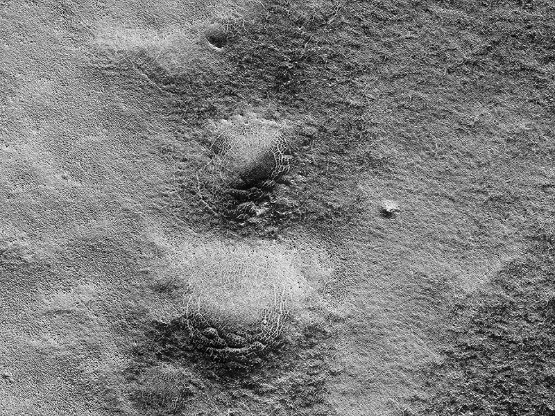
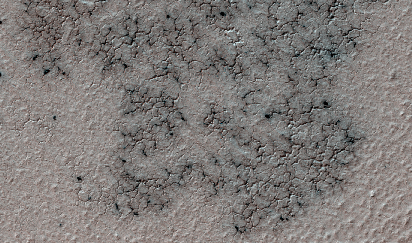
Candy Hansen wrote:Spiders Found by Citizen Scientists (ESP_047487_1005)
Mars has a seasonal polar cap composed of dry ice. In the spring, the ice turns into gas and carves spidery channels in the ground, unlike anything on Planet Earth!
To investigate more locations where these unique features occur, we enlisted citizen scientists to go through the Mars Reconnaissance Orbiter Context Imager’s images and identify regions with this terrain. This HiRISE image highlights one of the locations identified through the Planetfour: Terrains website. The “spiders” here are surrounded by ground described as “basketball terrain” because of its textural similarity to the stippled surface of a basketball.
http://asterisk.apod.com/viewtopic.php?t=36490

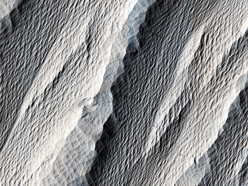
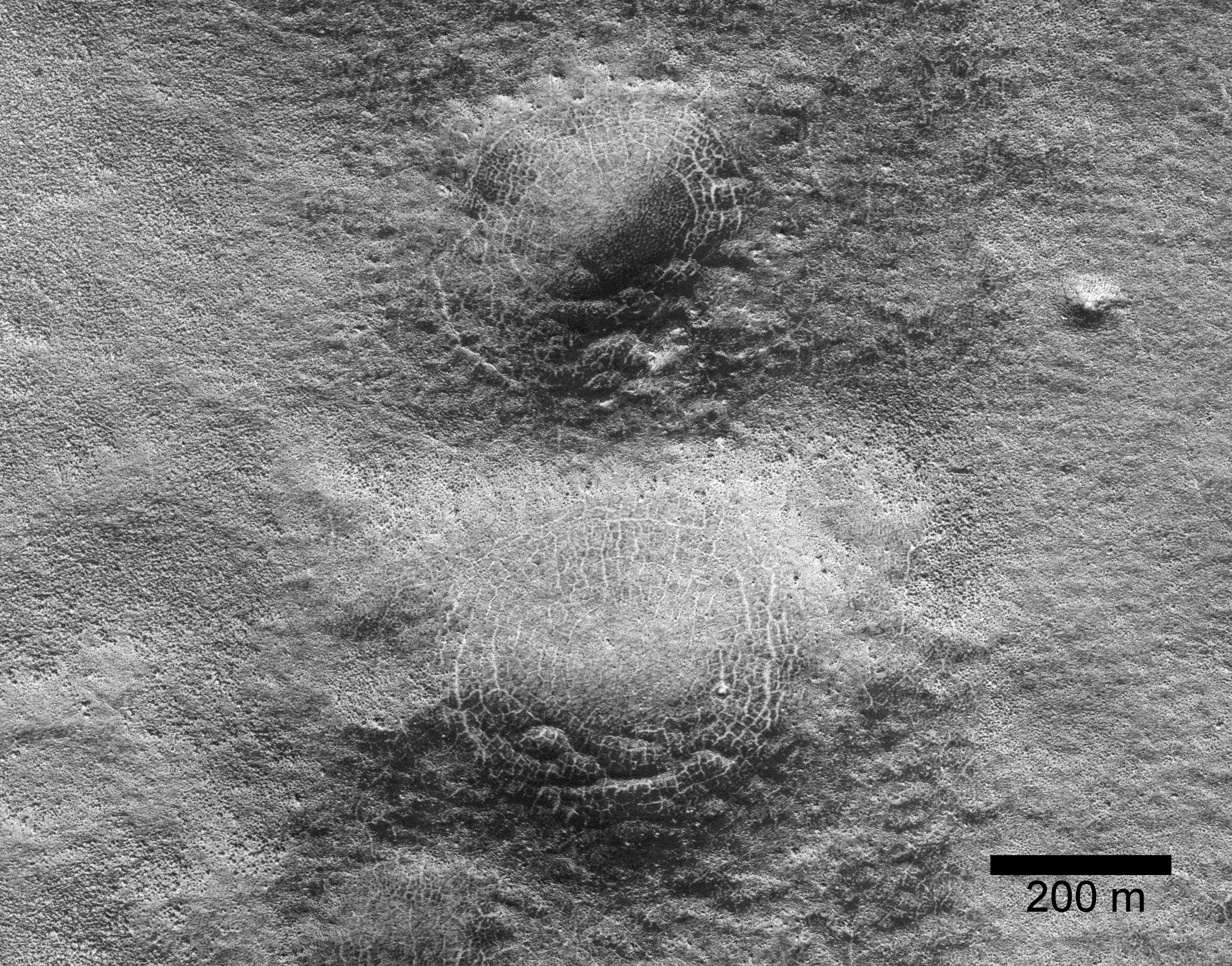
Paul Geissler wrote:Spider Webs (ESP_046359_1250)
This image shows a lava channel north of Kuiper Crater in the high southern latitudes just before spring equinox. It was a target suggested by members of the public, using our suggestion tool called HiWish.
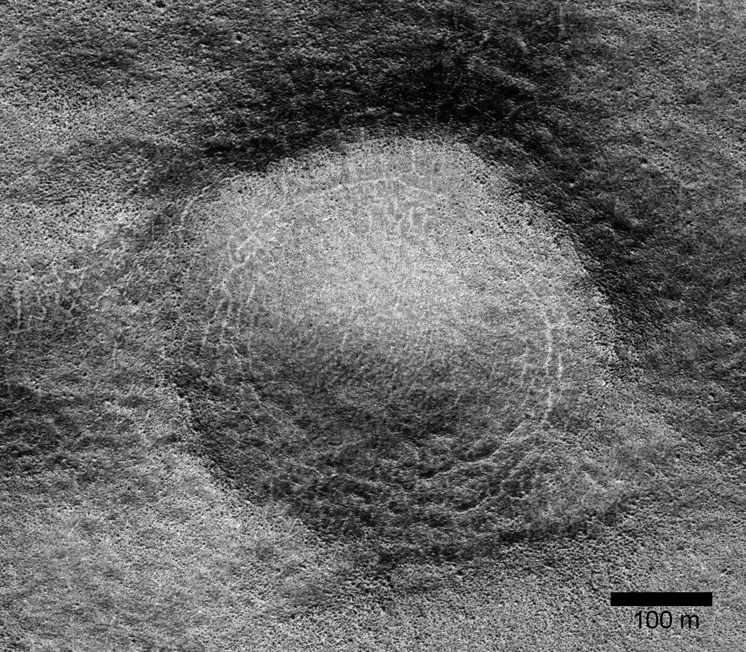
The channel confluence at the top of the image illustrates interesting volcanic processes that took place long ago. However, it was the mounds on the rim of the channel to the south of the confluence that we initially found alarming. These mounds, up to 400 meters in diameter, are decorated by radial and concentric patterns that resemble spider webs.
Radial and concentric fractures are familiar from forces penetrating a brittle layer, such as a rock thrown through a glass window. These particular fractures were evidently produced by something emerging from below the brittle surface of Mars. It seems likely that ice lenses, resulting from the accumulation of ice beneath the surface, created these peculiar mounds. Ice is less dense than rock, so the buried ice rose and pushed upwards on the surface and generated these spider web-like patterns. An analogous process creates similar sized mounds in arctic tundra on Earth that are known as “pingos,”, an Inuit word. The Martian fractures in this location are nowadays filled with dust instead of ice, so it is unclear how long ago this activity took place. It seems likely that these pingo-forming periglacial processes took place much more recently than the volcanic activity also evident in this region of Mars.
Michael Mellon wrote:Wind Carved Rock (ESP_046504_1785)
The distinctively fluted surface and elongated hills in this image in Medusae Fossae are caused by wind erosion of a soft fine-grained rock. Called yardangs, these features are aligned with the prevailing wind direction. This wind direction would have dominated for a very long time to carve these large-scale features into the exposed rock we see today.
Yardangs not only reveal the strength and direction of historic winds, but also reveal something of the host rock itself. Close inspection by HiRISE shows an absence of boulders or rubble, especially along steep yardang cliffs and buttresses. The absence of rubble and the scale of the yardangs tells us that the host rock consists only of weakly cemented fine granules in tens of meters or more thick deposits. Such deposits could have come from extended settling of volcanic ash, atmospheric dust, or accumulations of wind deposited fine sands. After a time these deposits became cemented and cohesive, illustrated by the high standing relief and exposed cliffs.
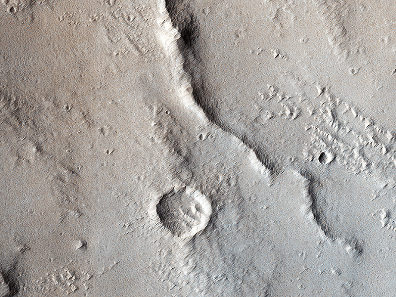
Kirby Runyon wrote:Wrinkle Ridges and Pit Craters (ESP_046817_1775)
Tectonic stresses highly modified this area of Ganges Catena, north of Valles Marineris. The long, skinny ridges (called “wrinkle ridges”) are evidence of compressional stresses in Mars’ crust that created a crack (fault) where one side was pushed on top of the other side, also known as a thrust fault.
As shown by cross-cutting relationships, however, extensional stresses have more recently pulled the crust of Mars apart in this region. (HiRISE imaged this area in 2-by-2 binning mode, so a pixel represents a 50 x 50 square centimeter.)
Ross Beyer wrote:Lava That Once Flowed (ESP_047071_2065)
This image shows some beautiful lava flows in Amazonis Planitia. Lava isn't moving around on Mars today, but it certainly once did, and images like this one are evidence of that.
A thick lava flow came in from the west, and you can see the cooled flow lobes and wrinkled upper surface. East of the flow margin, this most recent flow also coursed over an older lava surface which shows some long, north-south breaks, and in the southeast corner, an arrowhead-shaped set of ridges. These textures are most likely from rafted slabs of lava. Under certain conditions, a large piece of lava can cool, but then detach and move like an iceberg over a cushion of still-molten lava.
The long, narrow north-south smooth areas are probably where two of these plates rafted away from one another exposing the lava below. The arrowhead-shaped ridges are probably from when one of these plates pushed up against another one and caused a pile-up before cooling.
Credit: NASA/JPL-Caltech/University of Arizona
<< Previous HiRISE Update