
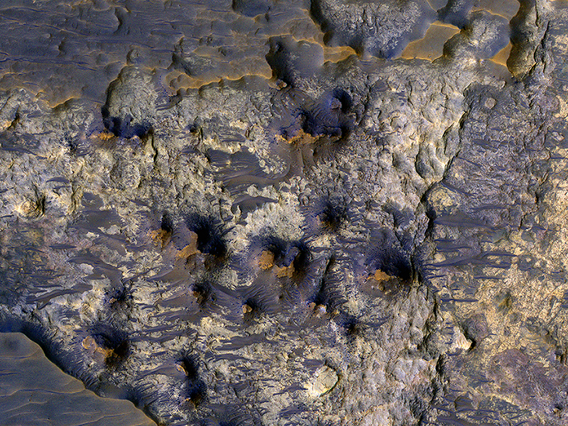
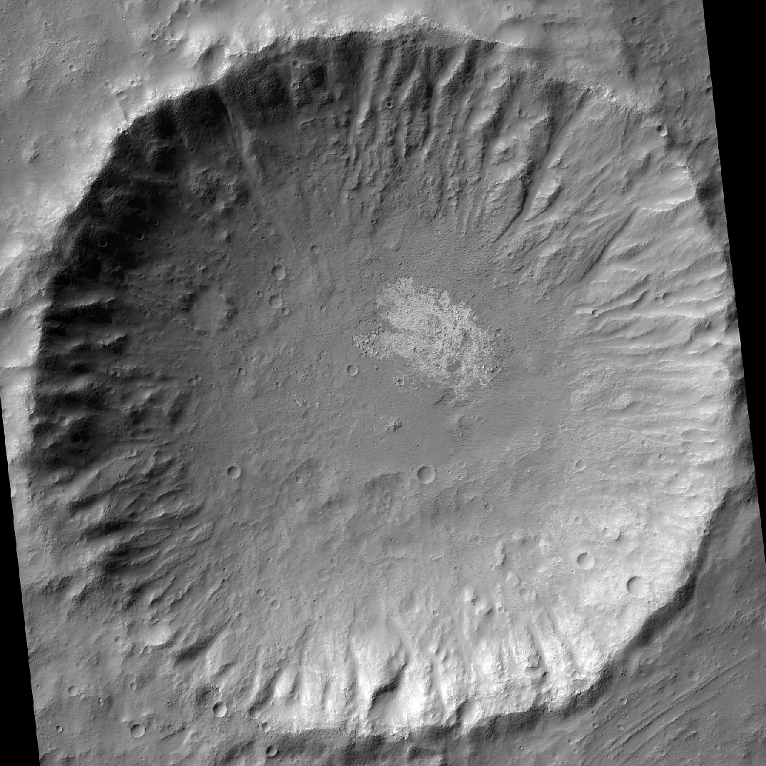
Eric Pilles, Arya Bina, Elise Harrington and Livio Tornabene wrote:Possible Layers on Floor of Suzhi Crater (ESP_030460_1525)
This image shows the floor of Suzhi Crater, an approximately 25-kilometer diameter impact crater located northeast of Hellas Planitia. The crater floor is mostly covered by dark-toned deposits; however some patches of the underlying light-toned bedrock are now exposed, like in this Context Camera image.
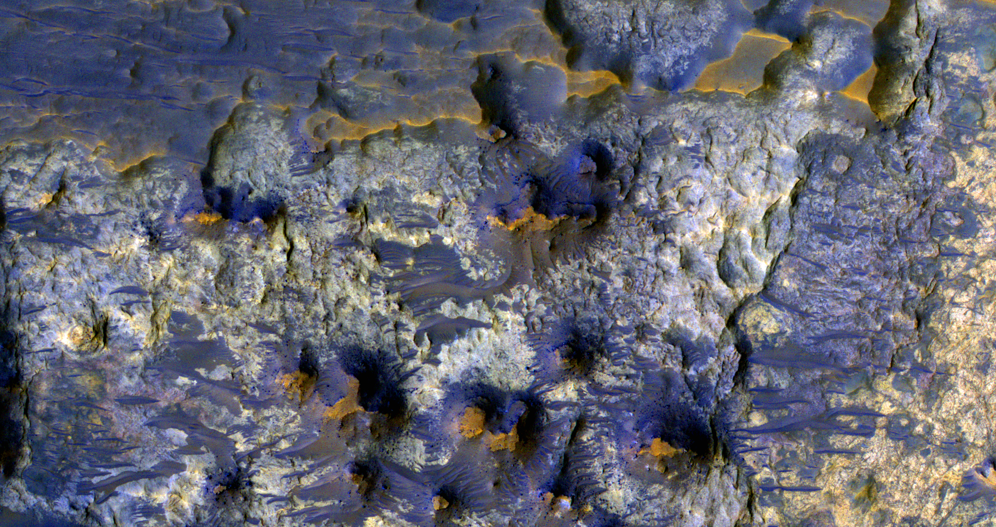
This enhanced-color infrared image shows a close up of the exposed bedrock on the floor of the crater. Here we can see the lighter-toned bedrock partially covered up by darker-toned bedrock and a few wind-blown bedforms. The lighter-toned bedrock appears to lie over yet another type of bedrock in our image, which appears to be yellowish and heavily fractured. What complex tale of Martian geologic and climate history might these rocks tell us if we were able to sample them in person? Perhaps, one day we’ll know.
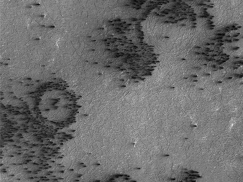
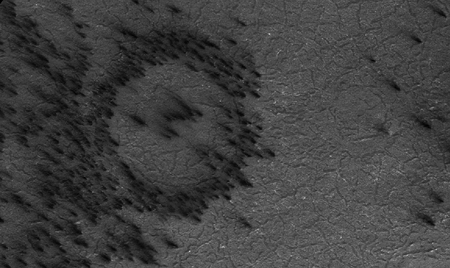
Candy Hansen wrote:Fans on Crater Rims (ESP_046332_1040)
Gas under pressure will choose an easy escape route. In this image, the terrain is covered with a seasonal layer of dry ice.
The weak spots, for gas sublimating from the bottom of the seasonal ice layer to escape, appear to be around craters, where the surface was broken and pulverized by an impact. Fans of surface material deposited on top of the seasonal ice layer show where the escape vents are.
This target was identified by the citizen scientists at Planetfour: Terrains.
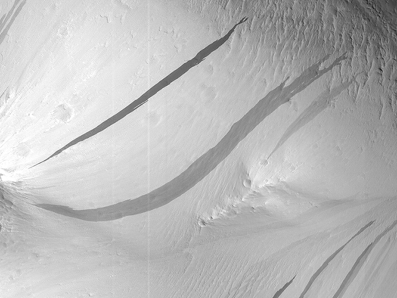
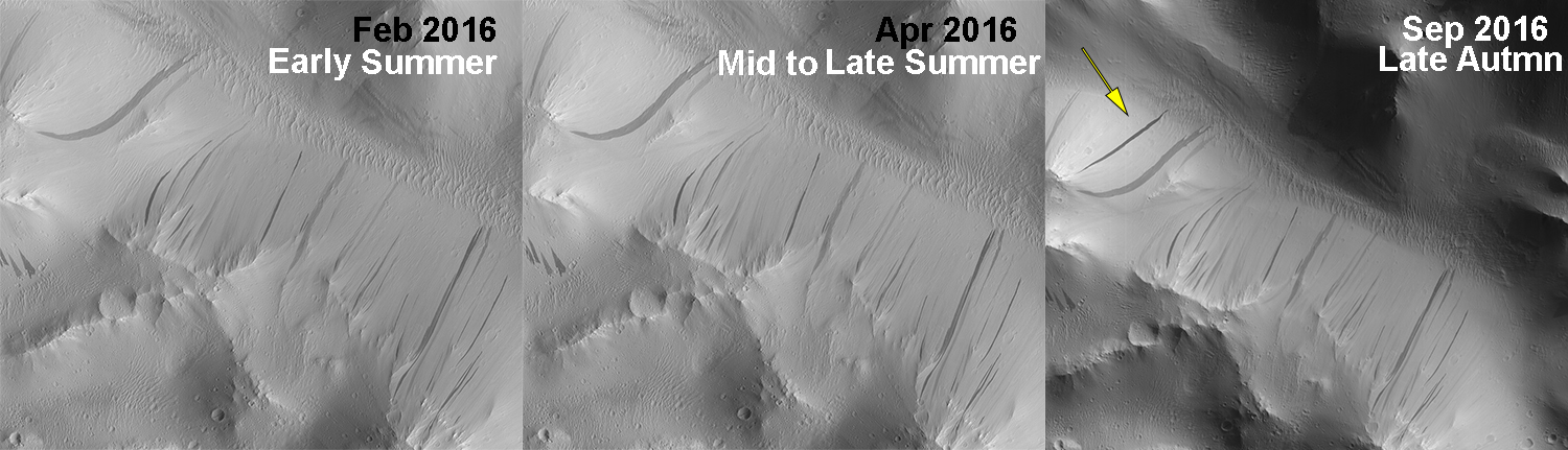
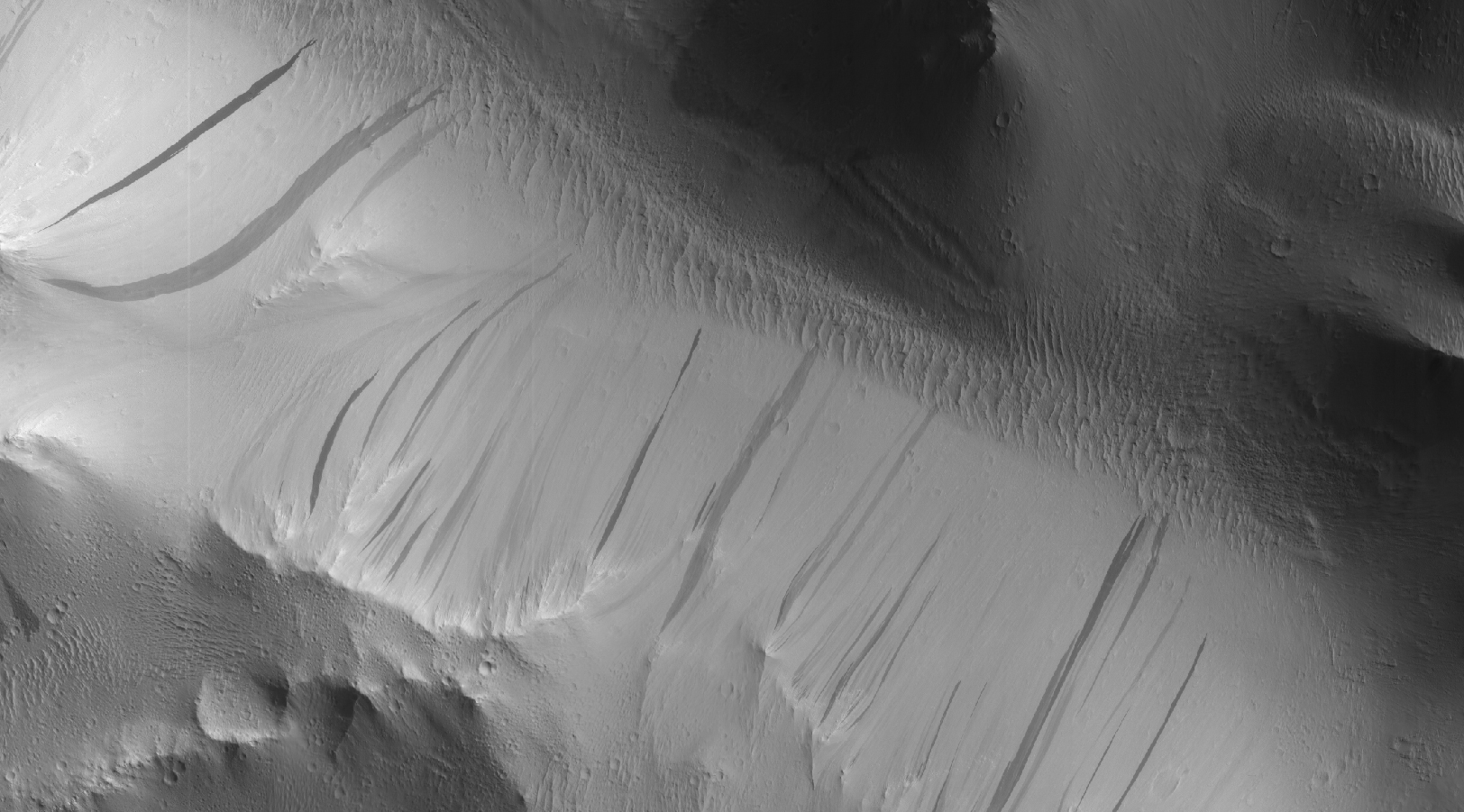
M. Ramy El-Maarry wrote:Slope Streaks or RSL? (ESP_047584_2115)
The image shows a region we see many slope streaks, typically dark features on slopes in the equatorial regions on Mars. They may extend for tens of meters in length and gradually fade away with time as new ones form. The most common hypothesis is that they are generated by dust avalanches that regularly occur on steep slopes exposing fresh dark materials from underneath the brighter dust.
There are many types of slope streaks but one of the most recent and significant findings using HiRISE was the discovery of a new type called “recurring slope lineae,” or RSL for short. Recent studies suggest that RSL may form through the flow of briny (extremely salty) liquid water that can be stable on the surface of Mars even under current climatic conditions for a limited time in summer when it is relatively warm.
How can we distinguish between conventional slope streaks like the ones we see here and RSL? There are many criteria. For instance, RSL are usually smaller in size than regular slope streaks. However, one of the most important conditions is seasonal behavior, since RSL appear to be active only in summer while regular slope streaks can be active anytime of the year.
This site is monitored regularly by HiRISE scientists because of the high density of slope streaks and their different sizes and orientations. If we look at a time-lapse sequence, we will see that a new slope streak has indeed formed in the period since April 2016 (and we can note how dark it is in comparison to the others indicating its freshness). However, this period corresponds mainly to the autumn season in this part of Mars, whereas we do not see any major changes in the summer season. This suggests that the feature that developed is a regular slope streak just like all the others in the area.
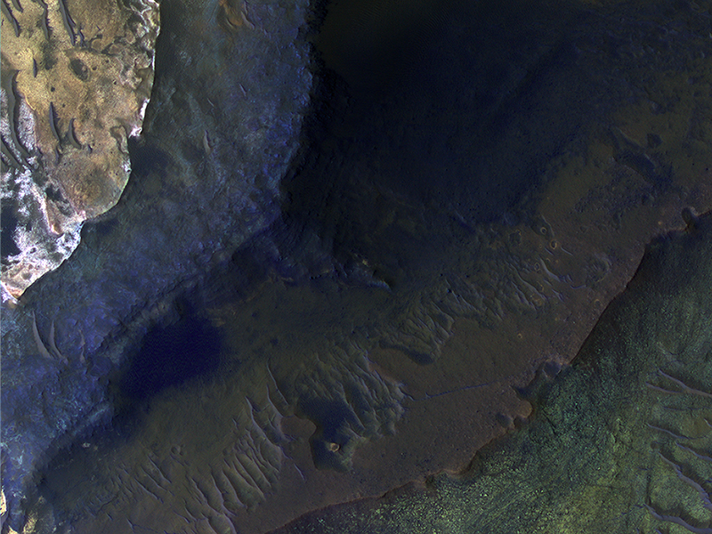
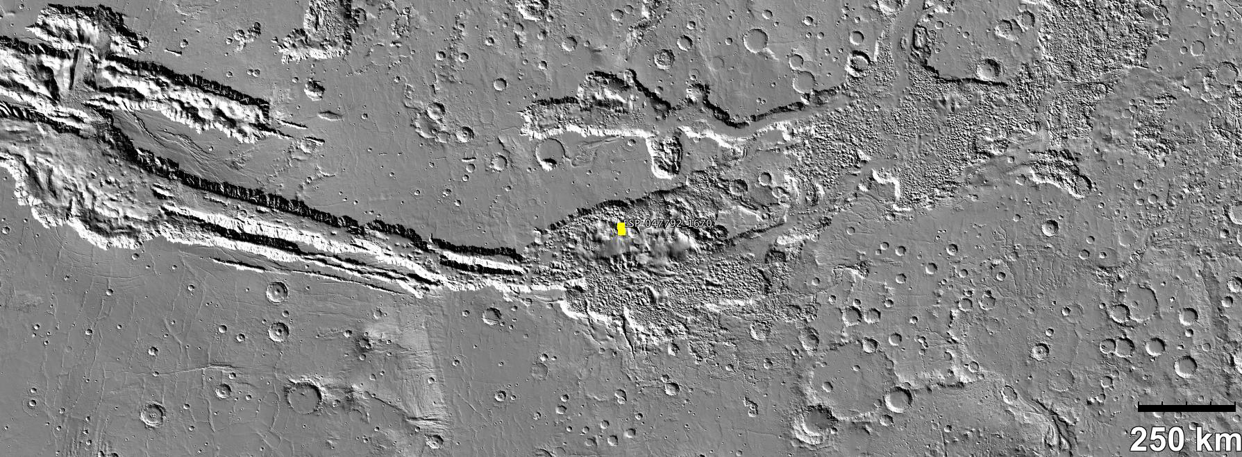
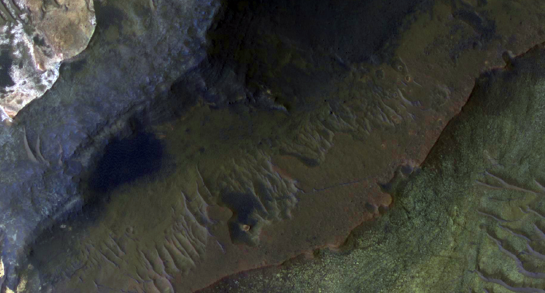
Elise Harrington, Arya Bina, Eric Pilles and Livio Tornabene wrote:Hematite-Rich Deposits in Capri Chasma (ESP_047792_1670)
Capri Chasma is located in the eastern portion of the Valles Marineris canyon system, the largest known canyon system in the Solar System. Deeply incised canyons such as this are excellent targets for studying the Martian crust, as the walls may reveal many distinct types of bedrock.
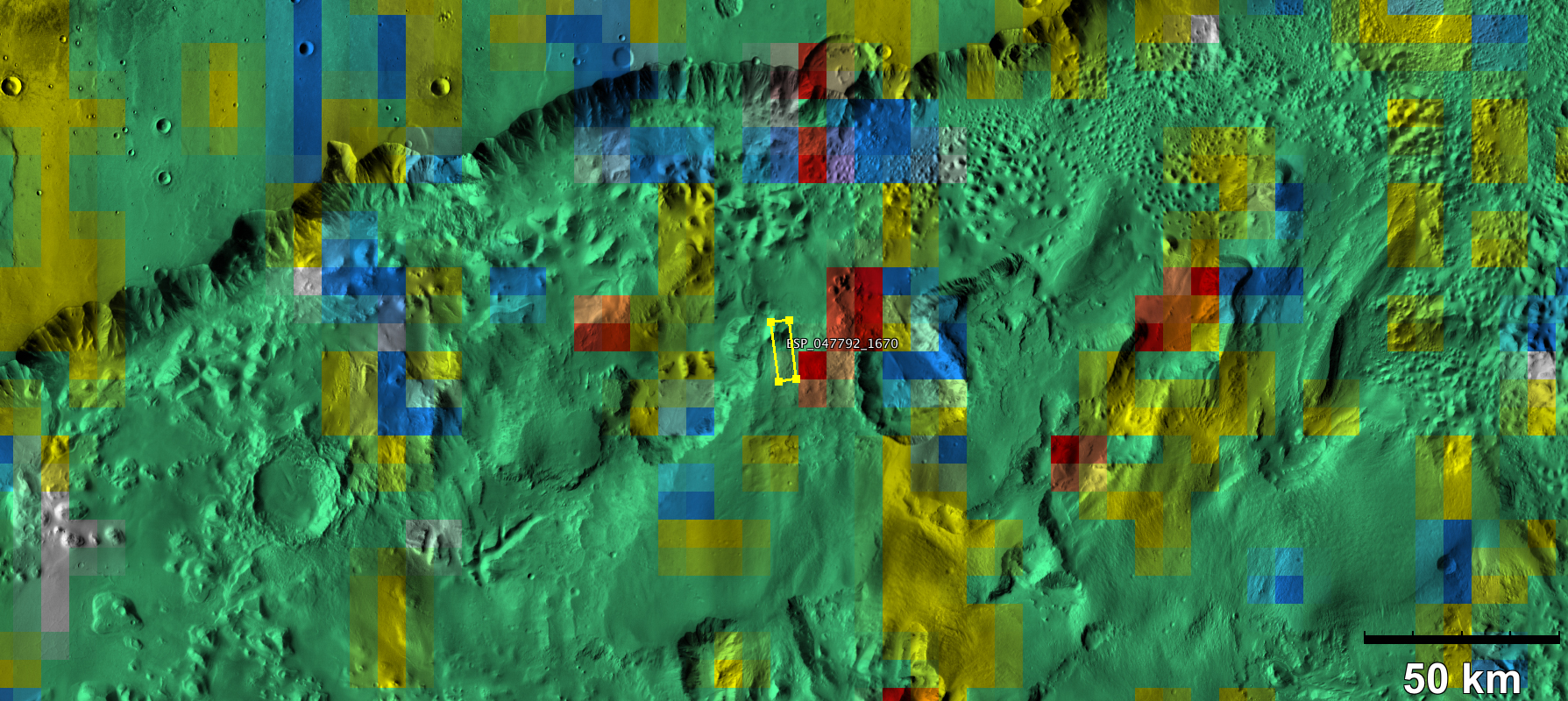
This section of the canyon was targeted by HiRISE based on a previous spectral detection of hematite-rich deposits in the area. Hematite, a common iron-oxide mineral, was first identified here by the Mars Global Surveyor Thermal Emission Spectrometer (TES). In this TES image, red pixels indicate higher abundances of hematite, while the blue and green pixels represent different types of volcanic rocks (e.g., basalt).
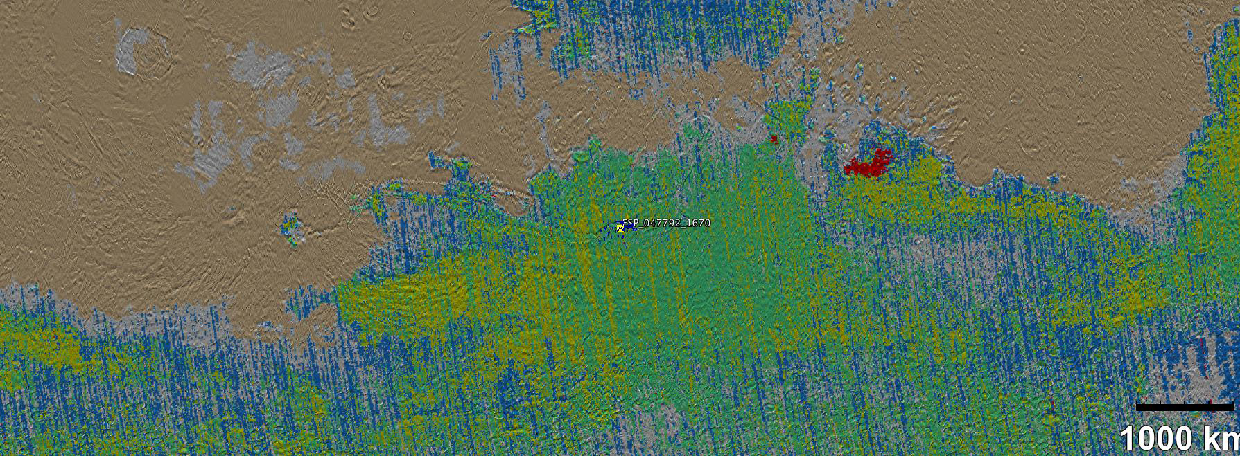
Hematite in the Meridiani Planum region was also detected with the TES instrument (which we can see with the bright red spot on the Global TES mineral map). As a consequence, Meridiani Planum was the first landing site selected on Mars due to the spectral detection of a mineral that may have formed in the presence of liquid water.
Shortly after landing, the Opportunity rover detected the presence of hematite in the form of concretions called "blueberries". The blueberries are found in association with layers of sulfate salt-rich rocks. The salts are hypothesized to have formed through the raising and lowering of the groundwater table. During one such an event, the rock altered to form the hematite-rich blueberries. As the rock was eroded away, the more resistant hematite-rich blueberries were plucked out and concentrated on the plains as a "lag" deposit. Martian blueberries are observed to be scattered across the plains of Meridiani along Opportunity's traverse from Eagle Crater to Endeavor Crater, where Opportunity continues to explore after its mission began over 10 years ago.
This infrared-color image close-up highlights what is possibly the hematite-rich deposits nestled between different types of bedrock terraces in Capri Chasma. The bluish terrace is likely volcanic in origin, possibly basaltic, whereas the greenish rocks remain unidentified.
The central reddish terrace is possibly where some of the hematite may be concentrated. The higher elevation terrace with the lighter-colored materials is likely a sulfate-rich rock (based on CRISM data in the area). Given the presence of both sulfate salts and hematite in this area, akin to the deposits and associations explored by the Opportunity rover in Meridiani Planum, it might be that these materials in Capri Chasma may share a similar origin.
The yellow rectangular box shown on the TES spectral map outlines the corresponding location of the HiRISE image. Although the outline does not appear to contain a high hematite abundance, we note that the lower resolution of TES (about 3 to 6 kilometers per pixel) may exclude smaller exposures and finer sub-pixel details not-yet captured, but could be with HiRISE. A follow-up observation by the CRISM spectrometer may reveal additional details and a spectral signature for hematite in the vicinity at a finer resolution than TES.
Credit: NASA/JPL-Caltech/University of Arizona
<< Previous HiRISE Update