
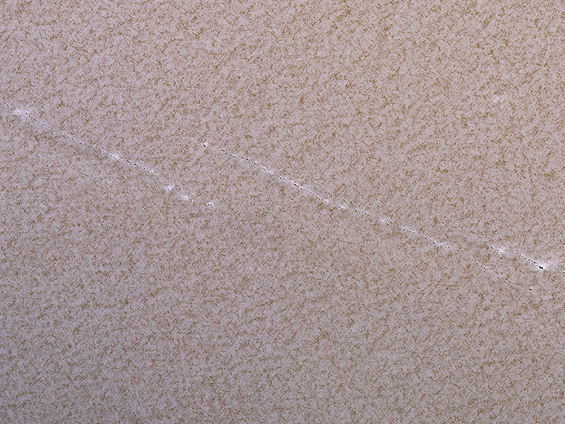
Alfred McEwen wrote:Polar Pits: Are They Active? (PSP_009834_2645)
This 2008 image shows a portion of the North Polar layered deposits with lines of very small pits, only about 1 meter in diameter.
Such small pits should be quickly filled in by seasonal ice and dust, so their existence suggests active processes such as faults pulling apart the icy layers.
This is a stereo pair with PSP_009873_2645.
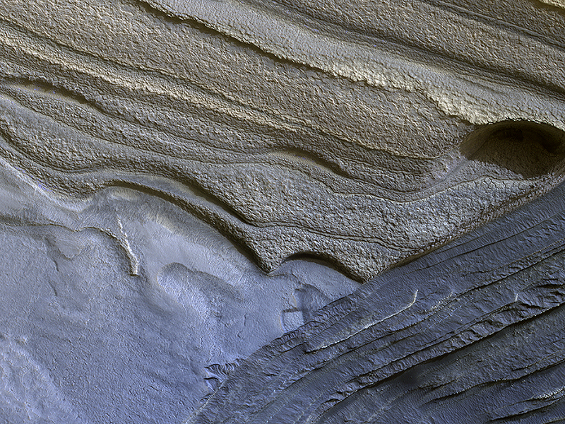
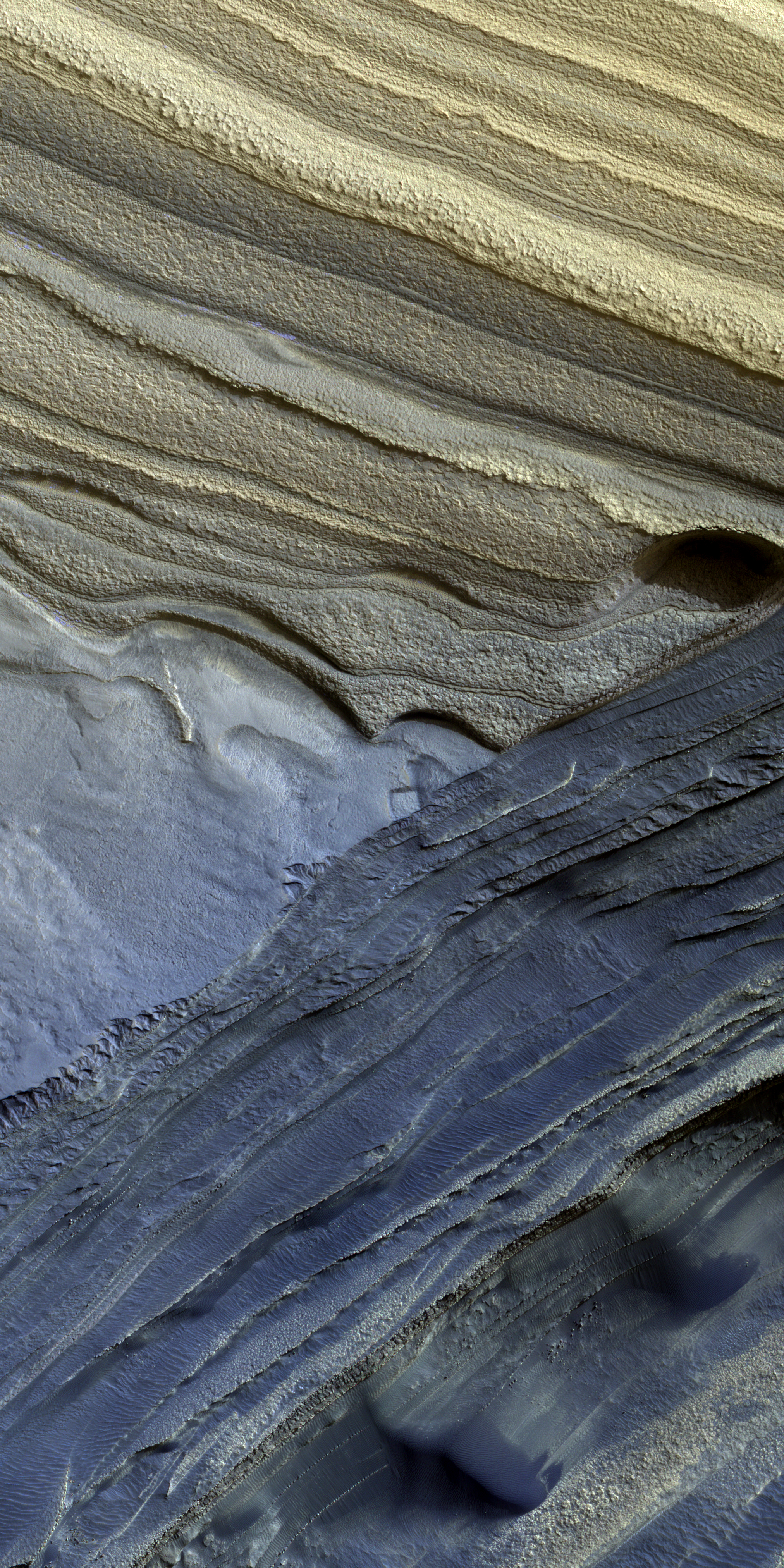
Shane Byrne wrote:North Polar Layers (ESP_018636_2745)
The North Polar layered deposits are a 3-kilometer thick stack of dusty water ice layers that are about 1000 kilometers across. The layers record information about climate stretching back a few million years into Martian history.
In many locations erosion has created scarps and troughs that expose this layering. The tan colored layers are the dusty water ice of the polar layered deposits; however a section of bluish layers are is visible below them. These bluish layers contain sand-sized rock fragments that likely formed a large polar dunefield before the overlying dusty ice was deposited.
The lack of a polar ice cap in this past epoch attests to the variability of the Martian climate, which undergoes larger changes over time than that of the Earth.
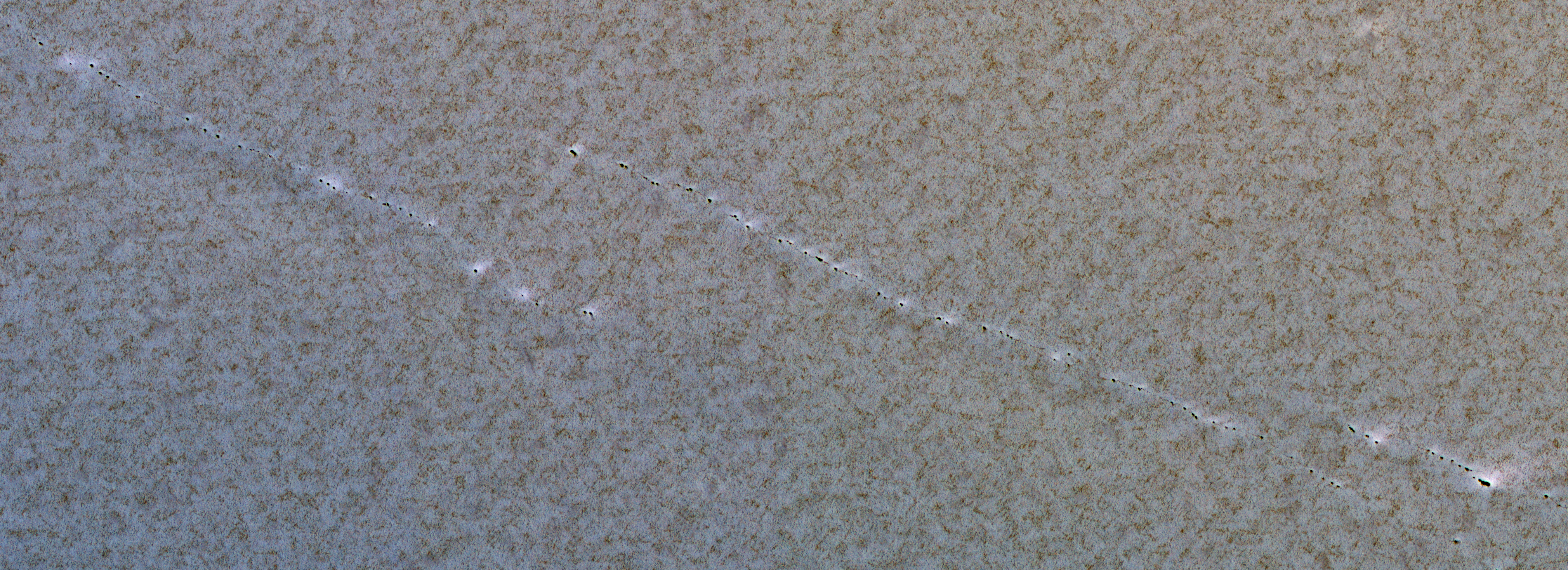
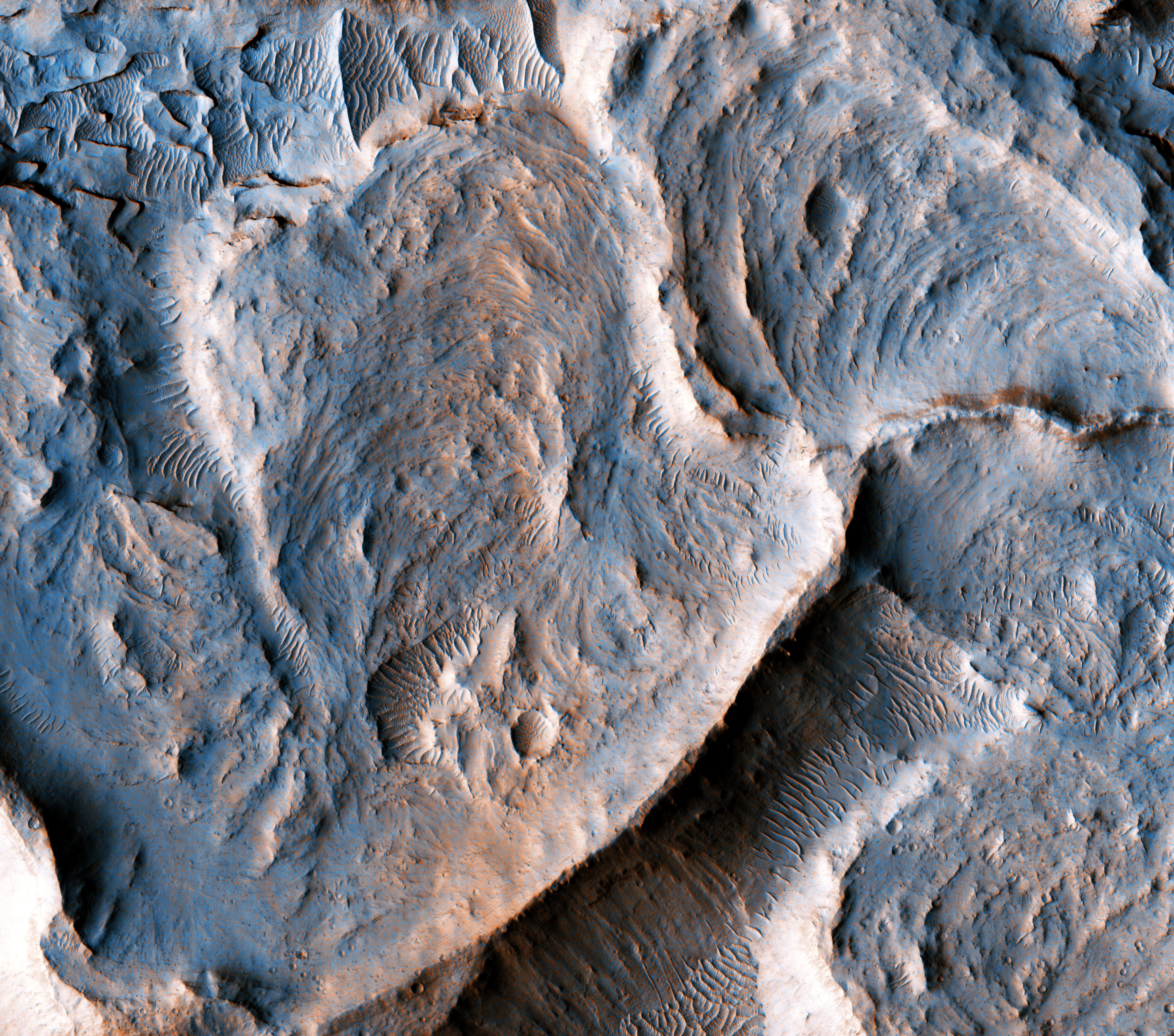
Alexandra Lefort wrote:Martian Meanders and Scroll-Bars (ESP_020673_1750)
This is a portion of an inverted fluvial channel in the region of Aeolis/Zephyria Plana, at the Martian equator.
Channels become inverted when the sediments filling them become more resistant to erosion than the surrounding material. Here, the most likely process leading to hardening of the channel material is chemical cementation by precipitation of minerals. Once the surrounding material erodes, the channel is left standing as a ridge. The series of curvilinear lineations are ancient scroll-bars, which are features typical of river meanders (bends) in terrestrial fluvial channels.
Scroll-bars are series of ridges that result from the continuous lateral migration of a meander. On Earth, they are more common in mature rivers. The presence of scroll bars suggests that the water flow in this channel may have been sustained for a relatively long time.
Measuring characteristics of these scroll-bars and meanders may help to estimate the amount of water that once flowed in this channel, aiding our understanding of the history of water on Mars.
This is a stereo pair with ESP_020528_1750.

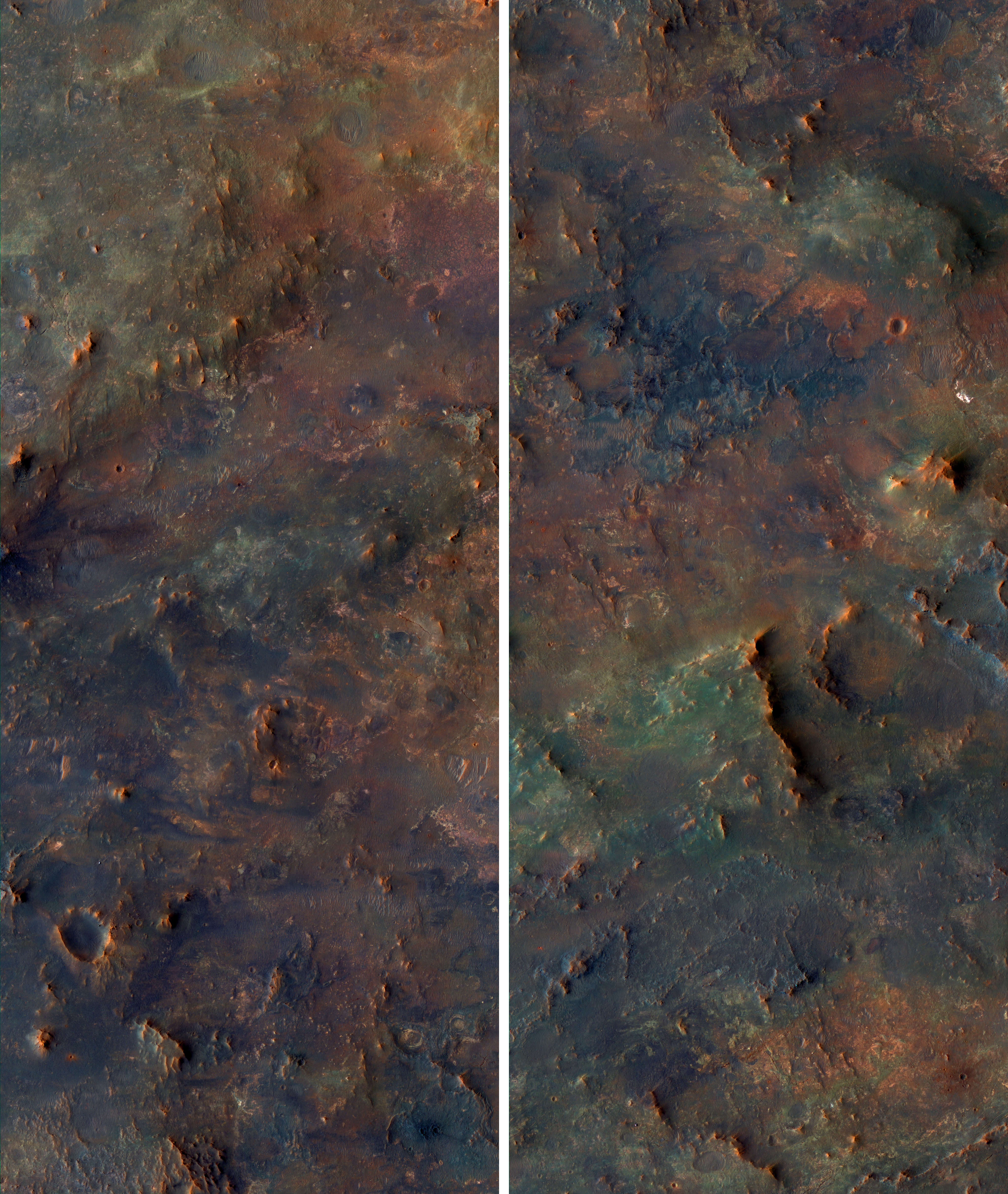
Alfred McEwen wrote:Isidis Basin Ejecta (ESP_011261_1960)
This scene is a jumbled mess! There are blocks and smears of many different rocks types that appear to have been dumped into a pile.
That’s probably about what happened, as ejecta from the Isidis impact basin to the east. This pile of old rocks is an island surrounded by younger lava flows from Syrtis Major.

Credit: NASA/JPL-Caltech/University of Arizona
<< Previous HiRISE Update