
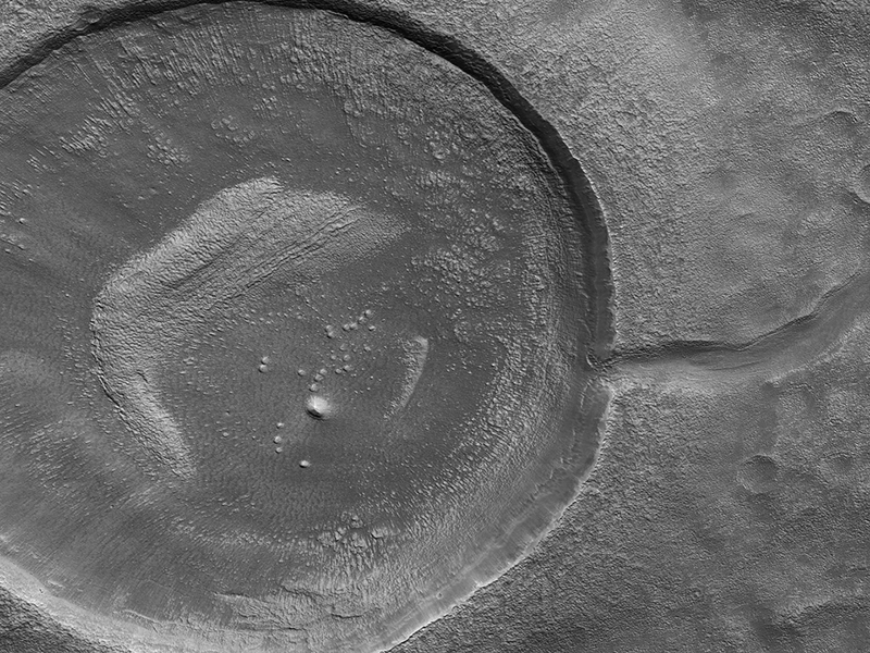
M. Ramy El-Maarry wrote:Crater Tadpoles (ESP_053222_2150) (HiClip)
This impact crater looks amusingly like a tadpole because of the valley that was carved by water that used to fill it. When the water level inside the crater increased, it breached the crater wall, flowed outward and formed a valley. Sometimes, the water may flow in the opposite direction, like from a channel into a crater.
It is often difficult to differentiate between inlet and outlet channels, but water always flows downhill. In this particular case, we can infer that water is flowing outward because we have the necessary terrain-height information.
When studying these images in detail, scientists can gain a better understanding of the strength of the flooding water that carved the channels, and better understand the history of water activity in this region of Mars.
This is a stereo pair with ESP_052945_2150.
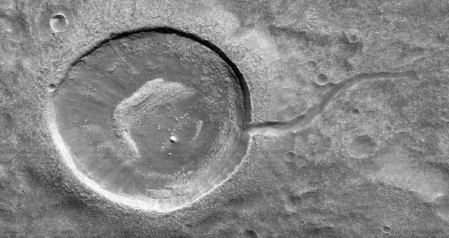
Shane Byrne wrote:Splitting Slope Streaks (ESP_053518_1955) (HiClip)
Streaks form on slopes when dust cascades downhill. The dark streak is an area of less dust compared to the brighter and reddish surroundings. What triggers these avalanches is not known, but might be related to sudden warming of the surface.
These streaks are often diverted by the terrain they flow down. This one has split into many smaller streaks where it encountered minor obstacles.
These streaks fade away over decades as more dust slowly settles out of the Martian sky.

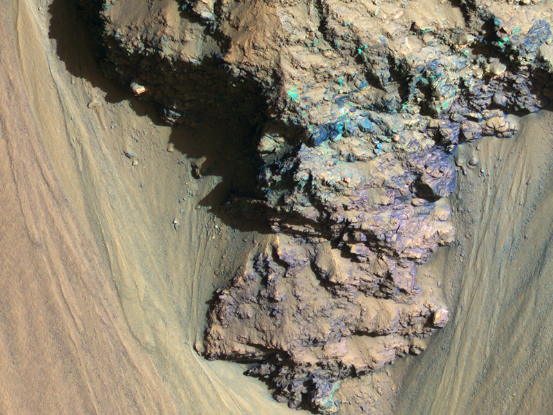
Alfred McEwen wrote:Geologic History Revealed in Valles Marineris (ESP_013784_1710) (HiClip)
An enhanced-color image reveals bedrock that is several kilometers below the top of the giant Valles Marineris canyons.
The upper layers have relatively little diversity of colors and textures, but deeper levels show more complex processes. The upper layers could be mostly volcanic while the lower layers were influenced by the period of heavy bombardment and greater interactions with water.
This is a stereo pair with ESP_013362_1710.
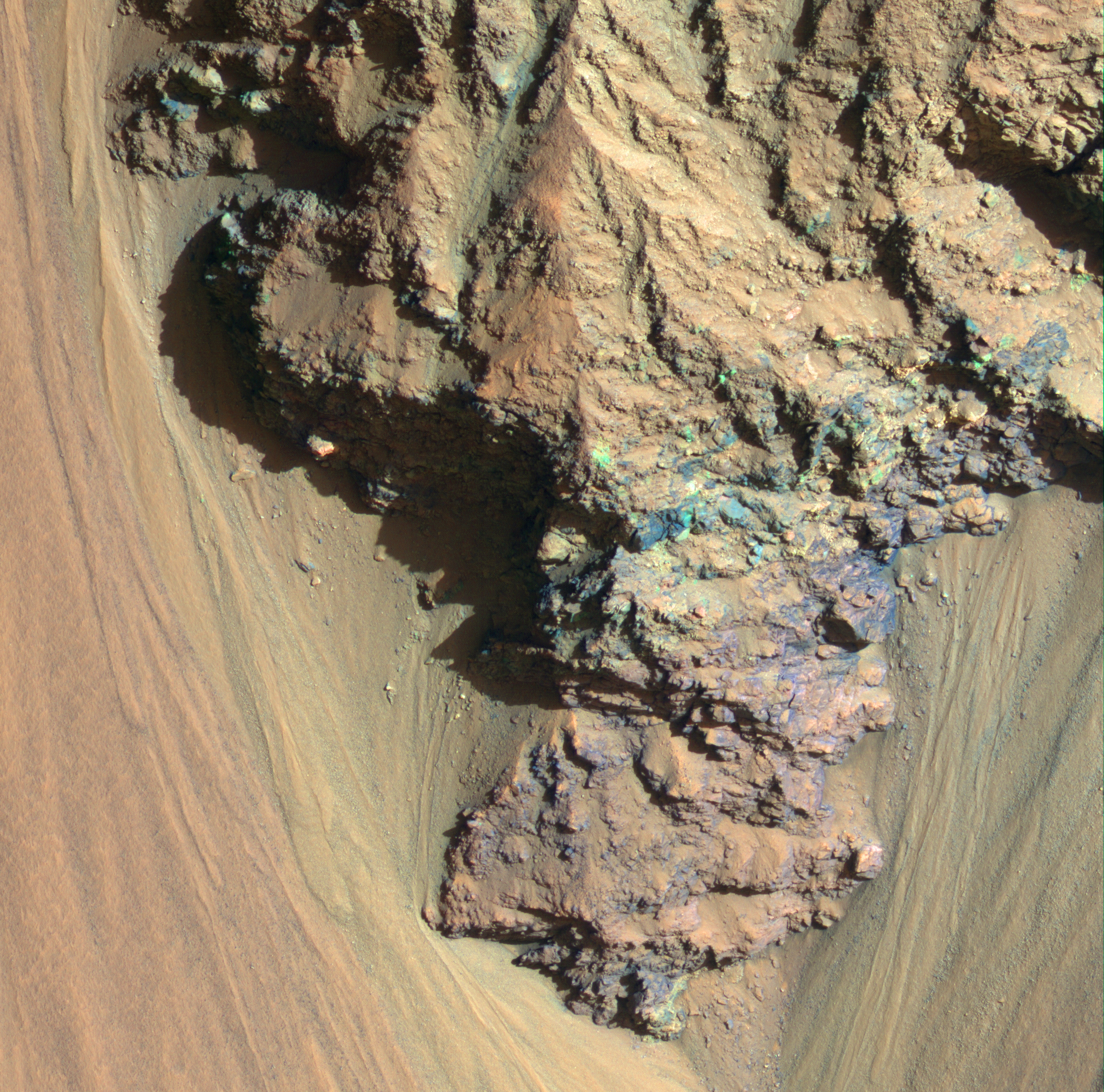
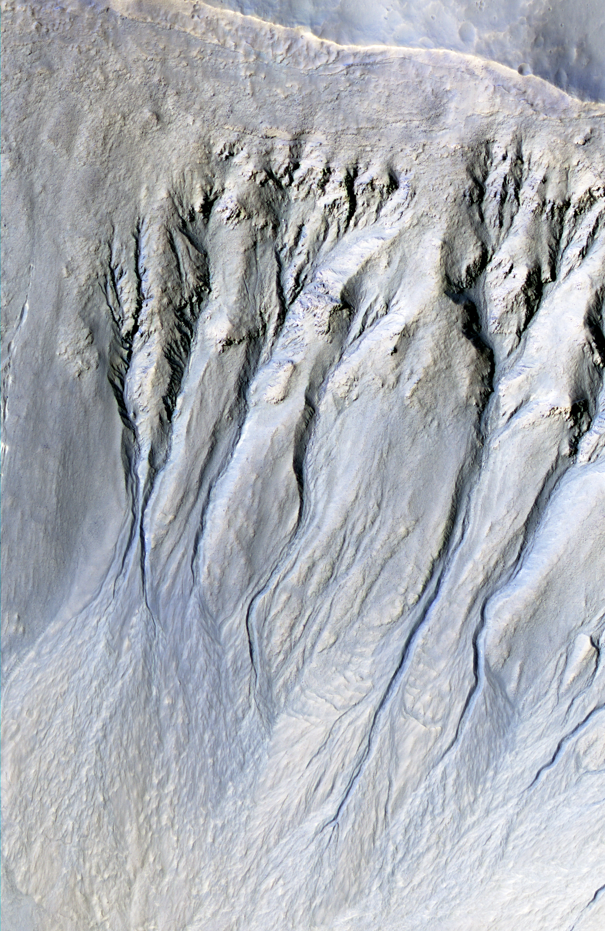
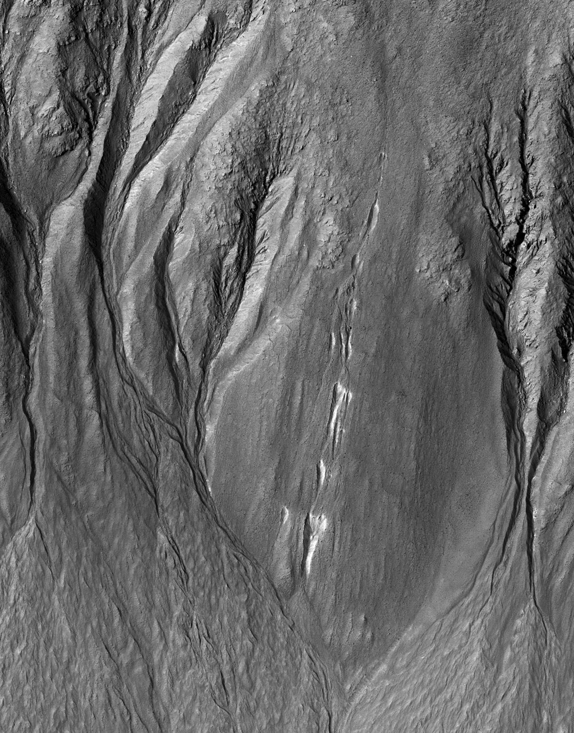
Ginny Gulick wrote:Gullies and Voids (ESP_021741_1415) (HiClip)
Intricate gullies have formed on the northern wall of this impact crater located in the Terra Cimmeria region.
This crater may have formed in a region rich in ground water. This ground water likely flowed down the wall, eventually eroding numerous gullies while carrying sediments to form fan deposits. Ultimately the water likely infiltrated and froze beneath the surface. Other hypotheses say gullies form through carbon dioxide frost avalanches that we can see today.
What about this chain of pits snaking their way downhill? After material was transported, subsurface voids may have formed, removing support for the overlying material. The collapse of the surface into the cavities below likely resulted in the pits and troughs, perhaps beginning a new cycle of gully formation.

Credit: NASA/JPL-Caltech/University of Arizona
<< Previous HiRISE Update