
NASA | JPL-Caltech | Univ of Arizona | MRO HiRISE | 2015 Oct 05
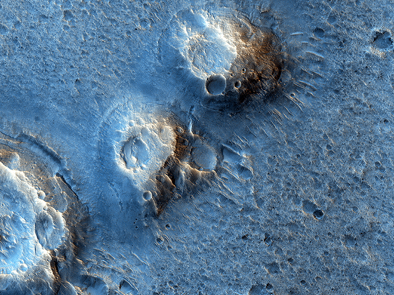
[img3="The Ares 3 Landing Site - Credit: NASA/JPL-Caltech/Univ. of ArizonaImages from a NASA Mars orbiter’s telescopic camera reveal details of real regions on Mars where a new Hollywood movie, “The Martian,” places future astronaut adventures.
This May 2015 image from the HiRISE camera on NASA's MRO shows a location on Mars associated with the best-selling novel and Hollywood movie, "The Martian." It is in a region called Acidalia Planitia, at the landing site for the fictional Ares 3 mission."]http://mars.nasa.gov/mro/imgs/2015/10/m ... A-full.jpg[/img3][hr][/hr]
The novel of the same name used actual locations on Mars for the landing sites for its “Ares 3” and “Ares 4” missions. The landing sites for “Ares 3” is on a Martian plain named Acidalia Planitia. The base for the “Ares 4” mission was set inside a crater named Schiaparelli.
Views of these two sites, and other locations pertinent to the fictional story, are in the latest weekly release of images from the High Resolution Imaging Science Experiment (HiRISE) camera on NASA’s Mars Reconnaissance Orbiter (MRO). They are available online at HiRISE and “The Martian”.
Each observation by HiRISE covers an area of several square miles and shows details as small as a desk. More than 39,000 of them have been taken since the MRO reached Mars in 2006. They are available online for anyone to explore, from the comfort of home, at University of Arizona's Lunar and Planetary Laboratory HiRISE site.
The HiRISE team has an online process through which anyone can register to submit suggestions for sites to be imaged on Mars, at HiWish.
HiRISE and “The Martian”
NASA | JPL-Caltech | Univ. of Arizona | MRO HiRISE | 2015 Sep 30
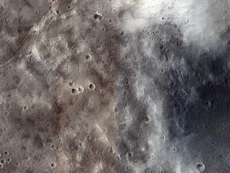
Alfred McEwen wrote:Ares 3 and The Martian (ESP_026086_2115) (HiClip)
In “The Martian” by Andy Weir (watch for the movie in late 2015), stranded astronaut Mark Watney spends most of his time at the “Ares 3” site in southern Acidalia Planitia. The book describes Acidalia as flat and easy to drive over; he even drives to the Pathfinder landing site and back.
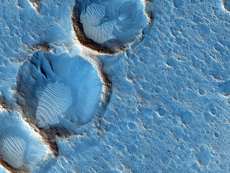
This region of Mars is actually far more diverse, interesting, and hazardous to drive over than depicted in the novel. These two images (this observation and ESP_019783_2115) are close to the Ares 3 landing site as shown in a map at the front of the novel, and shows many mounds, perhaps ancient volcanoes resulting from lava-water interaction or eruption of muddy sediments.
Much of Acidalia Planitia is covered by dense fields of boulders up to several meters high that would be difficult to drive around. There are also fissures associated with giant polygons, with steep rocky slopes that would be impassable. There are elongated fields of dense secondary craters where the surface is extremely rough at scales near the size of the rover. When our hero travels into Arabia Terra it is described as much rockier than Acidalia, but the opposite is generally true: much of Arabia is dust mantled and smooth at the scale of a rover.
People commonly assume that smooth at large scales (kilometers) means smooth at small scales (meters to tens of meters). Often on Mars, the exact opposite is seen: large flat low areas are more wind-scoured, removing fine materials and leaving rocks and eroded bedrock.
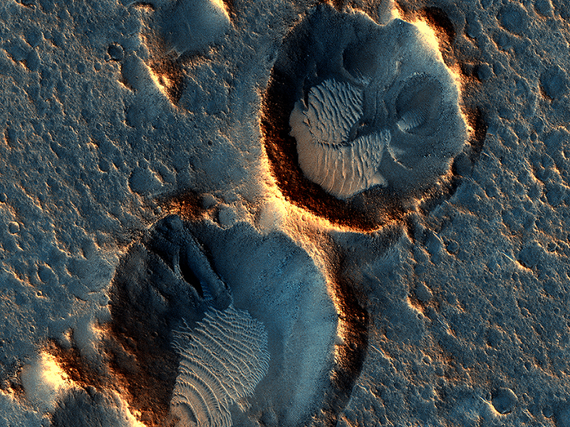
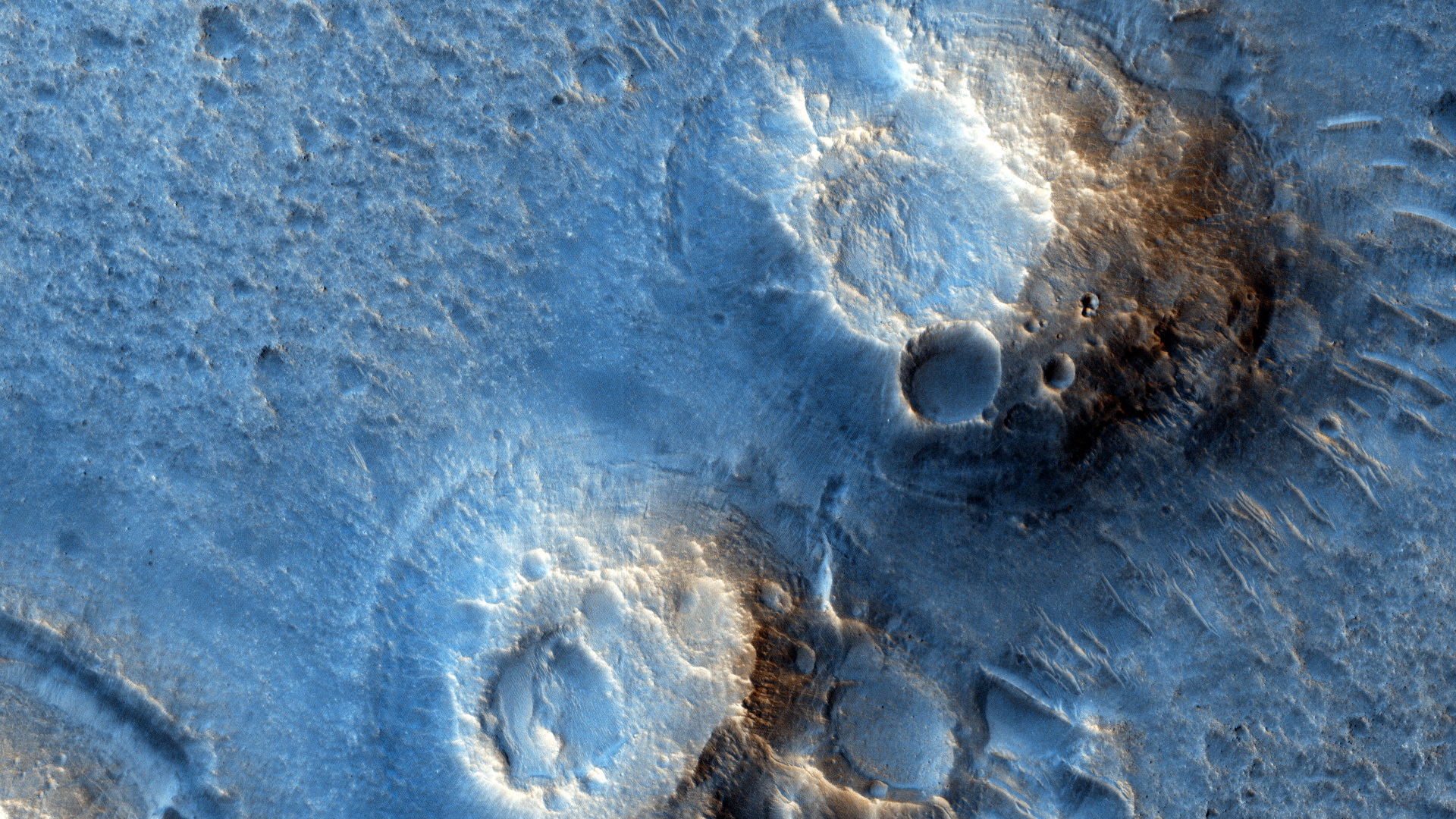
Alfred McEwen and Andy Weir wrote:Ares 3 Landing Site: The Martian Revisited (ESP_040776_2115)
We previously released an image near the Ares 3 landing site from “The Martian” by Andy Weir. Andy then sent us the exact coordinates, which we targeted, and this is it.
The closeup shows some wind-blown deposits inside eroded craters. We can’t see the Ares 3 habitat because it arrives sometime in the future, so this is the “before” image. The dark areas appear bluish in HiRISE color but would appear grey to humans on the surface, or maybe a bit reddish when the air is dusty.
Ares 3’s 6-meter-diameter habitat would be just 20 pixels across at this scale, about 1/10th the diameter of the largest crater in the central cluster. If protagonist Mark Watney were laying flat on the surface, he would be 6 pixels tall.
This is a stereo pair with ESP_041277_2115.
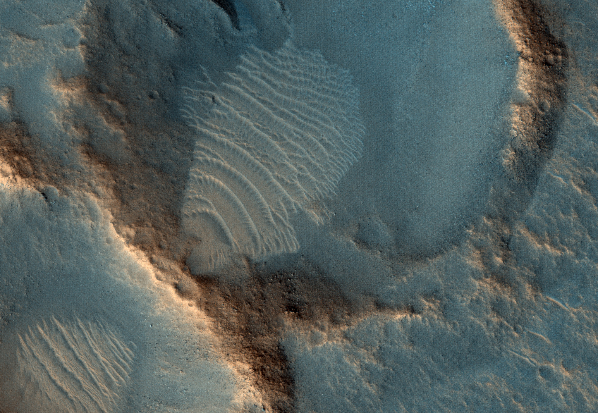
M. Ramy El-Maarry wrote:The Ares 3 Landing Site: Where Science Fact Meets Fiction (ESP_041277_2115) (HiClip)
Andy Weir, the author of the best-selling novel “The Martian,” had previously contacted the HiRISE team requesting that we take a picture of the Ares 3 landing site from his novel in Acidalia Planitia, within driving distance from the Pathfinder lander and Sojourner rover. We acquired the image back in April and you can view it here. With this second image, you can download both images and try spotting any changes.
One of the main objectives of the HiRISE camera is to carry out “monitoring science”, which means we usually take images of certain areas of high scientific interest on regular intervals. We usually do so to monitor a seasonal or recurring process such as melting of ice in spring in the polar regions, dune monitoring, or recurring slope lineae. However, we also take multiple images to keep “checking up” on the progress of active rovers such as Curiosity to make sure it’s in good shape, and in order to help plan a safe, future route that would also place it within striking distance of areas of high scientific interest.
There is another key responsibility for the HiRISE camera, which is to help choose landing sites for future missions. One of the techniques we usually use is to image a certain site of interest at least twice when the weather conditions are similar, but with a small difference in viewing angle, much like what you would experience if you looked at something with only your right eye, then looked at it again with the left. By doing this, we are able to build a “stereo view” of the site, providing a chance to identify high and low points in the site more effectively. Another useful technique is to combine these two images using elevation data from laser altimeters to create a highly accurate “digital terrain model” or DTM for short.
DTMs allow us to view the locations in 3D and to analyze them by measuring the exact height of features that could be hazardous to the future mission such as large boulders or small impact craters. DTMs from HiRISE were a key factor in choosing the landing site for Curiosity in Gale Crater and are extensively being used as well to choose sites for the 2016 InSight lander and Mars 2020 rover missions. And now, we have a similar stereo pair for the Ares 3 landing site. That way, NASA can start planning on sending Mark Watney to Mars!
This is a stereo pair with ESP_040776_2115.
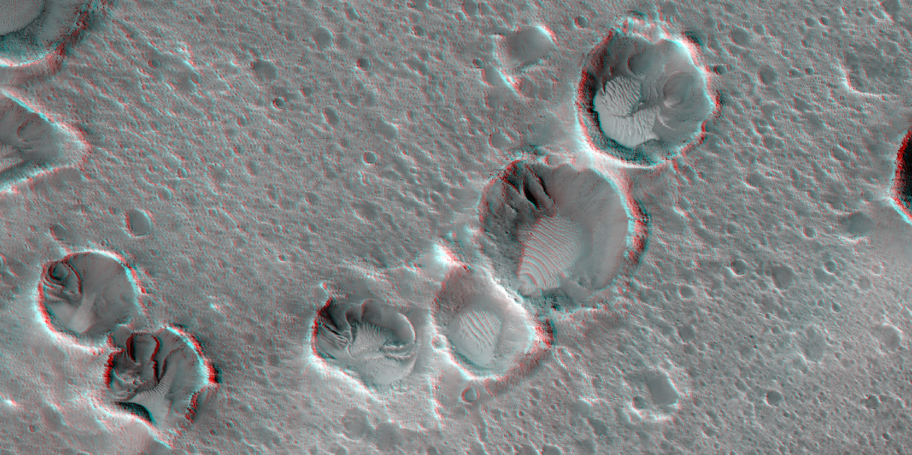
Alfred McEwen wrote:From Ares 3 to Ares 4 (ESP_042014_1760) (HiClip)
We previously released stereo images of the Ares 3 landing site from Andy Weir’s “The Martian.” In the novel, stranded astronaut Mark Watney travels from the Ares 3 site to the Ares 4 site where a Mars Ascent Vehicle could get him into Mars orbit to rejoin a spacecraft and return home.
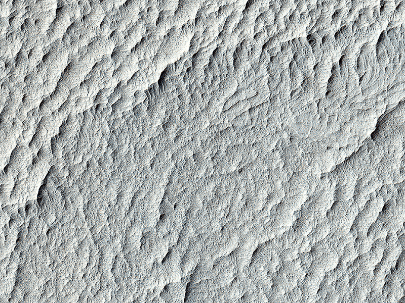
The Ares 4 site is on the floor of a very shallow crater in the southwestern corner of Schiaparelli Crater. Our image image shows a flat region that is entirely mantled by bright Martian dust. There are no color variations, just uniform reddish dust. At full resolution, we see a pervasive, pitted texture that is characteristic of many dust deposits on Mars. No boulders are visible, so the dust is probably at least a meter thick.
Past Martian rovers and landers from NASA have avoided such pervasively dust-covered regions for two reasons. First, the dust has a low thermal inertia, meaning that it gets extra warm in the daytime and extra cold at night, a thermal challenge to survival of the landers and rovers (and people). Second, the dust hides the bedrock, so little is known about the bedrock composition and whether it is of scientific interest.
There is morphologic evidence for layered rocks, and narrow curving structures that could be fluvial channels, so the bedrock geology could be quite interesting, but exploring this site would be like trying to do field work when there is several feet of snow on the ground. Then again, maybe the dust is cemented so it is easier to drive or walk on it, but it still hides the bedrock from easy access.
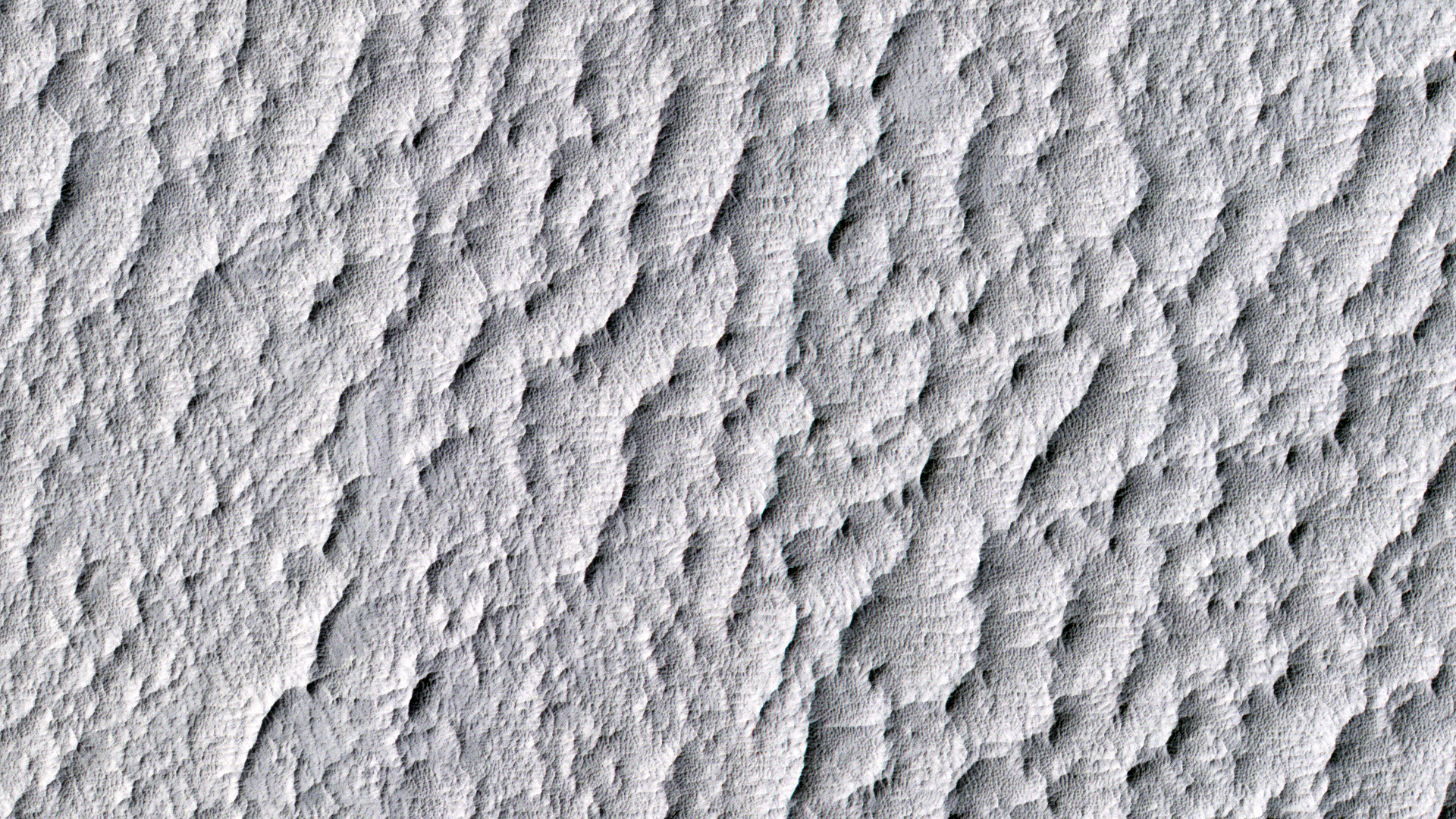
Alfred McEwen wrote:Western Edge of Marth Crater (ESP_042252_1930) (HiClip)
In the book “The Martian” by Andy Weir, stranded astronaut Mark Watney is headed for the Ares 4 landing site but encounters the rim of Marth Crater just as a dust storm arrives. This HiRISE image shows the nature of this terrain.
The crater rim is not very distinct and from the ground it would be quite difficult to tell that you are even on the rim of a crater. The terrain is hummocky and rolling, punctuated by smaller impact craters and wind-blown drifts of sand or dust.
This is a stereo pair with ESP_042753_1930.
Credit: NASA/JPL-Caltech/University of Arizona