In reference to the April 20th APOD picture, it would be very nice to know the SCALE of the structures shown. micrometers or kilometers ?
Thanks
Scale for Picture: Barchans on Mars (2009 April 20)
-
Bob Stothfang
- Asternaut
- Posts: 5
- Joined: Thu Nov 02, 2006 1:05 pm
- Location: Hamilton, Ohio
Re: Scale for Picture
I agree with the previous poster about a scale reference.
In addition, can someone (probably a geologist type) explain why the downwind slope forms an ≈32º angle as explained in the Wikipedia link for barchan dunes?
Thanks
In addition, can someone (probably a geologist type) explain why the downwind slope forms an ≈32º angle as explained in the Wikipedia link for barchan dunes?
Thanks
-
orin stepanek

- Plutopian
- Posts: 8200
- Joined: Wed Jul 27, 2005 3:41 pm
- Location: Nebraska
Re: Scale for Picture
http://apod.nasa.gov/apod/ap090420.html
The resolution is a half of a meter per pixel. I don't know how many pixels make up a page; but I'd say the dunes are quite large. 8)
I like the picture though. The Dunes make great art.
Orin
The resolution is a half of a meter per pixel. I don't know how many pixels make up a page; but I'd say the dunes are quite large. 8)
I like the picture though. The Dunes make great art.
Orin
Orin
Smile today; tomorrow's another day!
Smile today; tomorrow's another day!
-
neufer

- Vacationer at Tralfamadore
- Posts: 18805
- Joined: Mon Jan 21, 2008 1:57 pm
- Location: Alexandria, Virginia
Re: Scale for Picture
32º is the angle of repose for dry sand (independent of scale or gravitational strength!!!).Bob Stothfang wrote:can someone (probably a geologist type) explain why the downwind slope forms an ≈32º angle as explained in the Wikipedia link for barchan dunes?
------------------------------------------------------
------------------------------------------http://everything2.com/index.pl?node_id=1251318 wrote:
<<Angle of repose is the steepest angle which the surface of a mass of loose particulate matter makes with the ground. Angle of repose is affected by the size, mass, angularity, and dampness of the particles, and by the force of downward acceleration, but it is consistent for a given material. Knowing the angle of repose of a material in various circumstances is vital for engineers and landscapers, for example.
The way in which most people are familiar with angle of repose is sand castles. Dry sand generally has an angle of repose of about 30°, so piled dry sand forms shallow inverted cones. When sand is dampened, the surface tension of the water binds the grains together, and the angle of repose is increased to more than vertical, so that walls and towers and sea caves can be made. When sand is too wet, however, the water lubricates the grains instead of sticking them together, and the angle of repose is decreased to nearly 0. This should be required knowledge for anyone who is thinking of buying a house built on a sandbar.
Code: Select all
    .        .....
  .....      .....
.........    .....    ...............
Dry sand   Damp sand  Saturated sand
------------------------------------------http://www.nps.gov/archive/whsa/Sand%20Dune%20Geology.htm wrote:
<<According to Bagnold (1941), certain conditions must be met for flat sandy areas to build up into true dunes. The primary prerequisites are relatively strong winds and a fine-grained surface. Coarse sand grains and pebbles tend to stabilize a surface of sand by preventing light or moderate winds from moving the finer grain sand mixed in the coarser material. Bagnold has observed that large sand sheets (without dunes) are generally covered with coarse sand or small pebbles and are generally devoid of ripples. Only strong winds can remove the finer grains from amidst the coarse grains and carry them downwind where they can form dunes by self-accumulation. The rougher the surface of a source of sand (the more coarse material mixed with the finer sand) the stronger the winds needed for dune formation. Also, sandy areas with periodic wet-season rainfall may also be prevented from developing dunes by a light, intermittent vegetation.
Assuming a steady input of sand from an upwind source, any patch of sand that meets the above conditions and is four to six meters long can develop into a true dune. (A true dune generally refers to a self-accumulating mound of sand with a distinct slip-face, as opposed to an obstacle formed pile of sand, such as a sand shadow, which will not be discussed in this paper.) Saltation drag is a primary factor contributing to dune formation. Wind speeds are highest and saltation drag is least at the windward edge of a sandy patch. The further downwind on the sand, the greater the drag and the slower the winds, resulting in differential sand movement across the sandy surface. As the movement of grains slows toward the leeward side of the sandy area, accumulation of sand increases and sand begins to mound up on the leeward end (Bagnold, 1941).
As the sand mound grows, the point of maximum sand deposition on the leeward face moves closer to the summit, causing a steepening of the leeward face relative to the windward face. The steepening and growing dune now forces wind out over the top of the dune rather than down the leeward face. The saltating sand drops out at the crest and further steepens the leeward face until it reaches its angle of repose (about 32 to 34 degrees for dry sand), at which time gravity may pull sand from the crest down the leeward slope in the form of either isolated slow-flowing avalanches or the shearing and slumping of whole blocks of sand. This sand movement by slippage rather than by saltation or creep has earned the leeward face of an advancing dune the name of "slip-face" (Bagnold, 1941).
The slip-face is an effective sand trap. Bagnold's field observations on barchans showed that even in strong winds a near-perfect wind shadow exists along the slip-face. Any sand driven up the windward slope drops out as it hits the stagnant air above the slip face, resulting in renewed steepening of the slip-face near the crest of the dune until the angle of repose is once again reached. Thus, entire dunes slowly move downwind due to avalanching and slumping along the slip-face. The rate of dune advance is directly related to the rate of sand movement over the dune crest and inversely related to the height of the slip-face, i.e. as dunes grow in height their forward movement slows (Bagnold, 1941).
Bagnold felt that strong winds tended to build up dunes in terms of height, while gentler winds generally extend the length of the dunes at the expense of height. Cooke and Warren (1973, p. 271) explain this phenomenon as follows: "a wind capable of moving sand over a sandy surface could not move it over a pebbly surface, so that a sand patch would be eroded and extended downwind by such a wind. A stronger wind on the other hand might move more sand over pebbles, because of the better rebound from the harder surface...and the sand patch grows.">>

http://en.wikipedia.org/wiki/Angle_of_repose wrote:
<<The angle of repose (sometimes incorrectly confused with the 'angle of internal friction') is an engineering property of granular materials. The angle of repose is the maximum angle of a stable slope determined by friction, cohesion and the shapes of the particles.
When bulk granular materials are poured onto a horizontal surface, a conical pile will form. The internal angle between the surface of the pile and the horizontal surface is known as the angle of repose and is related to the density, surface area, and coefficient of friction of the material. Material with a low angle of repose forms flatter piles than material with a high angle of repose. In other words, the angle of repose is the angle a pile forms with the ground.
. Sand pit trap of the ant lion
The larva of the ant lion traps small insects such as ants by digging a conical pit in loose sand, such that the slope of the walls is very close to the angle of repose for the sand. Thus, when a small insect blunders into the pit, its weight causes the sand to collapse below it, drawing the ant toward the center where the ant lion larva lies in wait. The ant lion larva assists this process by vigorously flicking sand out from the center of the pit when it detects a disturbance, undermining the pit walls and causing them to collapse toward the center, bringing the prey with them.
Last edited by neufer on Wed Apr 22, 2009 1:36 pm, edited 1 time in total.
Art Neuendorffer
-
Bob Stothfang
- Asternaut
- Posts: 5
- Joined: Thu Nov 02, 2006 1:05 pm
- Location: Hamilton, Ohio
Re: Scale for Picture: Barchans on Mars (2009 April 20)
Thanks folks....
I knew there had to be a reason for the specific angle mentioned.
A lot of learning occurred for me in those replies.
The dry/damp/wet sand example really made sense to me.
I am off to do some more reading on the subject now that I know where to look.
I knew there had to be a reason for the specific angle mentioned.
A lot of learning occurred for me in those replies.
The dry/damp/wet sand example really made sense to me.
I am off to do some more reading on the subject now that I know where to look.
-
aristarchusinexile
- Commander
- Posts: 977
- Joined: Tue Jan 06, 2009 5:55 pm
- AKA: Sputnick
Re: Scale for Picture: Barchans on Mars (2009 April 20)
According to a regular APOD poster depths of three kilometres on Mars have been imaged by Ground Penetrating Radar, yet according to Wikipedia, http://en.wikipedia.org/wiki/Ground_penetrating_radar "Optimal depth penetration is achieved in ice where the depth of penetration can achieve several hundred meters. Good penetration is also achieved in dry sandy soils or massive dry materials such as granite, limestone, and concrete where the depth of penetration could be up to 15 m. In moist and/or clay-laden soils and soils with high electrical conductivity, penetration is sometimes only a few centimetres."
I propose that early hand drawn images of Mars showing canals may have been accurate, the canals filled in by blowing sand. The canals may have been dug as a 'last ditch' effort to save a civilization threatened by climate change, the remnants of that civilization now living underground, possibly accessed by the large 'rabbit holes' photographed by the orbiters. I also suggest we will find creatures living on the surface of Mars, and that a pair of those creatures situated side-by-side and looking directly at the lander, were actually photographed by the first lander, the creatures announced as 'boulders' in press releases.
I propose that early hand drawn images of Mars showing canals may have been accurate, the canals filled in by blowing sand. The canals may have been dug as a 'last ditch' effort to save a civilization threatened by climate change, the remnants of that civilization now living underground, possibly accessed by the large 'rabbit holes' photographed by the orbiters. I also suggest we will find creatures living on the surface of Mars, and that a pair of those creatures situated side-by-side and looking directly at the lander, were actually photographed by the first lander, the creatures announced as 'boulders' in press releases.
Duty done .. the rain will stop as promised with the rainbow.
"Abandon the Consensus for Individual Thought"
"Abandon the Consensus for Individual Thought"

Re: Scale for Picture: Barchans on Mars (2009 April 20)
I would like to see that imagearistarchusinexile wrote:According to a regular APOD poster depths of three kilometres on Mars have been imaged by Ground Penetrating Radar, yet according to Wikipedia, http://en.wikipedia.org/wiki/Ground_penetrating_radar "Optimal depth penetration is achieved in ice where the depth of penetration can achieve several hundred meters. Good penetration is also achieved in dry sandy soils or massive dry materials such as granite, limestone, and concrete where the depth of penetration could be up to 15 m. In moist and/or clay-laden soils and soils with high electrical conductivity, penetration is sometimes only a few centimetres."
I propose that early hand drawn images of Mars showing canals may have been accurate, the canals filled in by blowing sand. The canals may have been dug as a 'last ditch' effort to save a civilization threatened by climate change, the remnants of that civilization now living underground, possibly accessed by the large 'rabbit holes' photographed by the orbiters. I also suggest we will find creatures living on the surface of Mars, and that a pair of those creatures situated side-by-side and looking directly at the lander, were actually photographed by the first lander, the creatures announced as 'boulders' in press releases.
-
aristarchusinexile
- Commander
- Posts: 977
- Joined: Tue Jan 06, 2009 5:55 pm
- AKA: Sputnick
Re: Scale for Picture: Barchans on Mars (2009 April 20)
I would love to see it again, BMA. It was so remarkable I can remember it clearly.BMAONE23 wrote:
I would like to see that image
Duty done .. the rain will stop as promised with the rainbow.
"Abandon the Consensus for Individual Thought"
"Abandon the Consensus for Individual Thought"
-
spaceLance
- Asternaut
- Posts: 1
- Joined: Mon Apr 20, 2009 8:12 pm
Re: Scale for Picture: Barchans on Mars (2009 April 20)
Dudes. That looks like some blatant photoshoppery going on there. Am I missing something?

Re: Scale for Picture: Barchans on Mars (2009 April 20)
Must be! Suggest you go to HIRISE Barchans!spaceLance wrote:Am I missing something?
Re: Scale for Picture: Barchans on Mars (2009 April 20)
Here is an image from the Mars Express website indicating the radar imaging MARSIS is capable of penetrating over 3.7Kmaristarchusinexile wrote:According to a regular APOD poster depths of three kilometres on Mars have been imaged by Ground Penetrating Radar, yet according to Wikipedia, http://en.wikipedia.org/wiki/Ground_penetrating_radar "Optimal depth penetration is achieved in ice where the depth of penetration can achieve several hundred meters. Good penetration is also achieved in dry sandy soils or massive dry materials such as granite, limestone, and concrete where the depth of penetration could be up to 15 m. In moist and/or clay-laden soils and soils with high electrical conductivity, penetration is sometimes only a few centimetres."
I propose that early hand drawn images of Mars showing canals may have been accurate, the canals filled in by blowing sand. The canals may have been dug as a 'last ditch' effort to save a civilization threatened by climate change, the remnants of that civilization now living underground, possibly accessed by the large 'rabbit holes' photographed by the orbiters. I also suggest we will find creatures living on the surface of Mars, and that a pair of those creatures situated side-by-side and looking directly at the lander, were actually photographed by the first lander, the creatures announced as 'boulders' in press releases.
-
JohnD

- Tea Time, Guv! Cheerio!
- Posts: 1580
- Joined: Wed Feb 16, 2005 2:11 pm
- Location: Lancaster, England
Re: Scale for Picture: Barchans on Mars (2009 April 20)
See a bigger picture, with scales, on the HiRise site: http://hirise.lpl.arizona.edu/PSP_007676_1385
-
neufer
- Vacationer at Tralfamadore
- Posts: 18805
- Joined: Mon Jan 21, 2008 1:57 pm
- Location: Alexandria, Virginia
Re: Scale for Picture: Barchans on Mars (2009 April 20)
aristarchusinexile wrote:I propose that early hand drawn images of Mars showing canals may have been accurate, the canals filled in by blowing sand. The canals may have been dug as a 'last ditch' effort to save a civilization threatened by climate change, the remnants of that civilization now living underground, possibly accessed by the large 'rabbit holes' photographed by the orbiters. I also suggest we will find creatures living on the surface of Mars, and that a pair of those creatures situated side-by-side and looking directly at the lander, were actually photographed by the first lander, the creatures announced as 'boulders' in press releases.
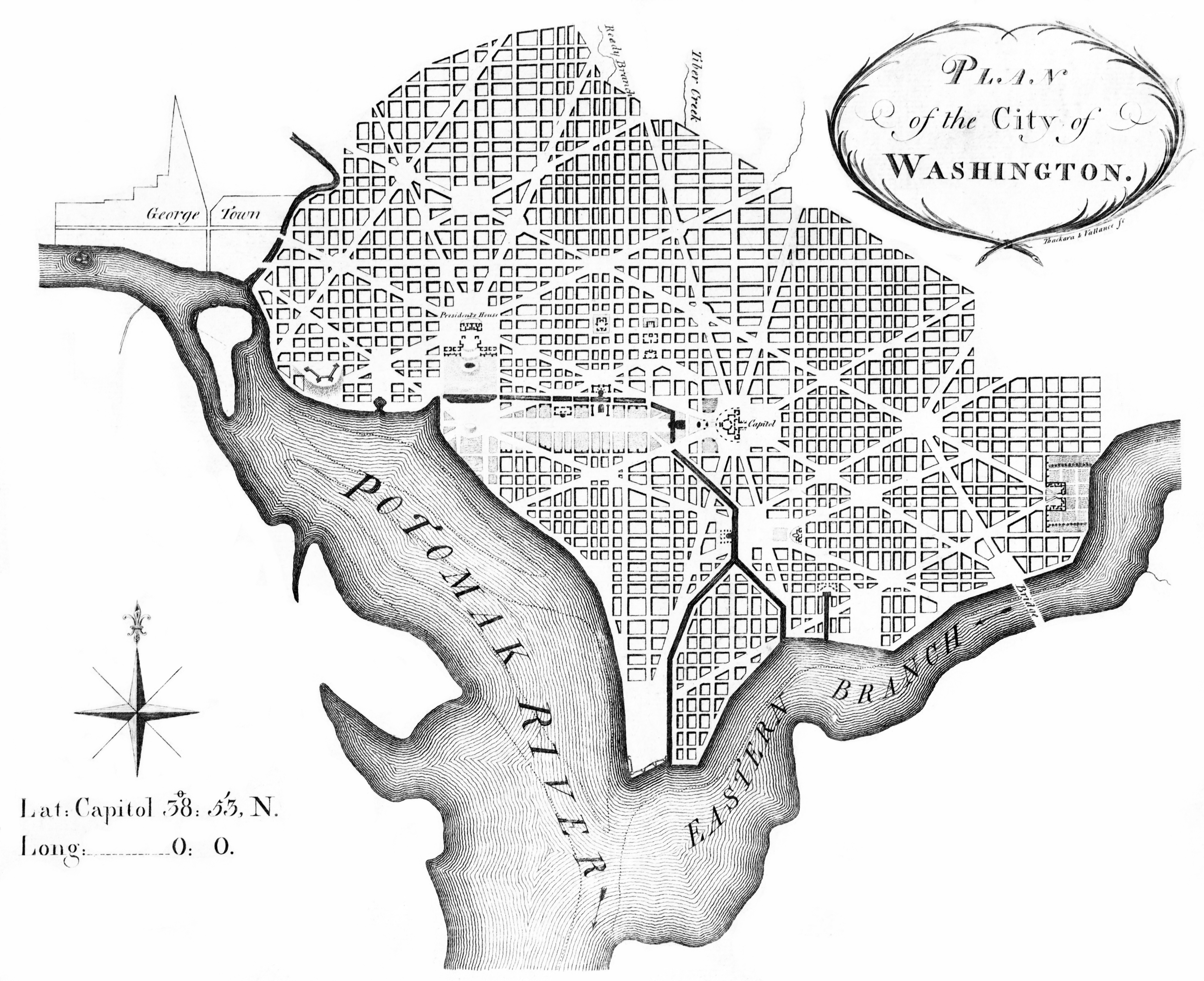
Is the methane observed on Mars Martian B&O?http://en.wikipedia.org/wiki/Constitution_Avenue wrote:
<<In Washington, D.C., Constitution Avenue is a major east-west street running just north of the United States Capitol in the city's Northwest and Northeast quadrants. The avenue carries heavy commuter traffic on weekdays and heavy tourist traffic on the weekends; it is also an important parade route. The segment of Constitution Avenue west of Pennsylvania Avenue was once the Washington Canal. Construction on the canal, which was part of Pierre L'Enfant's original plan for the city, began in 1810.
Tiber Creek was transformed into the Washington Canal, which ran along what is today Constitution Avenue, eventually working its way towards the U.S. Capitol. It is believed that early city plans called for an extensive network of canals snaking through the Northeast corridor of the United States. In 1872, the canal was converted to an underground tunnel; it had become common for Washington residents to throw their garbage into it, and the unsanitary conditions became a health concern. Additionally, plans for an extensive canal system were abandoned around this time in favor of a railroad system that would connect Washington to the West. These canal plans were not successful; after completion of the B&O Railroad, city officials abandoned their plans for a rail system. The canal was converted to a tunnel and paved over.>>
Art Neuendorffer
-
JohnD
- Tea Time, Guv! Cheerio!
- Posts: 1580
- Joined: Wed Feb 16, 2005 2:11 pm
- Location: Lancaster, England
Re: Scale for Picture: Barchans on Mars (2009 April 20)
Rather than counter your proposal with pictures of nineteenth century Washington street plans, may I suggest that you search the 'net for the very many photographs, to a resolution of half a metre, that are available? For instance look at the HiRise website, which contains 9432 images at present.aristarchusinexile wrote:I propose that early hand drawn images of Mars showing canals may have been accurate, the canals filled in by blowing sand. The canals may have been dug as a 'last ditch' effort to save a civilization threatened by climate change, the remnants of that civilization now living underground, possibly accessed by the large 'rabbit holes' photographed by the orbiters. I also suggest we will find creatures living on the surface of Mars, and that a pair of those creatures situated side-by-side and looking directly at the lander, were actually photographed by the first lander, the creatures announced as 'boulders' in press releases.
If you can find anything - anything! - that can be interpreted as the buried remains of an artificial canal, then you will be short listed for a Nobel. But you won't.
John
PS just to make it easy for you: http://hirise.lpl.arizona.edu/
-
neufer
- Vacationer at Tralfamadore
- Posts: 18805
- Joined: Mon Jan 21, 2008 1:57 pm
- Location: Alexandria, Virginia
Canal Knowledge
http://antwrp.gsfc.nasa.gov/apod/ap030411.htmlJohnD wrote:Rather than counter your proposal with pictures of nineteenth century Washington street plans,
http://hirise.lpl.arizona.edu/PSP_003443_0980
JohnD wrote:may I suggest that you search the 'net for the very many photographs, to a resolution of half a metre, that are available? For instance look at the HiRise website, which contains 9432 images at present. If you can find anything - anything! - that can be interpreted as the buried remains of an artificial canal, then you will be short listed for a Nobel. But you won't.
PS just to make it easy for you: http://hirise.lpl.arizona.edu/

http://hirise.lpl.arizona.edu/PSP_008311_1835
http://hirise.lpl.arizona.edu/PSP_005720_1885
http://hirise.lpl.arizona.edu/PSP_007055_1450
http://hirise.lpl.arizona.edu/PSP_007925_1990
http://hirise.lpl.arizona.edu/PSP_004992_1635
Art Neuendorffer
-
aristarchusinexile
- Commander
- Posts: 977
- Joined: Tue Jan 06, 2009 5:55 pm
- AKA: Sputnick
Re: Scale for Picture: Barchans on Mars (2009 April 20)
I said they were burried, didn't I!?JohnD wrote: Rather than counter your proposal with pictures of nineteenth century Washington street plans, may I suggest that you search the 'net for the very many photographs, to a resolution of half a metre, that are available? For instance look at the HiRise website, which contains 9432 images at present.
If you can find anything - anything! - that can be interpreted as the buried remains of an artificial canal, then you will be short listed for a Nobel. But you won't.
John
PS just to make it easy for you: http://hirise.lpl.arizona.edu/
!?!?!?!?!?!????!??!!?!??
!?!?!?!?!?!!??!!?!?!?
!?!?!?!?!?!?!?
!?!?!?!
?!!?
?
The !?s were supposed to be an inverted period, but the danged calmpooper is rearranging the lines.
Last edited by aristarchusinexile on Tue Apr 21, 2009 2:50 pm, edited 3 times in total.
Duty done .. the rain will stop as promised with the rainbow.
"Abandon the Consensus for Individual Thought"
"Abandon the Consensus for Individual Thought"
-
aristarchusinexile
- Commander
- Posts: 977
- Joined: Tue Jan 06, 2009 5:55 pm
- AKA: Sputnick
Re: Scale for Picture: Barchans on Mars (2009 April 20)
B&O or B.O.?neufer wrote: Is the methane observed on Mars Martian B&O?
Duty done .. the rain will stop as promised with the rainbow.
"Abandon the Consensus for Individual Thought"
"Abandon the Consensus for Individual Thought"
-
aristarchusinexile
- Commander
- Posts: 977
- Joined: Tue Jan 06, 2009 5:55 pm
- AKA: Sputnick
Re: Scale for Picture: Barchans on Mars (2009 April 20)
The Wiki article said GPR pentrates ice easily, but not sand. Your images are of the south polar ice, BMA. Still, I'm surprised Wiki is so far wrong. Perhaps someone with scientific credentials should correct the entry.BMAONE23 wrote:
Here is an image from the Mars Express website indicating the radar imaging MARSIS is capable of penetrating over 3.7Km
Duty done .. the rain will stop as promised with the rainbow.
"Abandon the Consensus for Individual Thought"
"Abandon the Consensus for Individual Thought"
-
neufer
- Vacationer at Tralfamadore
- Posts: 18805
- Joined: Mon Jan 21, 2008 1:57 pm
- Location: Alexandria, Virginia
Re: Scale for Picture: Barchans on Mars (2009 April 20)
BO Obama.aristarchusinexile wrote:B&O or B.O.?neufer wrote: Is the methane observed on Mars Martian B&O?
Art Neuendorffer
-
aristarchusinexile
- Commander
- Posts: 977
- Joined: Tue Jan 06, 2009 5:55 pm
- AKA: Sputnick
Re: Scale for Picture: Barchans on Mars (2009 April 20)
Is that a FO or an Ag'inst.neufer wrote:BO Obama.aristarchusinexile wrote:B&O or B.O.?neufer wrote: Is the methane observed on Mars Martian B&O?
Duty done .. the rain will stop as promised with the rainbow.
"Abandon the Consensus for Individual Thought"
"Abandon the Consensus for Individual Thought"
Re: Scale for Picture: Barchans on Mars (2009 April 20)
But...If there were canals there (as indicated in the sketch from 100+ years ago) the sand filling them wouldn't be thick enough to fill them completely and they would still be visible. Further, the sand filling them after 100 years would't be hardened enough to block radar signals. Then there is the fact that for these fetures to have been visible to the extent indicated in the old map, they would need to have been impressively large and deep. To have been visible from Earth, they would easily need to be deeper and wider than the "Eagle Crater" where Opportunity landed which if they were filled in by sand, that crater also would have been filled in. If eagle crater still exists (unfilled) then a global canal system should be easily discernable. Therefore, It doesn't exist (yet)aristarchusinexile wrote:The Wiki article said GPR pentrates ice easily, but not sand. Your images are of the south polar ice, BMA. Still, I'm surprised Wiki is so far wrong. Perhaps someone with scientific credentials should correct the entry.BMAONE23 wrote:
Here is an image from the Mars Express website indicating the radar imaging MARSIS is capable of penetrating over 3.7Km
-
JohnD
- Tea Time, Guv! Cheerio!
- Posts: 1580
- Joined: Wed Feb 16, 2005 2:11 pm
- Location: Lancaster, England
Re: Scale for Picture: Barchans on Mars (2009 April 20)
But aris, buried doesn't mean invisible, especially from on high. On Earth, "field markings" have been a well used tool of archaeology since planes began to fly. Invisble from ground level, such markings may be obvious from above, especially if there are crops in the ground (not on Mars!) or if the sun is rising or setting, so that the light glances across the ground at an extreme angle, casting long shadows. Search for "Aerial Archaeology" for many examples.I said they were burried, didn't I!?
!?!?!?!?!?!????!??!!?!??
!?!?!?!?!?!!??!!?!?!?
!?!?!?!?!?!?!?
!?!?!?!
?!!?
?
The !?s were supposed to be an inverted period, but the danged calmpooper is rearranging the lines.
So, again, I challenge you to substantiate your thesis, that the Martian canals were real, and that they are now full of sand.
This is supposed to be a scientific website, where theories are based on evidence, not imagination.
Wierdly, in searching for an example, I came across: http://airminded.org/2009/03/15/the-can ... mars-1962/
Even in 1962, NASA was preparing copies of Mars maps showing the Schiaperelli/Lowell canals to help with the first Mariner missions - they had nothing better to go on!
John
Re: Scale for Picture: Barchans on Mars (2009 April 20)
Perhaps it would be found in the early Spirit Rover Imagesaristarchusinexile wrote:I would love to see it again, BMA. It was so remarkable I can remember it clearly.BMAONE23 wrote: (re: the rocks that resembled creatures)
I would like to see that image
Or was it in the early Opportunity Images
Or perhaps it was from the Pathfinder Mission
Re: Scale for Picture: Barchans on Mars (2009 April 20)
Thanks APOD for another truly great photo of Mars and its incredible landscape !!!!!
As I often complain about the description's assumptions of what we are seeing, I unconditionally love the photos !!!!!
Congratulations on finding a great photo!
I would venture an estimate that the dunes are 100-200 meters long and 20-30 meters high, the individual Barchan dunes that is.
They tell us what is happening on the surface of Mars, but can we correctly interpret what we are seeing?
This would sure make a nice wall photo in a 4'x5' size !
-
Chris Peterson

- Abominable Snowman
- Posts: 18185
- Joined: Wed Jan 31, 2007 11:13 pm
- Location: Guffey, Colorado, USA
- Contact:
Re: Scale for Picture: Barchans on Mars (2009 April 20)
All good points, and there are more. Keep in mind that the first images showing canali were made only a bit over a century ago. And the first good photographs showing the surface (with no canali) were made within a few decades of that. Is it really reasonable that all these structures were completely covered with sand in such a short time? We've been looking at Mars in exquisite detail for about 50 years, and we've never seen a global sandstorm cover anything. We've never even seen a local sandstorm cover anything. Winds on Mars just shift the sand around a little. All of our landers have found exposed surface dating back billions of years. Hard to see how that could be possible if sand had completely covered every remnant of "canals" in just a few decades.BMAONE23 wrote:But...If there were canals there (as indicated in the sketch from 100+ years ago) the sand filling them wouldn't be thick enough to fill them completely and they would still be visible. Further, the sand filling them after 100 years would't be hardened enough to block radar signals. Then there is the fact that for these fetures to have been visible to the extent indicated in the old map, they would need to have been impressively large and deep. To have been visible from Earth, they would easily need to be deeper and wider than the "Eagle Crater" where Opportunity landed which if they were filled in by sand, that crater also would have been filled in. If eagle crater still exists (unfilled) then a global canal system should be easily discernable. Therefore, It doesn't exist (yet)
There was an interesting article in Sky & Telescope a few years ago about the canali. It made a strong case that Schiaparelli (and others) were simply seeing the pattern of blood vessels on their retinas superimposed on the planet. I can easily see that effect on the Moon and on a highly magnified Jupiter (but I haven't tried on Mars).
Chris
*****************************************
Chris L Peterson
Cloudbait Observatory
https://www.cloudbait.com
*****************************************
Chris L Peterson
Cloudbait Observatory
https://www.cloudbait.com