HiRISE Updates (2014 Feb 26)
Posted: Thu Feb 27, 2014 8:24 pm
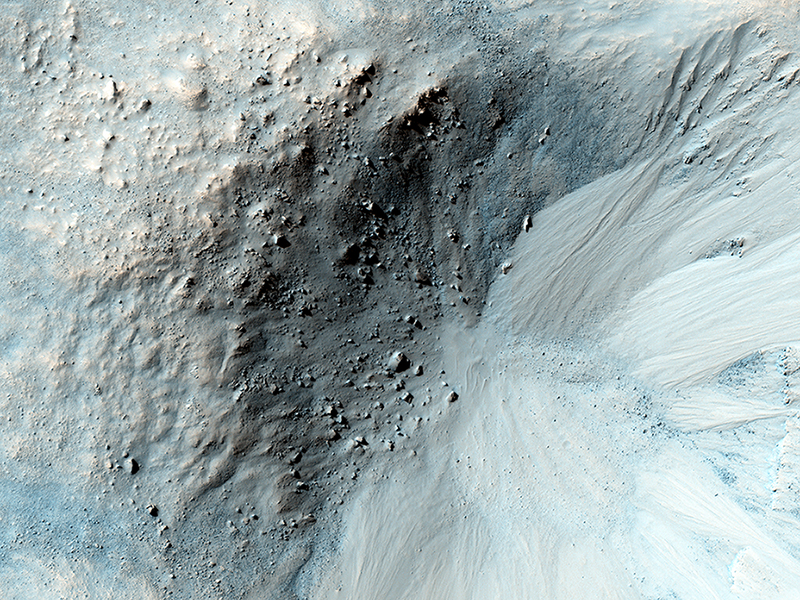
Alfred McEwen and Colin Dundas wrote:Equatorial Gullies (ESP_034864_1825) (HiClip)
Gully-like landforms, or ravines, are most common in the middle latitudes of Mars, but also occur in polar and equatorial latitudes.
We see here an impact crater about 900 meters wide, with distinct gullies on all inner slopes except in the northwest sector of the crater. The crater formed on the side of an ancient channel, so the northwestern section slumped into the channel, so the slopes are not as steep.
This region of Mars is called Libya Montes, near the equator on the south edge of the Isidis impact basin. These are typical gullies with alcoves at the top, channels, and depositional fans at the bottom, but the alcoves are relatively small compared with many other mid-latitude gullies. HiRISE has shown that gullies are actively forming today in the southern mid-latitudes, aided by the seasonal deposition of carbon dioxide frost or dry ice.
The equatorial gullies here appear pristine at the scale of HiRISE, with no superimposed craters or windblown deposits, so the gullies formed in the recent past and could still be forming today. Here in the Martian tropics, it is too warm for dry ice to help fluidize the movement of debris, but the slopes are probably steep enough for dry mass wasting to move dry particles, perhaps aided by water in the crust to reduce friction.
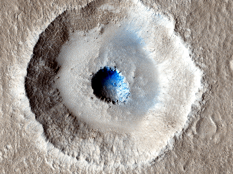
Shane Byrne wrote:Craters in an Icy Surface (ESP_035189_2240) (HiClip)
Small impact craters usually have simple bowl shapes, but sometimes more complicated shapes can occur if the target is unusual. The crater in the center of this HiRISE image is unusual because there is a wide, flat bench, or terrace, between the outer rim and the inner section, making it appear somewhat like a bullseye.
Crater shapes like this can occur if material underground changes from weak to strong. In these cases, the level of the terrace shows where this change occurs. In the area covered by this observation, we have other reasons to suspect that the upper material is mostly ice.
Terraced craters like this one show us how thick this ice is, as the terrace formation shows us where the ice meets the underlying rock.
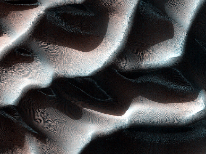
Veronica Bray wrote:Frost in Dune Shadows (ESP_034922_1385) (HiClip)
This Southern autumn image captures a view of frosty dunes. The sunlight is shining on the dunes from the upper right.
The low sun angle creates large shadows from these dunes, making for a dramatic picture. Frost is visible in the shadows of the dunes that appear as lighter or bluer swirls in each shadow. Along the illuminated section of the dunes, in the center-right of the image, five dark thin dust devil tracks are snaking their way along, parallel to the dune ridge. (North is to the left in this image, the image height covers 1.2 kilometers of the Martian surface.)
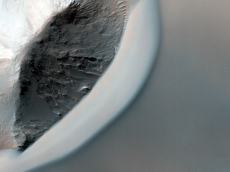
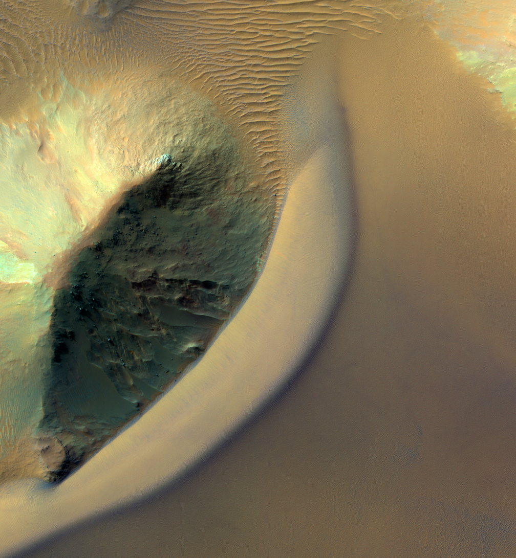
Alfred McEwen wrote:Dunes Streaming through Hills (ESP_034948_1720) (HiClip)
This dramatic image show dark rippled bodies of sand, sometimes in the form of dunes, streaming through Ganges Chasma. The floor of the canyon is covered by hills and mesas, perhaps remnants of chaotic terrain that formed from sudden collapse as water was withdrawn to form outflow channels.
The sand moving through (generally from east to west, or upstream) interacts with the topography to make streamlined shapes. A closeup image in enhanced-color shows one hill with a dune piling up to the east.
This is a stereo pair with ESP_033748_1720.
Credit: NASA/JPL/University of Arizona
<< Previous HiRISE Update