
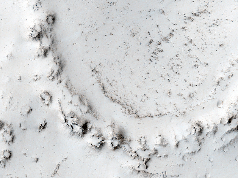
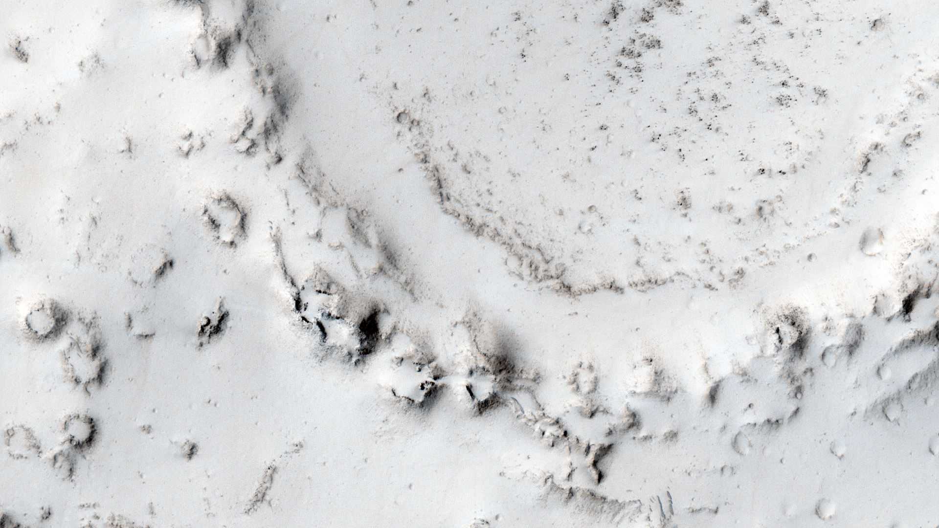
HiRISE Science Team wrote:Ring of Cratered Cones (ESP_035098_2065) (HiClip)
In the center of this observation, we see a ring of cones that have developed over a crater rim. Lava appears to have deflated around and within the ring.
Interestingly, the area around the ring has few cones: did water or steam flow to the crater and make that zone less fertile? These cones are likely "rootless cones," so named because they do not form as a result of direct magma supply, but from the interaction of lava and water or ice in the substrate. The rootless cones in this image may have formed around the crater rim because the lava was thin there.
This is a stereo pair with ESP_034808_2065.
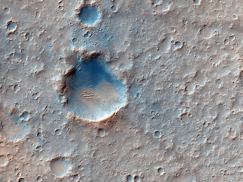
HiRISE Science Team wrote:Mission 2020: A Candidate Landing Site in Gusev Crater (ESP_035164_1655) (HiClip)
As we did for Phoenix in 2008 and the Mars Science Laboratory in 2012, HiRISE has been imaging landing sites for a potential rover mission in 2020.
With HiRISE resolution, mission teams can examine what areas of Mars are flat enough to touchdown safely and also investigate the terrain to satisfy scientific research goals. Gusev Crater, a massive and ancient impact crater, was also the landing site for the rover Spirit in January 2004.
With this image, the science rationale was to investigate nearby opaline silica, carbonates and other aqueous phases.
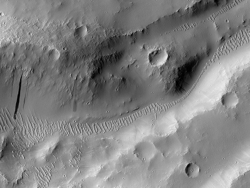
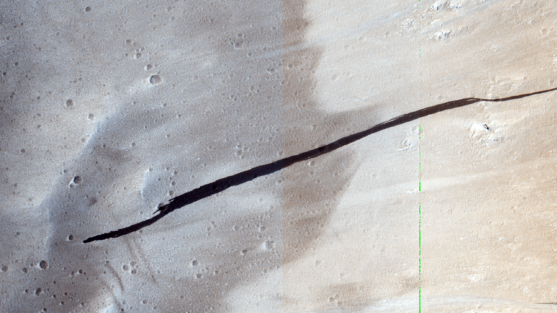
HiRISE Science Team wrote:An Irregular Crater Intersecting Graben in Tractus Albus (ESP_035226_2090) (HiClip)
This crater, of which only a small portion is visible in the full HiRISE image, is very irregularly shaped and might suggest that some underlying liquid was present that made it so elongated after the initial impact.
Another reason for the crater’s shape might be that it was caused by a binary asteroid pair or a meteorite that broke into multiple fragments just before hitting the ground leading to the formation of a number of superimposed craters that produced this odd-shaped depression. Such craters have been previously observed by HiRISE (PSP_009619_1630)
The crater itself intersects a graben, which is a depressed stretch of land typically bordered by parallel faults. Note the dark streak on the crater’s eastern wall.
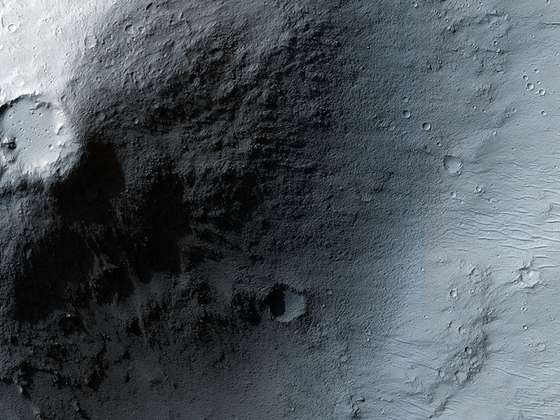
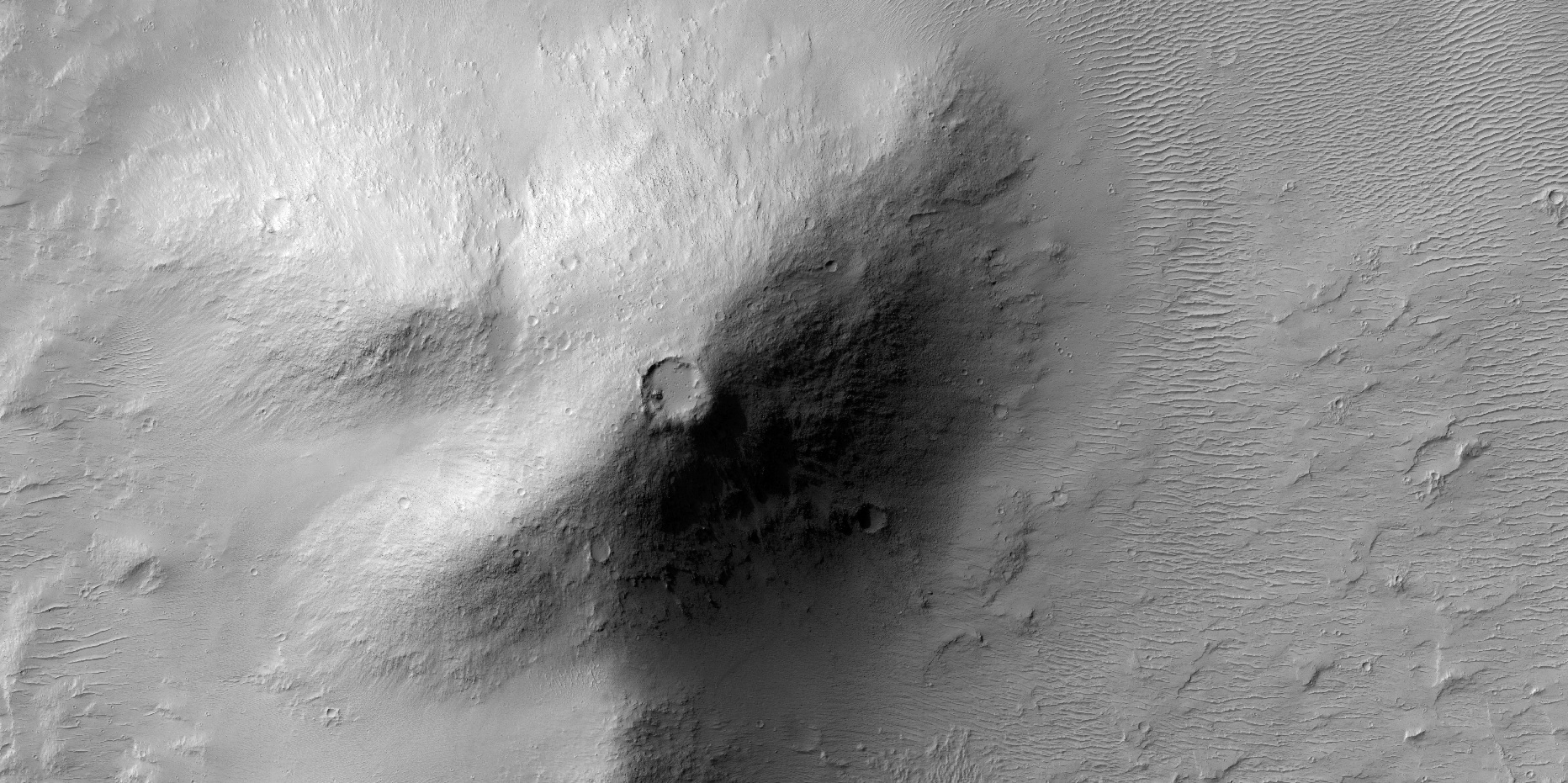
Ramy El-Maarry wrote:An Elevated Crater in the Apollinaris Mons Region: Volcanic or Impact-Related? (ESP_035863_1710) (HiClip)
Impact craters are very common on the surface of Mars. However, when a circular depression is visible on the summit of a mound or an elevated landform in general, careful analysis is needed to identify whether the crater is created by an impact or by volcanic activity.
This issue becomes even more problematic when the crater is located in a area known for its volcanic history such as the Apollinaris region where this image was taken and is very close to the prominent volcano Apollinaris Mons.
In fact, this classical problem has been encountered before here on Earth in the case of the famous Meteor Crater in Arizona just outside of the city of Flagstaff. Back in the late 19th century, many people believed that Meteor Crater was a volcanic crater because of its proximity to the San Francisco volcanic field and the rarity of impact craters on Earth.
Meteor Crater remained controversial until the 1960s when scientists were finally able to confirm that the crater was indeed an impact crater by identifying minerals in the crater site that can only form in extremely high pressures, which are usually associated with violent impact events.
In the absence of such “ground truth” or lab analysis, how can planetary scientists differentiate between impact and volcanic craters? There are a number of ways. For example, impact craters usually exhibit raised rims and distinctive ejecta patterns around the crater, formed by materials ejected during the impact event. Large craters (more than 7 kilometers-wide in general for Mars) exhibit central peaks that form due the rebound of the ground right after impact. All these features are not usually observed in volcanic craters. In this observation, none of these features is visible. Nonetheless, this region is old and heavily dusted so all the above-mentioned features may have been eroded away or are covered by other materials.
However, we can see in this image that the crater is on the summit of a mountain- or hill-like elevated land form. In addition, some of the materials at the base of this elevated land form exhibit a rough texture that may resemble volcanic flows. If we add to that that the region is within a volcanic area, it becomes highly likely that this crater in particular is, in fact a volcanic crater.
Credit: NASA/JPL/University of Arizona
<< Previous HiRISE Update