
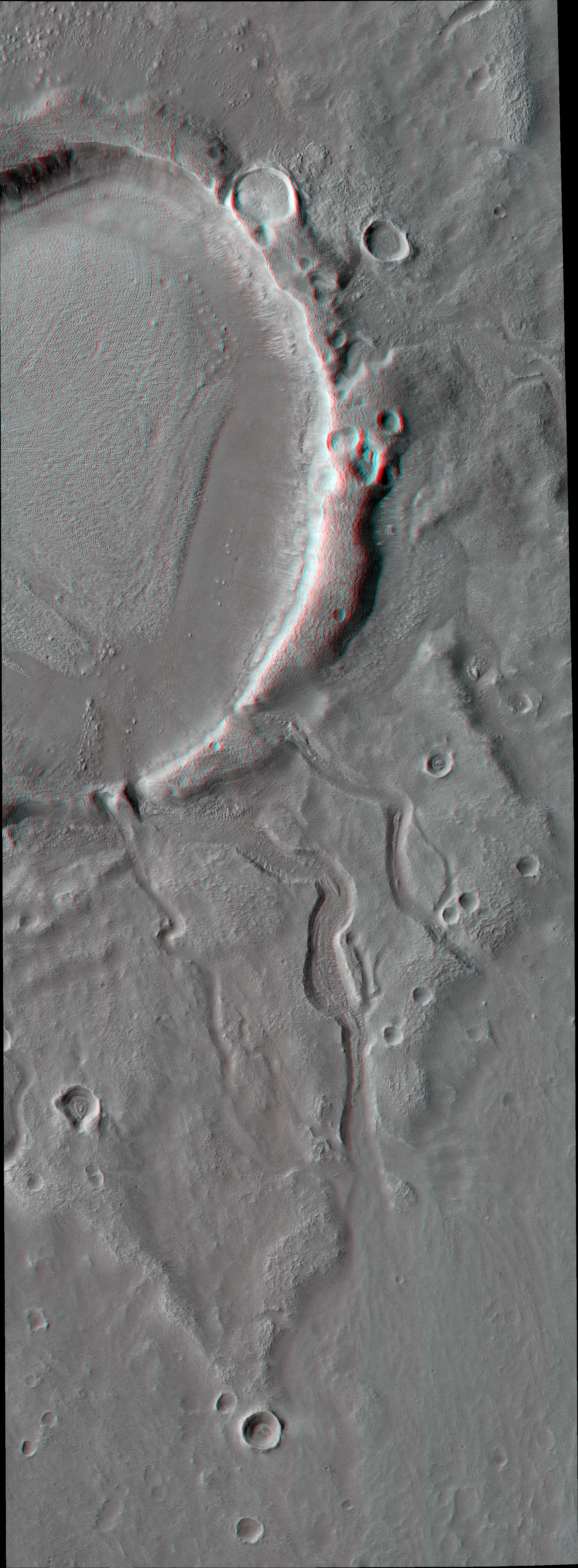
Alfred McEwen wrote:Three Channels Exiting a Crater Lake (ESP_053670_2180) (HiClip)
This image shows a roundish crater with three channels breaching the rim and extending to the south. The crater has been filled by sediments and may have been an ancient lake.
When the water began to overtop the crater rim, it would rapidly erode a channel and, at least, partially drain the lake.
Be sure to look at the stereo anaglyph.
This is a stereo pair with ESP_053736_2180.
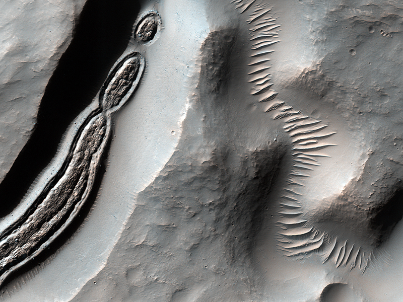
Colin Dundas wrote:Gullies of Matara Crater (ESP_054026_1300) (HiClip)
Gullies on Martian sand dunes, like these in Matara Crater, have been very active, with many flows in the last ten years. The flows typically occur when seasonal frost is present.
Here, we see frost in and around two gullies, which have both been active before. (View this observation to see what these gullies looked like in 2010.) There are no fresh flows so far this year, but HiRISE will keep watching!

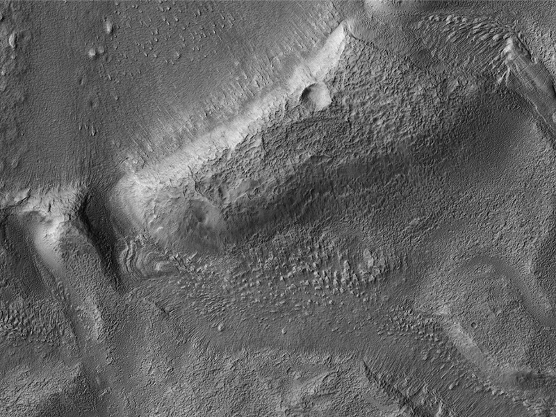
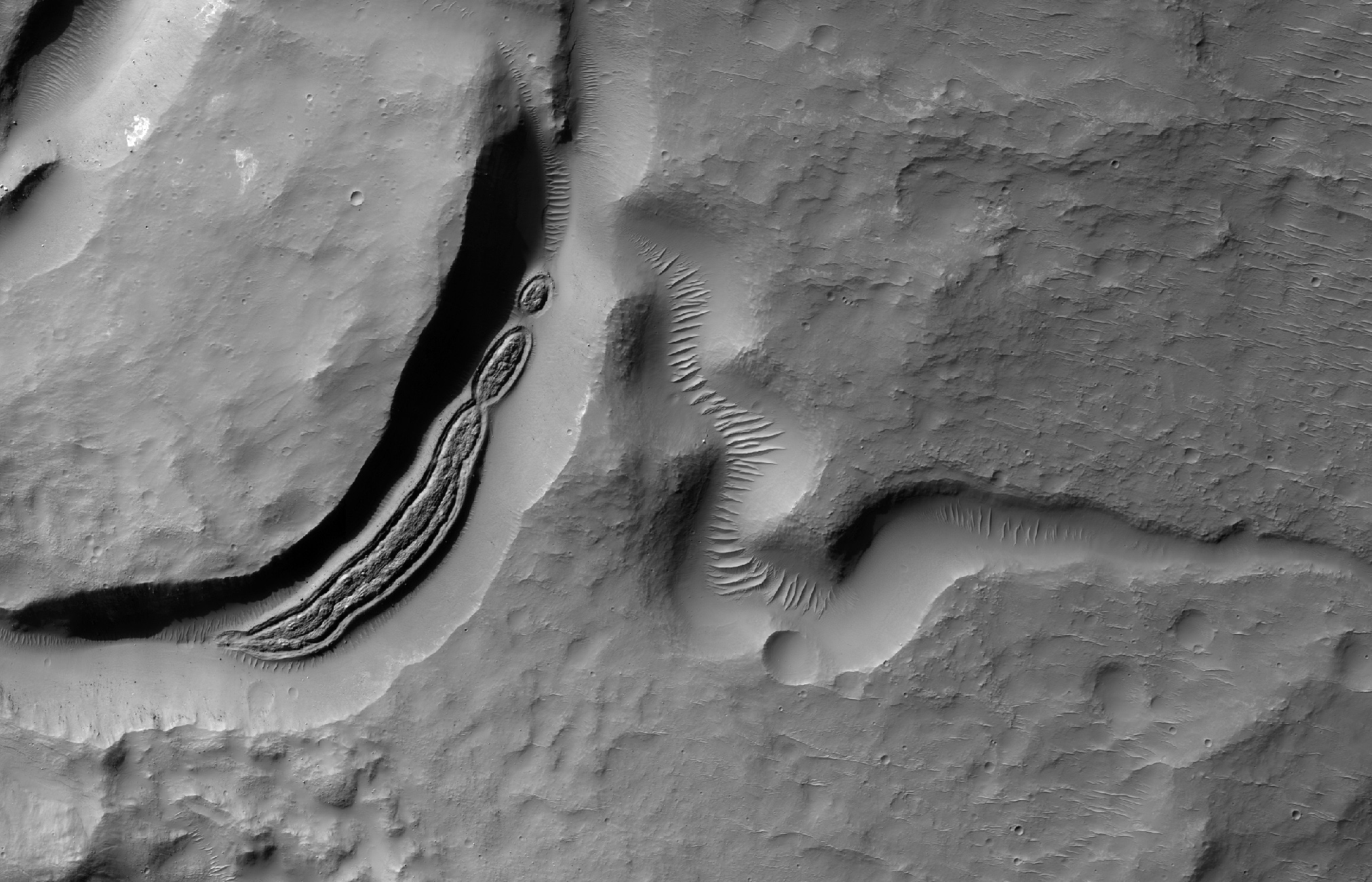
Alfred McEwen wrote:Formations in Context (Or, What is It?) (ESP_053734_1515) (HiClip)
Some HiRISE images show strange-looking formations. Sometimes it helps to look at Context Camera images to understand the circumstances of a scene—like this cutout from CTX 033783_1509—which here shows an impact crater with a central peak, and a collapse depression with concentric troughs just north of that peak. Our HiRISE picture is a close-up of one of those troughs, along with channels draining into the depression.
On the floor of the trough is some grooved material that we typically see in middle latitude regions where there has been glacial flow. These depressions with concentric troughs exist elsewhere on Mars, and their origins remain a matter of debate.
NB: The Context Camera is another instrument onboard MRO, and it has a larger viewing angle than HiRISE, but less resolution capability than our camera.
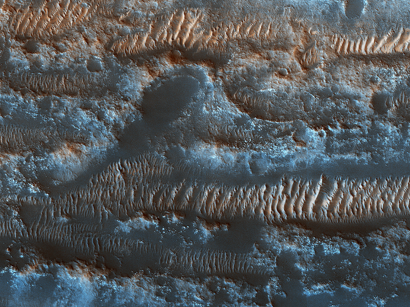
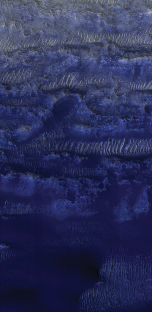
Serina Diniega wrote:The Moving Sands of Lobo Vallis (ESP_022250_2065) (HiClip)
Bright ripples line the topography in this region, formed within a past climate. Dark dunes and sand streaks (composed of basaltic sand) have moved and filled lower areas, pushed by more recent winds from the top towards the bottom of this image.
Lobo Vallis is named for a river on the Ivory Coast.
Credit: NASA/JPL-Caltech/University of Arizona
<< Previous HiRISE Update