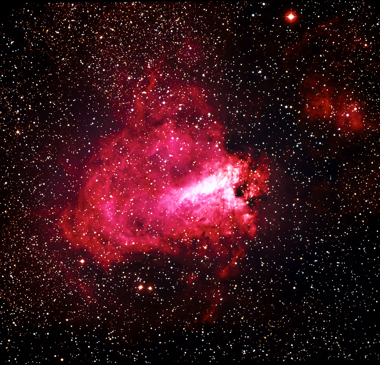
Explanation: Does the road to our galaxy's center go through Monument Valley? It doesn't have to, but if your road does -- take a picture. In this case, the road is US Route 163 and iconic buttes on the Navajo National Reservation populate the horizon. The band of Milky Way Galaxy stretches down from the sky and appears to be a continuation of the road on Earth. Filaments of dust darken the Milky Way, in contrast to billions of bright stars and several colorful glowing gas clouds including the Lagoon and Trifid nebulas. The featured picture is a composite of images taken with the same camera and from the same location -- Forest Gump Point in Utah, USA. The foreground was taken just after sunset in early September during the blue hour, while the background is a mosaic of four exposures captured a few hours later.
Re: APOD: Road to the Galactic Center (2021 Oct 25)
Posted: Mon Oct 25, 2021 11:13 am
by heehaw
We're in our car, guys, and we're headed down 163, straight for the Galactic Center!
Re: APOD: Road to the Galactic Center (2021 Oct 25)
Posted: Mon Oct 25, 2021 1:19 pm
by orin stepanek
Highway 163 to Galactic Center
imagem_ht_07-04-23.jpg (10.26 KiB) Viewed 3534 times
Extension?
Hope they have a lot of gas stations along the way!
It really is a beautiful photo; very stunning!
3.[2]1416 = 3 years, [2 months], 14 days & 16 hours
Posted: Mon Oct 25, 2021 2:20 pm
by neufer
Click to play embedded YouTube video.
Click to play embedded YouTube video.
Click to play embedded YouTube video.
Re: APOD: Road to the Galactic Center (2021 Oct 25)
Posted: Mon Oct 25, 2021 7:34 pm
by johnnydeep
Thanks, Ann! Only one thing would make your annotations better: adding the text to the image, or as here, alongside, to minimize the scrolling otherwise needed to correlate things:
Route 163 and The Milky Way, with Ann's Annotations alongside
Re: APOD: Road to the Galactic Center (2021 Oct 25)
Posted: Mon Oct 25, 2021 10:25 pm
by Joe Stieber
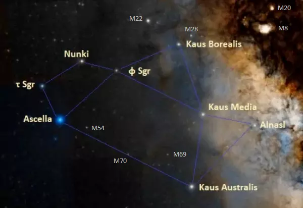
Here's my labeled version. A couple of changes from Ann's labeling. Nunki is not in the picture, #9 is actually Phi Sgr and #10, labeled Kaus Australis, is actually Kaus Media (Kaus Australis was unlabeled). Kaus Borealis (north), Media (middle) and Australis (south) comprise the centaur archer's bow.
Re: APOD: Road to the Galactic Center (2021 Oct 25)
Posted: Tue Oct 26, 2021 1:50 am
by neufer
Joe Stieber wrote: ↑Mon Oct 25, 2021 10:25 pm
A couple of changes from Ann's labeling. Nunki is not in the picture, #9 is actually Phi Sgr and #10, labeled Kaus Australis, is actually Kaus Media (Kaus Australis was unlabeled). Kaus Borealis (north), Media (middle) and Australis (south) comprise the centaur archer's bow.
In Ann's defense:
Ann has had her star program for quite some time now and stars do move.
<<The Shinarump Conglomerate is a geologic formation found in the Four Corners region of the United States. It was deposited in the early part of the Late Triassic period. The Shinarump Conglomerate is a highly resistant coarse-grained sandstone and pebble conglomerate, with rare lenses of mudstone, sometimes forming a caprock because of its hardness, cementation, and erosion resistance. The Shinarump is found throughout the Colorado Plateau with significant exposures as the canyon rimrock in the vicinity of Canyon De Chelly National Monument, at the north-northeast of the Defiance Plateau/Defiance Uplift. At Canyon De Chelly the Shinarump Conglomerate was laid down upon De Chelly Sandstone-(280 Ma, an erosion unconformity of 50 my), in a region at the west foothill region of the mostly north-south trending Chuska Mountains of northeast Arizona – northwest New Mexico.
Just northwest of Canyon De Chelly, the Shinarump also forms a caprock in Monument Valley across the border region of northern Arizona – and southern Utah. The Shinarump Conglomerate there is laid upon units of the Moenkopi Formation and remain as resistant caprocks preserving the vertical cliffs of De Chelly Sandstone and other units of the Monument Upwarp/Monument Uplift. The associated Black Mesa (Arizona)-Defiance Uplift extends southeast from Monument Valley into the western border region of New Mexico. The relatively steep east dip of geology units results in increasingly younger geologic units eastwards into New Mexico.>>
 Road to the Galactic Center
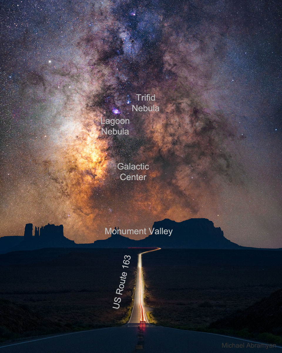

