
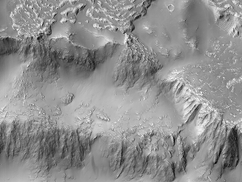
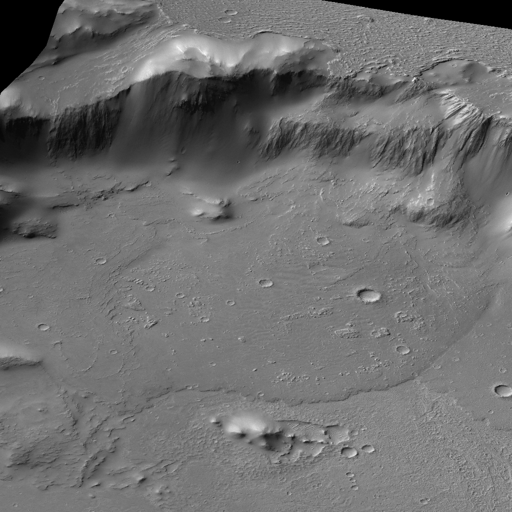
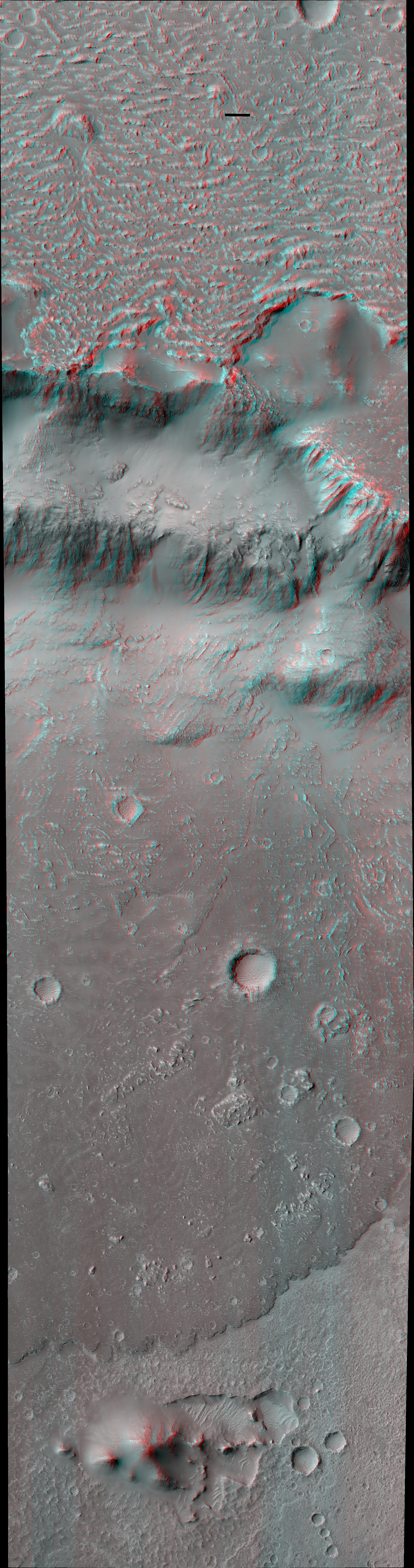
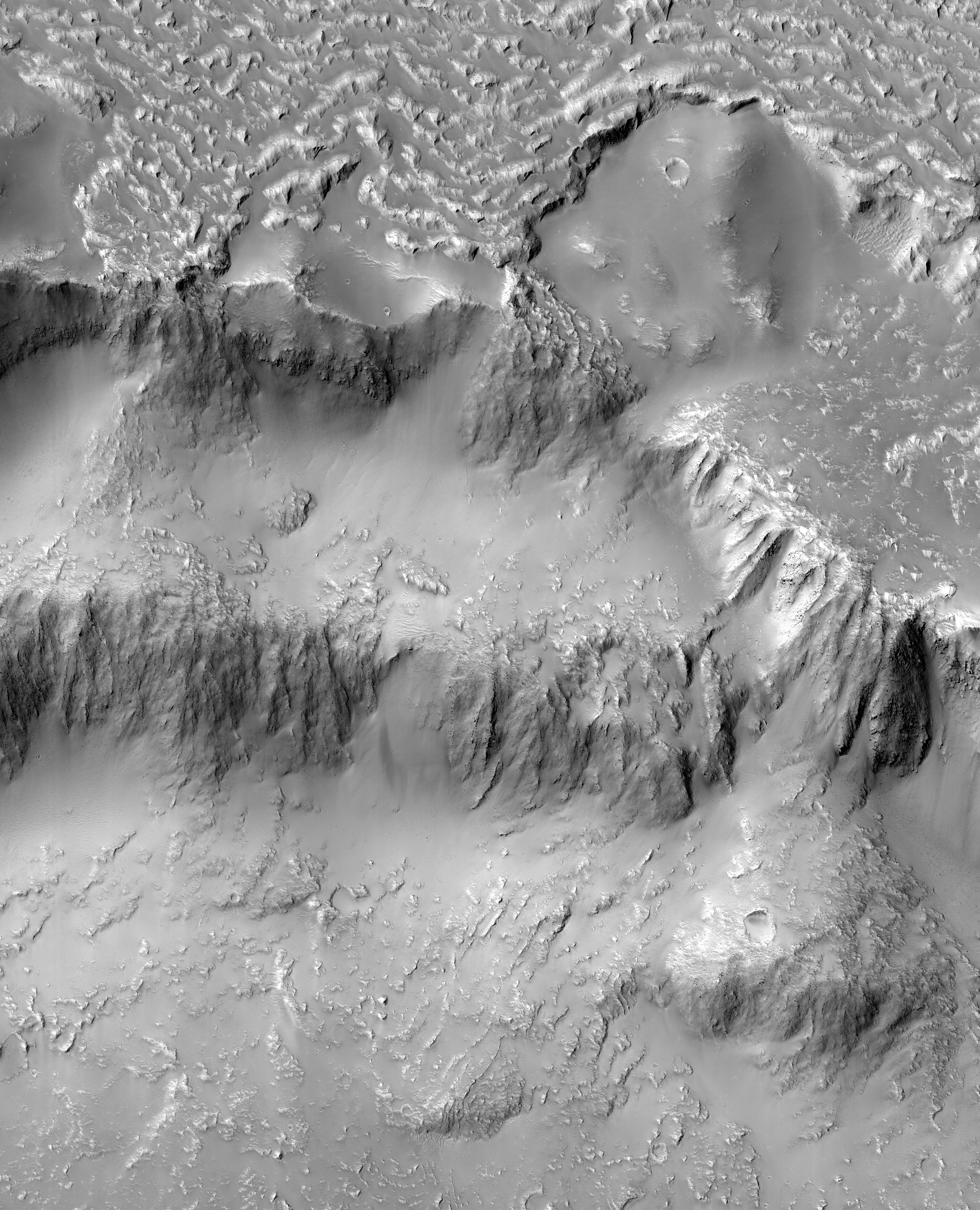
Eric Pilles and Livio L. Tornabene wrote:The Niagara Falls of Mars (ESP_050406_1585)
Various researchers are often pre-occupied with the quest for flowing water on Mars. However, in this image, we see one of many examples from Mars where lava (when it was molten) behaved in a similar fashion to liquid water.
In a 3D image from the Context Camera, we can see the northern rim of a 30-kilometer diameter crater situated in the western part of the Tharsis volcanic province. (See our own 3D image as well.) The image shows that a lava flow coming from the north-northeast surrounded the crater rim, and rose to such levels that it breached the crater rim at four locations to produce spectacular multi-level lava falls (one in the northwest and three in the north). These lava “falls” cascaded down the wall and terraces of the crater to produce a quasi-circular flow deposit. It seems that the flows were insufficient to fill or even cover the pre-existing deposits of the crater floor. This is evidenced by the darker-toned lavas that overlie the older, and possibly dustier, lighter-toned deposits on the crater floor.
Our image covers the three falls in the north-central region of the crater wall. The lava flows and falls are distinct as they are rougher than the original features that are smooth and knobby. In a close-up image the rough-textured lava flow to the north has breached the crater wall at a narrow point, where it then cascades downwards, fanning out and draping the steeper slopes of the wall in the process.
Now, if you’re thinking such as scene can only be observed on another planet, here’s a beautiful snapshot of lava falls from the 1969 Mauna Ulu eruption in Hawaii.
This is a stereo pair with ESP_050472_1585.
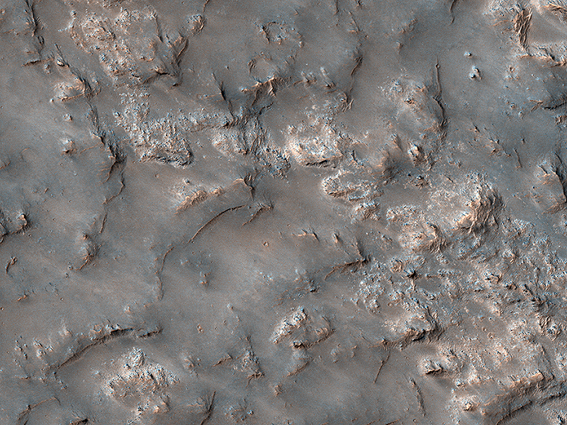
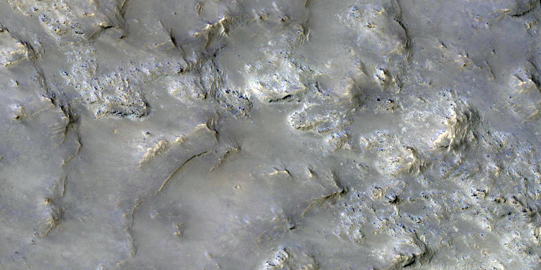
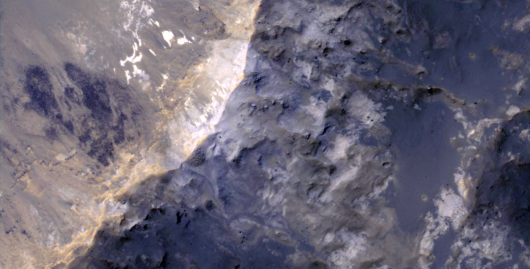
Gavin Tolometti, Livio L. Tornabene, Jon Kissi and Zach Morse wrote:Exposed Bedrock in the Koval’sky Impact Basin (ESP_050314_1510)
This image shows partially exposed bedrock within the Koval'sky impact basin, which is on the outskirts of the extensive lava field of Daedalia Planum. Daedalia Planum is located southwest of Arsia Mons, which may be the source responsible for filling the crater with lava flows and ash deposits.
On one side, we see bright bedrock with scattered dark blue spots. The dark blue spots are boulders shedding from the outcrops. The color range of the bedrock provides some information on its composition. The blue color is indicative of the presence of iron-rich minerals that are generally not oxidized (i.e., rusted), unlike most of the ruddy Martian surface. Volcanic rocks are common on Mars. Possible candidate minerals for the bluish materials are often consistent with iron-rich minerals, such as pyroxene and olivine. The ridges may represent remnants of the original surface of the lava flows that filled the Koval'sky impact basin.
NB: The region is named for M.A. Koval’sky, a Russian astronomer.
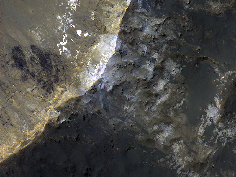
Zach Morse, Livio L. Tornabene, Jon Kissi, and Gavin Tolometti wrote:“Elementary, My Dear Deposit...” (ESP_050250_1435)
Just like Earth, Mars experiences seasons that change as the planet orbits the Sun. Seasonal changes are most apparent at the higher latitudes. As these regions in each hemisphere enter their respective summer seasons, the sun rises higher in the Martian sky causing frost and ice to sublimate, and illuminate more features across the landscape. As the high latitudes of each hemisphere move toward their respective winters, the days (called “sols”) grow shorter and the sun hangs low on the horizon, giving rise to prolonged periods of cold, darkness, and frost accumulation.
In this image, we see an impact crater with associated bright deposits that at first glance give the appearance of seasonal frost or ice accumulations. The Mars Reconnaissance Orbiter has an onboard spectrometer called CRISM that can distinguish between ices and other minerals. Unfortunately, there is currently no coverage of this particular spot. However, it can be deduced through several lines of evidence that this is, in fact, not ice.
First, it should be noted that at the time this image was taken, the Southern hemisphere is at the end of the summer season, so any frost or ice deposits have long since sublimated away. Second, numerous HiRISE images of seasonal targets show that ice accumulates on pole-facing slopes. The deposits in question are situated on a slope that faces the equator, and would not accumulate deposits of frost. Thus, it can be concluded that these exposures are light-toned mineral deposits.
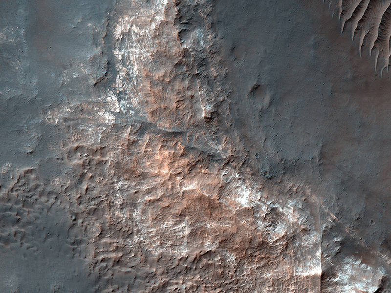
Cathy Weitz wrote:Light-toned Mounds in Gorgonum Basin (ESP_050948_1430)
Gorgonum Basin is one of several large basins within the Terra Sirenum region of Mars. Each basin has light-toned mounds, many of which contain clays.
Scientists think that Terra Sirenum once had a large lake during an epoch called the Late Noachian/Early Hesperian, and each basin filled with sediments. The water within the lake may have altered these sediments to form the clays we now observe from orbit. Ma’adim Vallis, which drains into Gusev Crater where the Spirit rover landed, drained the water from this ancient lake.
Why the basin floors exhibit mounds similar to chaos regions on Mars is unknown, but could be the result of collapse and subsequent erosion within the basins.
This is a stereo pair with ESP_046478_1430.
Credit: NASA/JPL-Caltech/University of Arizona
<< Previous HiRISE Update